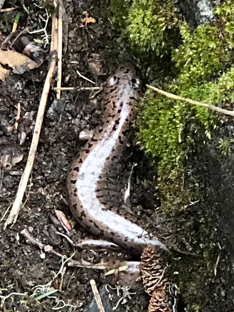
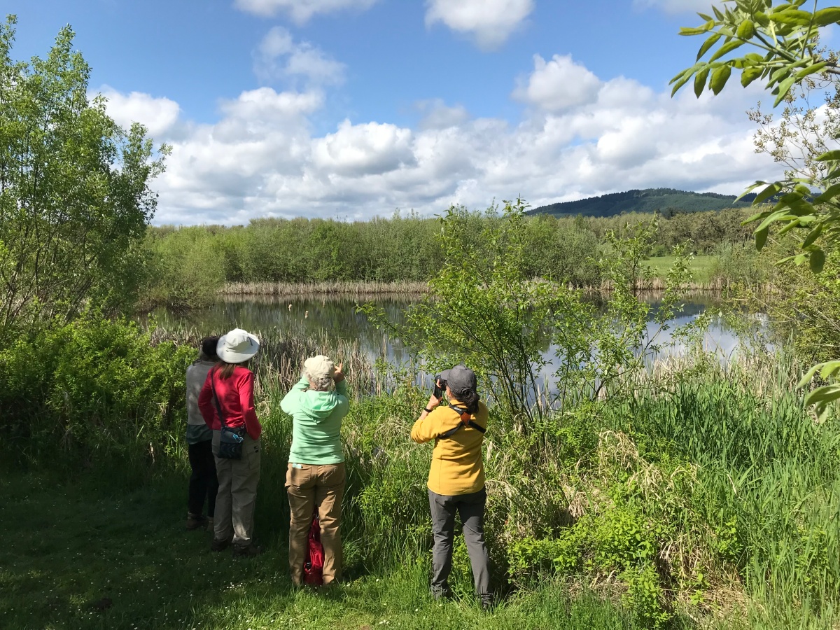
I am excited to have completed the first half of my ecoregion fieldwork with the Oregon Master Naturalist (OMN) program this past week. The focus area was the mid-Willamette Valley. The OMN program is through Oregon State University Extension. Oregon’s landscapes define the people and wild species that call this land home. Students of the OMN program learn about the natural history, ecology, and natural resource management practices of Oregon. I am looking forward to applying this new knowledge within my own volunteer-led hikes so others can better appreciate Oregon’s beautiful and dynamic landscape. Kudos to the OSU Extension and the many volunteer instructors for helping to make this happen!
During a trip to the Olympic Peninsula in March, I was excited to experience the Hoh Rainforest, but upon arriving at the Ranger’s kiosk was told that a tree had fallen over the road. The tree was large enough that outside help had been called in to help with the removal. My vehicle, along with others, was told to return another day. 🙁
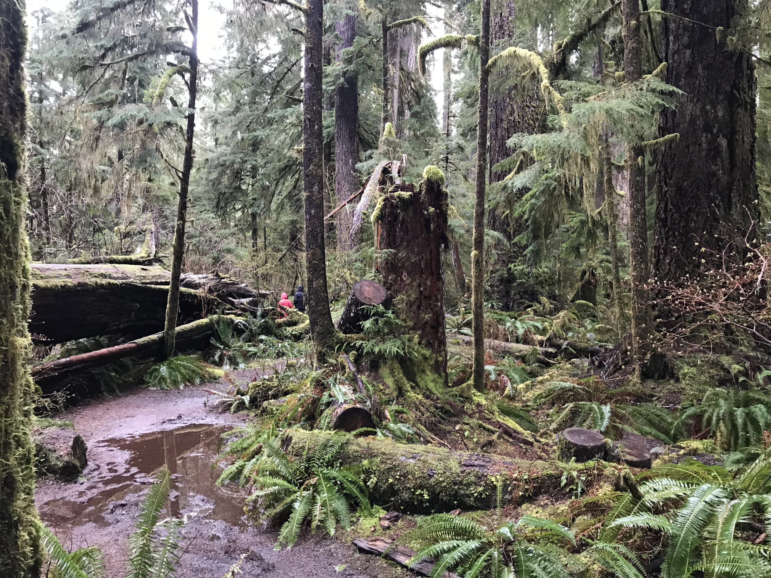
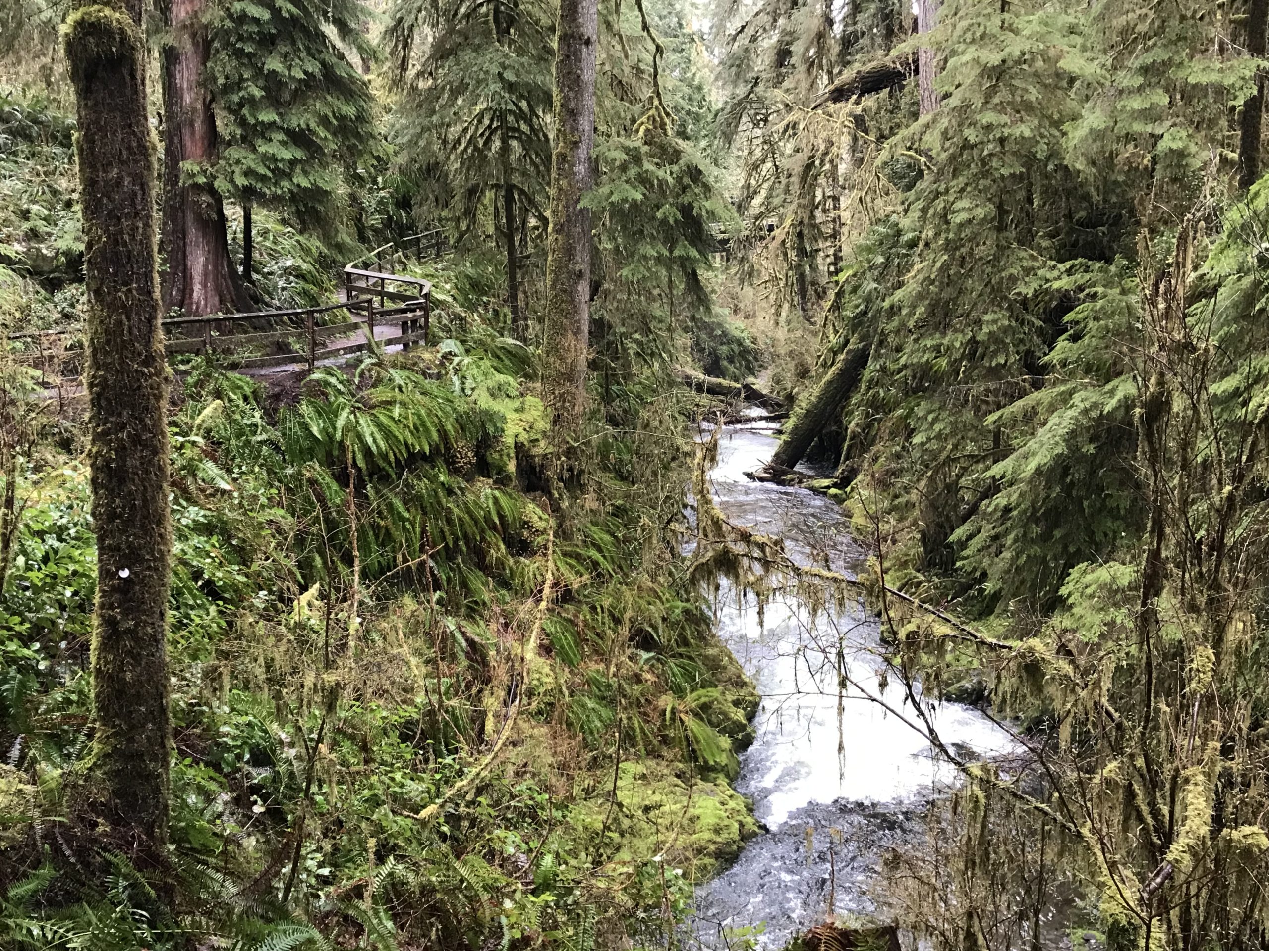
But the ranger, upon hearing that I was traveling to the south shore of Lake Quinalt suggested visiting the Quinault Rain Forest Nature Trail -a personal favorite of his.
Upon seeing the striking beauty of the trail I was hooked. This trail was about half a mile in distance but required an hour just to meander through this old-growth forest and fern-covered canyon. There were hanging carpets of lush green moss, signs of various animals, fungi, and the wonderful smell of clean air. This place, in a word, is breathtaking. I love interpretive trails but had not expected this half-mile walk to be so encompassing. For a longer walk, the nature trail connects to the Quinalt National Recreation Trail System with several additional miles of trails. The trail has some fantastic interpretive signage – kudos to those who arranged the material! This visit was in the springtime with temperatures in the low 50s and lots and lots of rain.
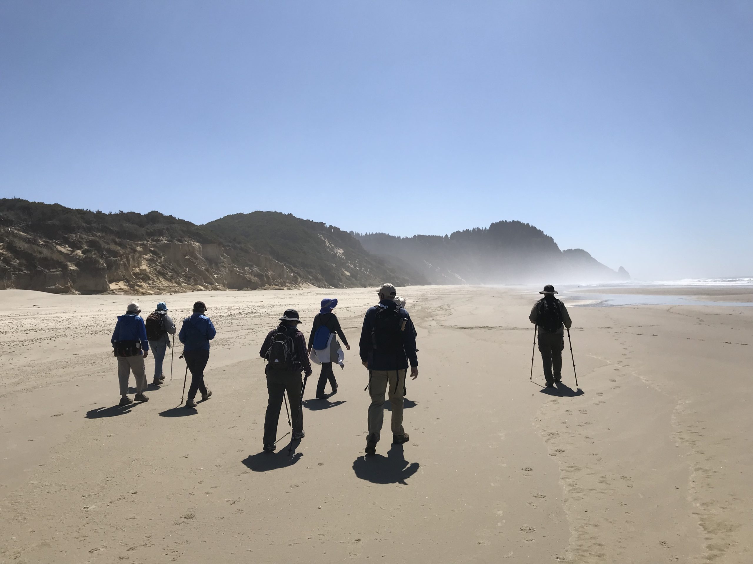
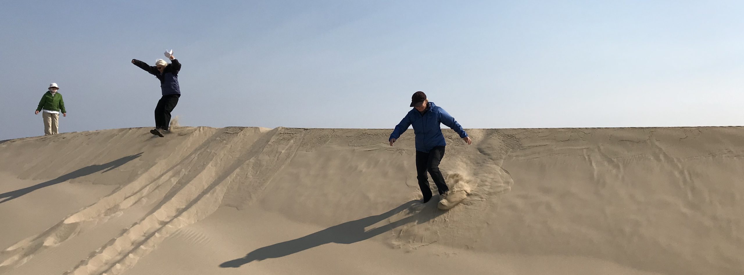
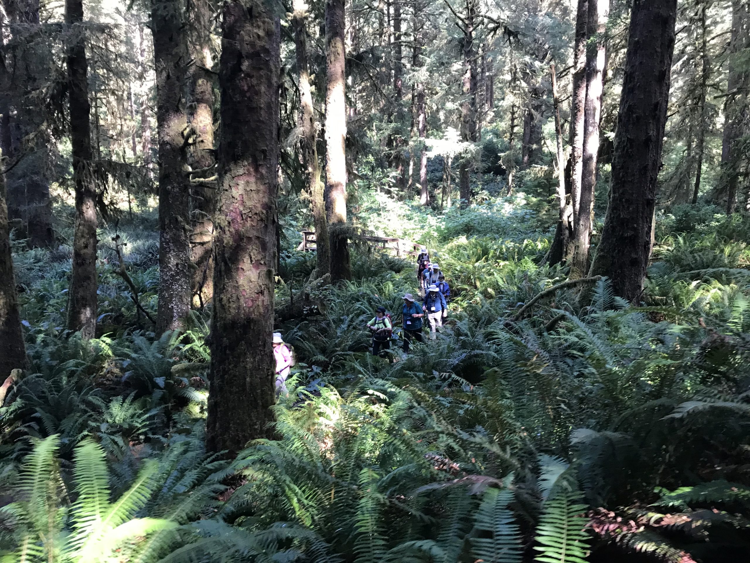
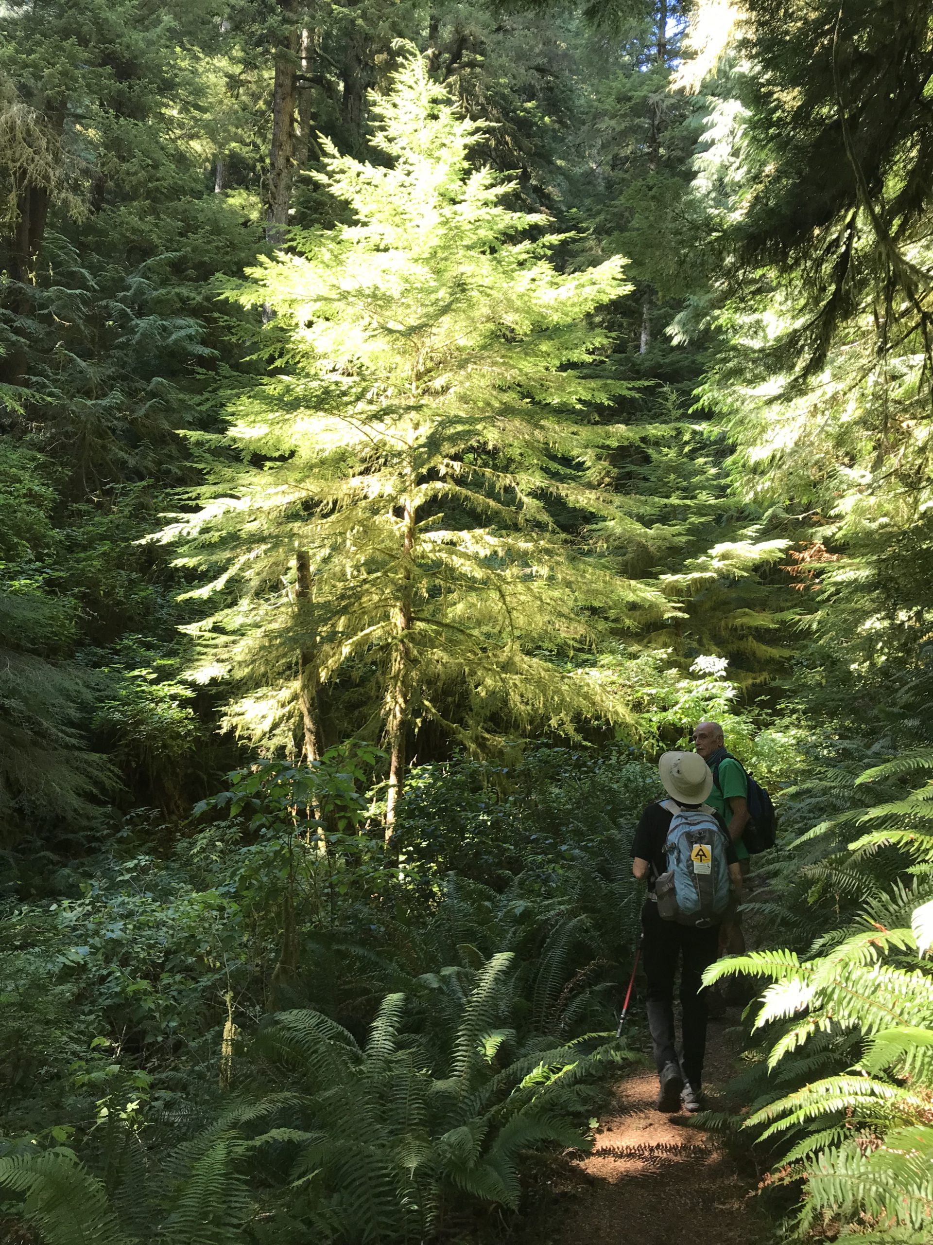
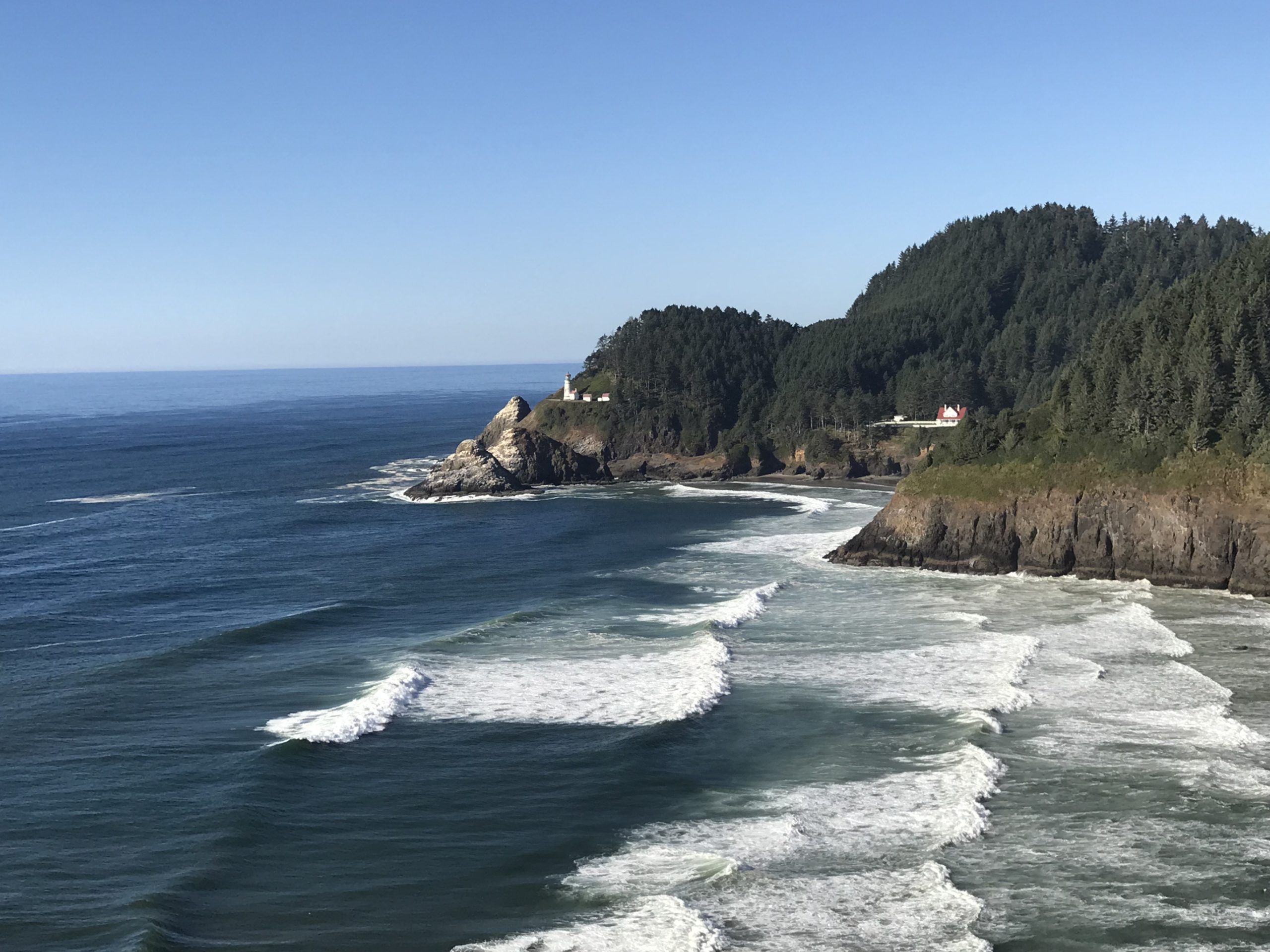
Trip Report: Group Leader: Mark Hougardy | Organization: Road Scholar | Date: August & September 2021 | Departures: 4 | Duration per Program: 6 days | Hiking Distance: 30 miles each departure | Participants: ~20 per departure | Type: Hiking | Note: The trip leader and participants were fully vaccinated against Covid-19 and Covid safety protocols were strictly observed. A big thank you to everyone for being considerate and recognizing the safety of your fellow travelers allowing all to better enjoy this program.
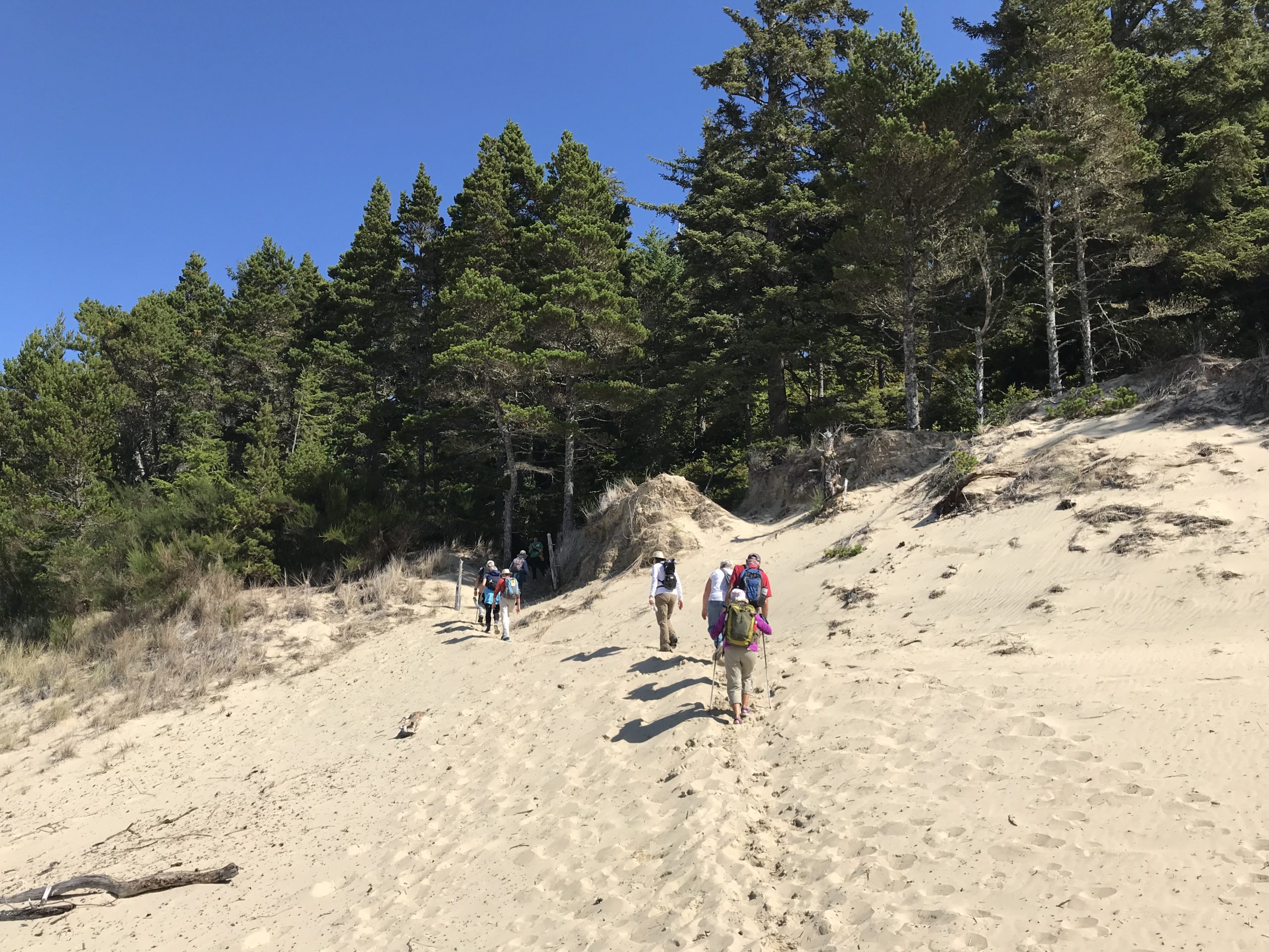
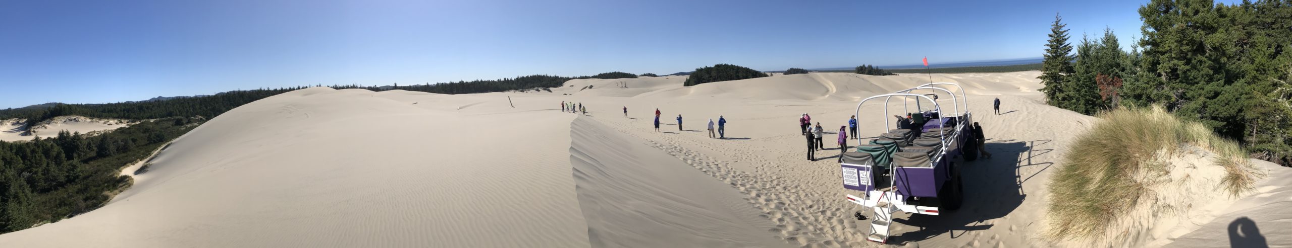
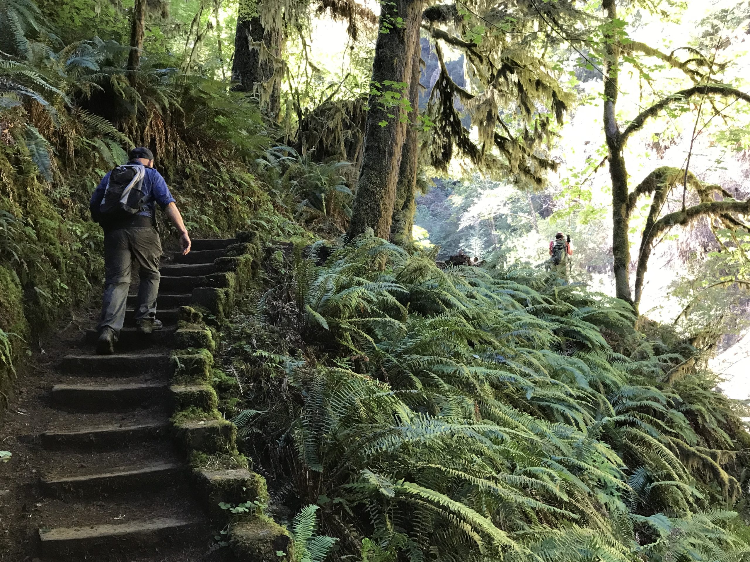
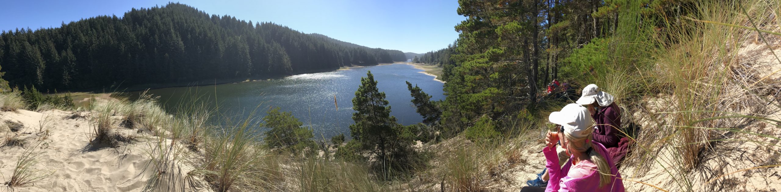
Sunny weather and pleasant temperatures greeted participants on 4 hiking programs exploring Oregon’s central coast. The focus of each program was learning about how the coast has changed especially over the last 100 years. Hikes included exploring the temperate rain forest, old-growth Sitka Spruce, the rugged Oregon coast, and the Oregon Dunes National Recreation Area which is one of the largest expanses of temperate coastal sand dunes in the world.
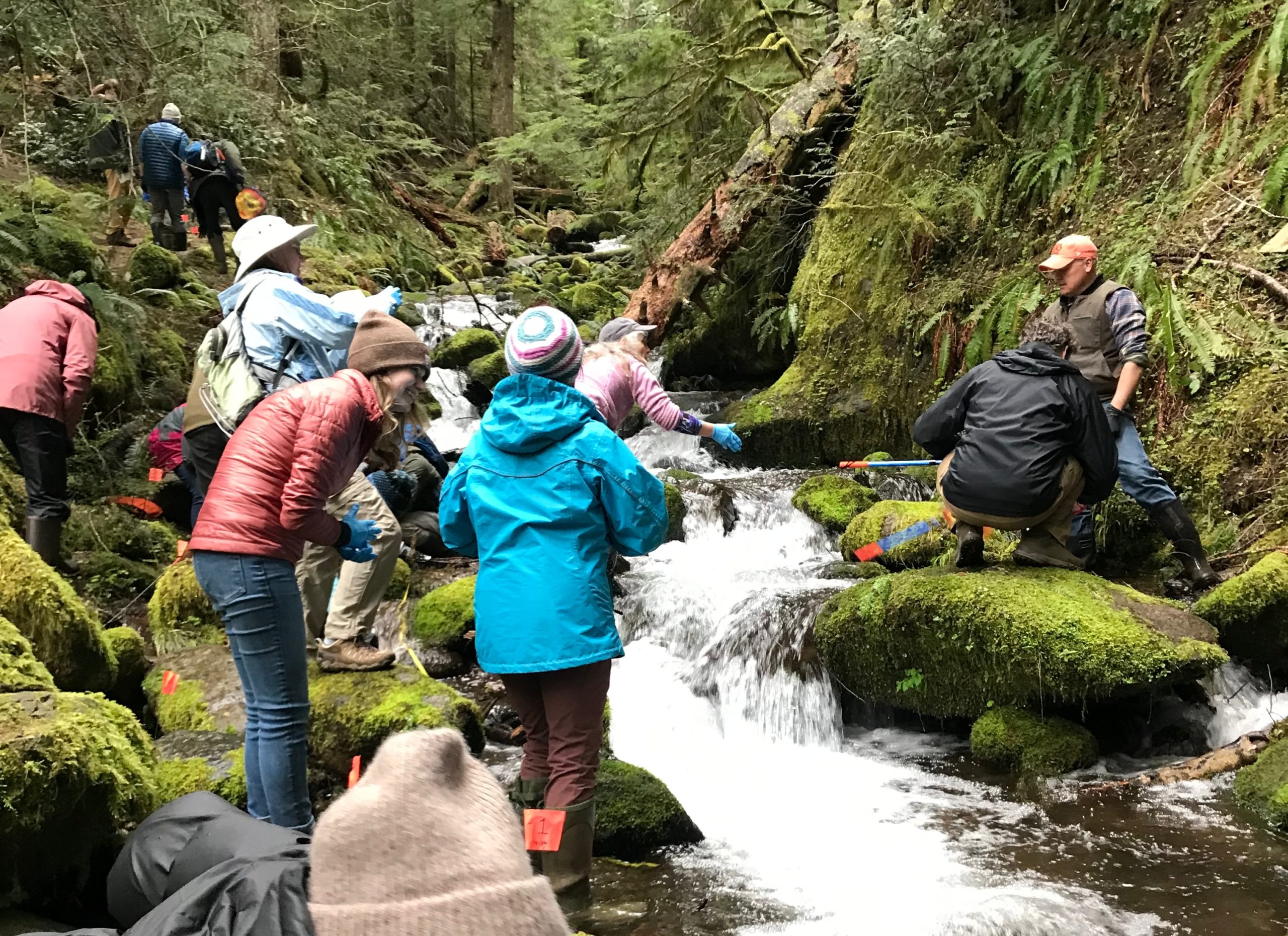
Creeks and rivers are amazing storytellers – they can teach, captivate, and inspire curious minds.
I always try to include creeks and rivers into the larger interpretive theme of a tour or educational travel program, especially when these waterways can provoke people into broadening their horizons.
It’s always fun to open up an itinerary so trip participants can look under rocks, get their feet wet, observe critters in the water, touch, hear, smell, see, and learn more about the story of a place.
To help with bringing this story to life I bring along a simple “Water Discovery Kit.” The kit can be made at home, packs well, and weighs just a few pounds. It includes:
1 Gallon-sized Plastic Bucket with Handle
1 10x Microscope
2 Dip Nets
1 Big Pipette (medium-sized turkey baster)
1 Thermometer
3 Magnification Loops
1 Set of Laminated Instructions
1 Plankton Net with ziplock
6 Small Pipettes
3 Round clear observation dishes
3 Rectangular clear observation dishes
3 Rectangular observations plates
1 Funnel
1 Gallon-sized ziplock
1 Secchi dish (8-inch)
Everything on the list fits inside the bucket, except for the Secchi disk which I carry separately. The kit can be used by elementary kids on up, though it works best when various generations (grandparents and grandchildren) are involved.
Crater Lake National Park never ceases to amaze the viewer, but this time the lake astounded me and my Road Scholar participants with some mysterious rings seen upon the lake’s surface.
These unusual rings were viewed near Wizard Island from Watchman Peak and were observed on August 29, 2019, between 9:20 am & 9:40 am (approximately).
That morning, my educational tour group had hiked to the summit of Watchmen Peak. We were treated to an expansive vista over an exceptionally peaceful Crater Lake. The gigantic body of water mirrored the sky as there was no wind, nor any waves caused by the island excursion boats. What we did see upon this flat liquid pallet were multiple “rings.” At first, the rings appeared to be raindrops to the west and southwest of Wizard Island (in the Skell Channel area), yet our perspective was 800 feet higher and three-quarters of a mile distant. These rings were sizable!
I had never observed such rings during multiple visits to the lake. Were these new? Had I not observed them before because of wind, light, or other surface conditions? -The mystery is afoot!
As my group arrived at the summit several of the participant’s phones reconnected with cell service. The group had been a couple of days without any service and a few people were eager to check email, news, etc. One person exclaimed that about an hour earlier (approx. 8 am Pacific) a 6.3 earthquake had struck off the Oregon coast. The question was raised, could a massive and distant energy release encountering a different density (energy waves traveling from rock then to liquid, especially upon a very still body of water) have allowed stored gases in a shallow area of the lake to escape, causing these rings?
Overlooking Crater Lake & Wizard Island from the Watchman
It was intriguing, yet an earthquake some 200+ miles distant seemed remote. What there a more likely cause? The area in the Skell Channel area is relatively shallow (from 60 to 200 feet deep) compared to the rest of the lake, and has an abundance of underwater moss. The water at Crater Lake is known for its clarity and this massive biomass might have been bathing in a bounty of sunlight. The weather for several days prior had been mostly sunshine with only some rain that night…could these conditions have accelerated photosynthesis? What about springs in the area? Based on the ring images (especially the close-up image) this seems likely, but Crater Lake is essentially a closed system, its small watershed (the rim of the lake) means the lake receives all its incoming water from snow-melt and rain. There is supposedly some hydrothermal spring activity on the bottom of the lake, but this appears to be limited and at greater depths.
Was there a more likely explanation? I reached out to the Crater Lake Institute and the Oregon Master Naturalist program for help. I also included some photos of the curious phenomena, including one close-up, and several photos that were overlaid with Google Earth to help with identifying the location and determining the scale.
The ring images were highlighted (first in Adobe Illustrator) then overlaid into Google Earth. The shoreline features of Wizard Island were mapped to the photos.A close-up of the two images showing ring diameters. The various ring diameters were measured using Google Earth.
After a few emails were exchanged one cause of the rings’ formation was the most supported: “unusually strong photosynthetic activity by prominent beds of submerged plants, which occur in shallow waters around Wizard Island creating supersaturated oxygen levels, resulting in oxygen bubbles rising to the surface.” – Crater Lake Institute.
This sounds very plausible and I’m grateful for the feedback. I am curious if there is any research or photos showing this phenomenon in previous years. If anyone has any knowledge, please contact me. Seeing the rings was amazing and I hope to return on future clear summer days to gather some additional data.
Thank you to the Crater Lake Institute and the Oregon Master Naturalist program!
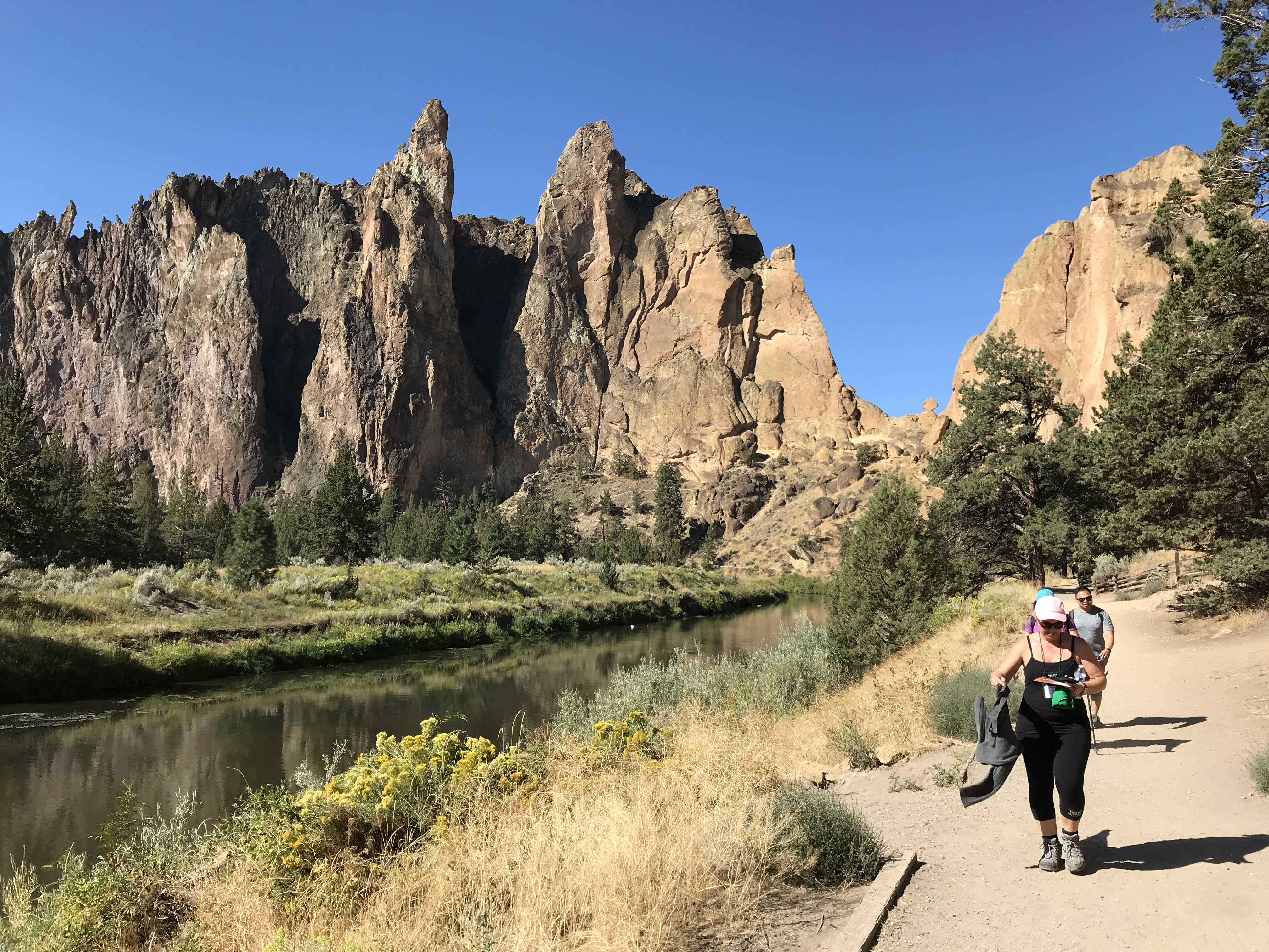
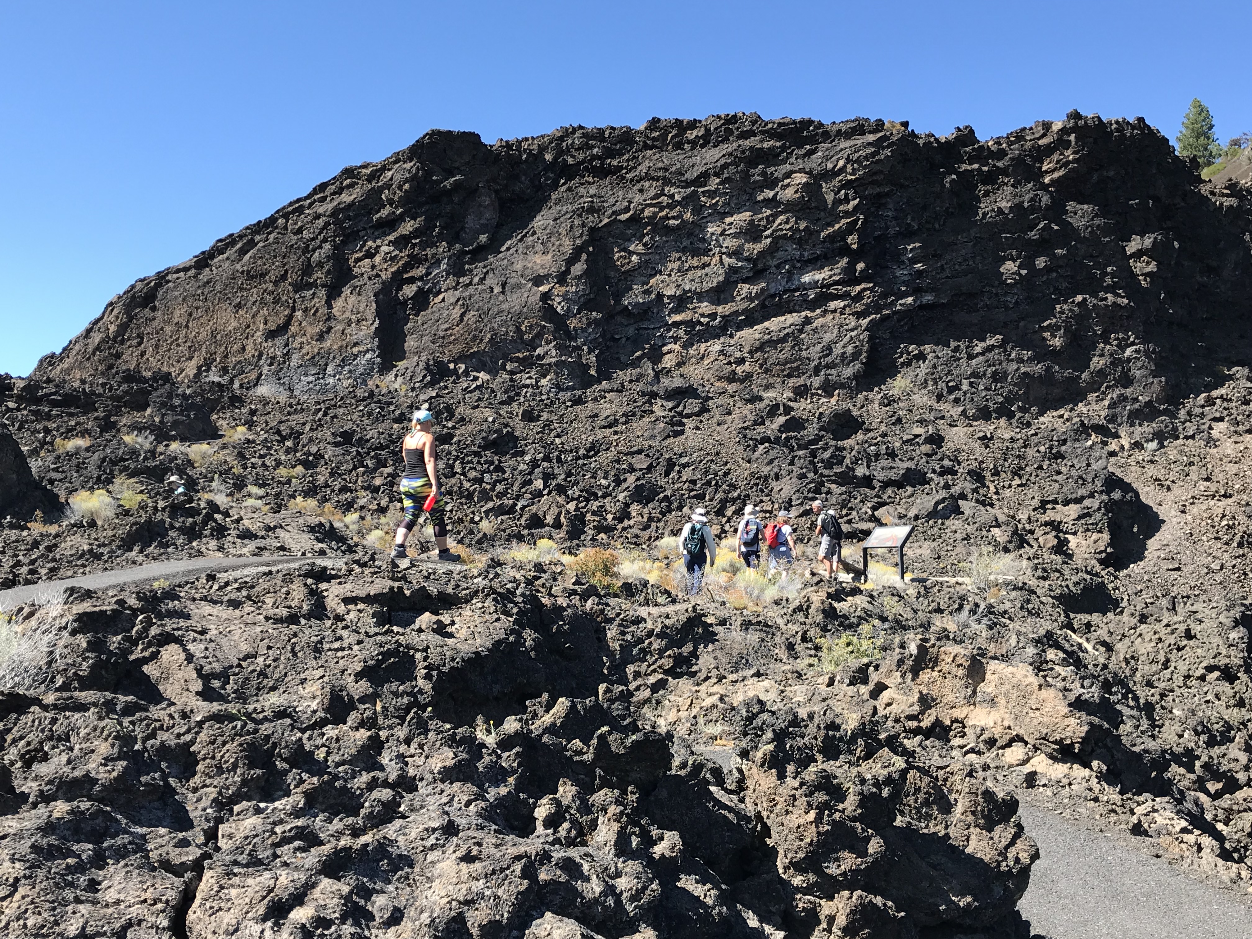
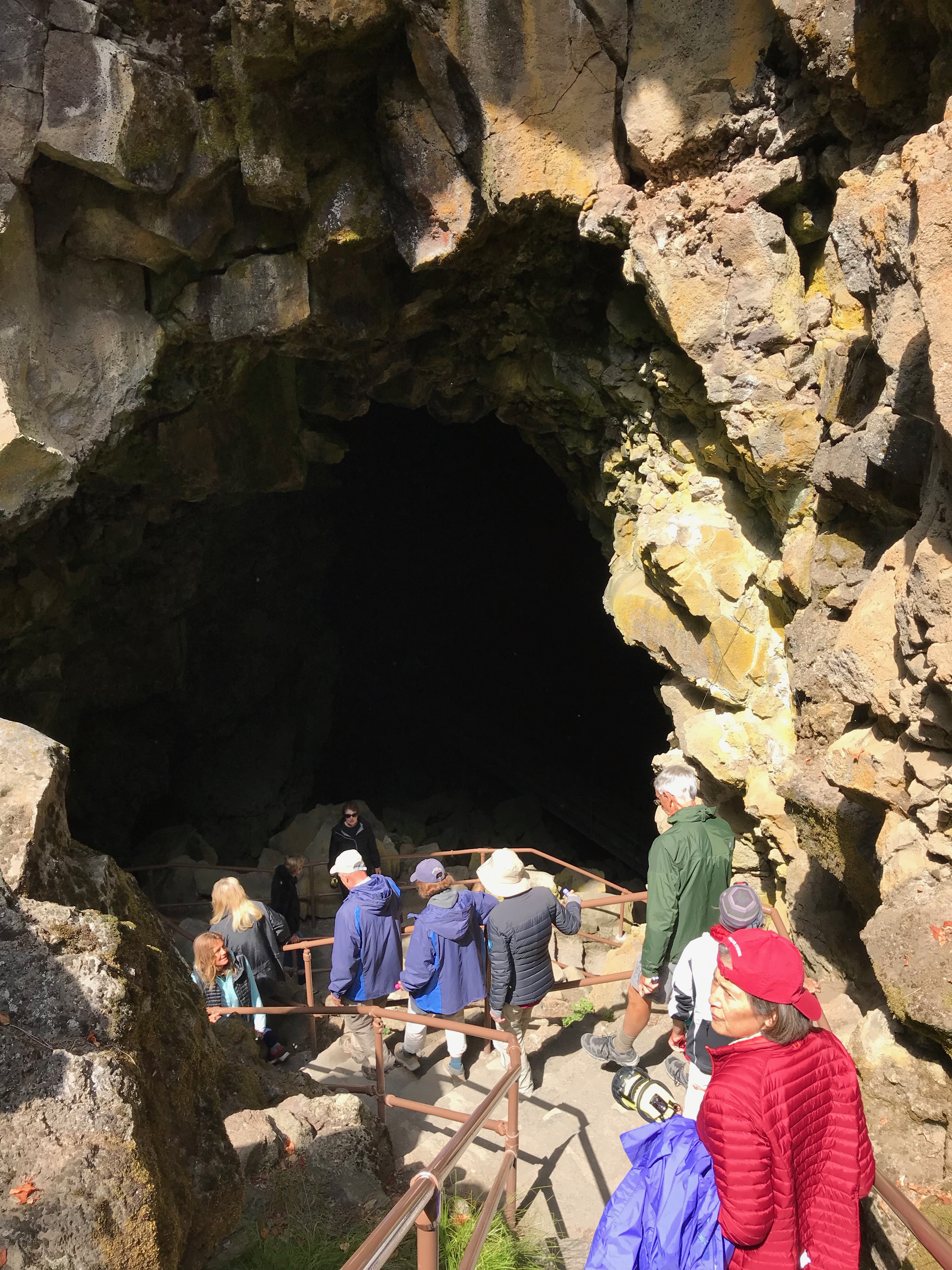
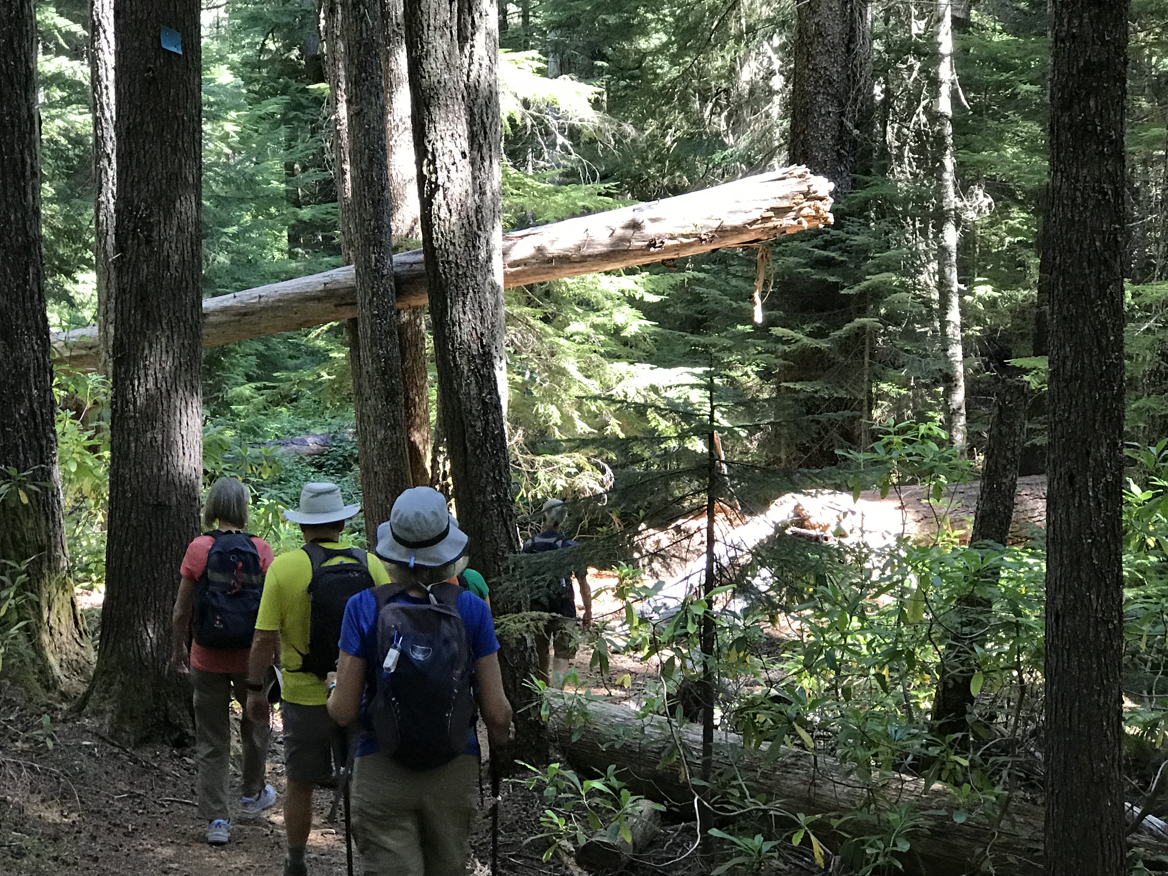
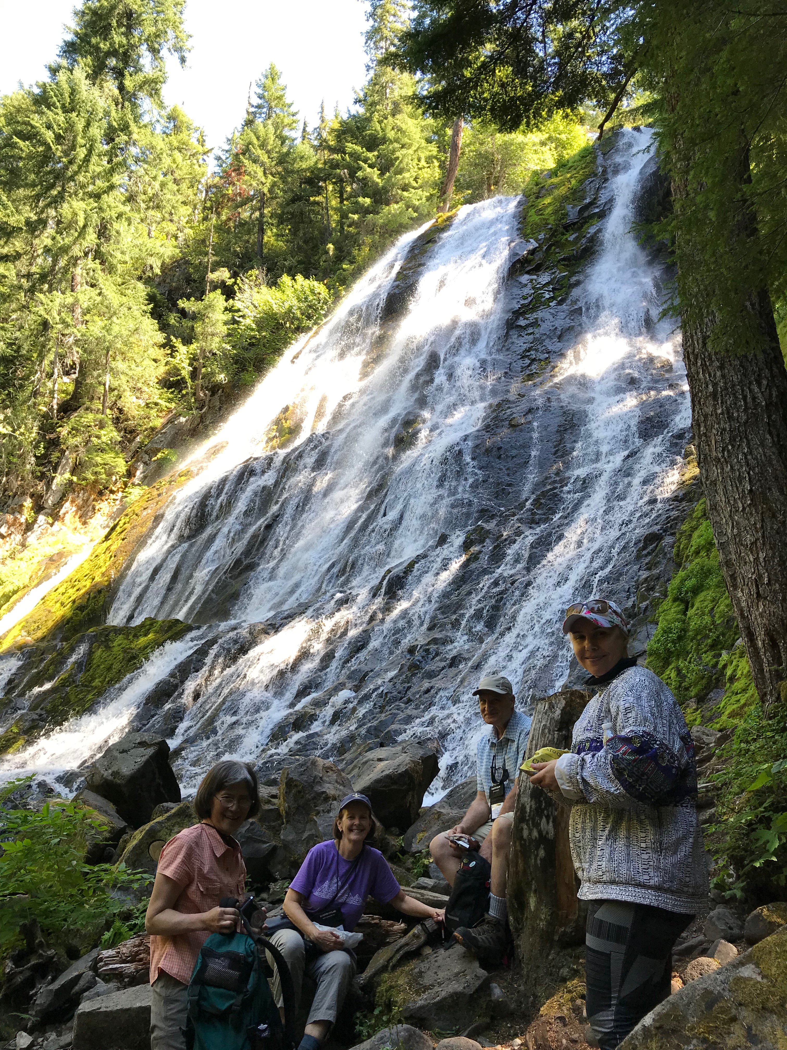
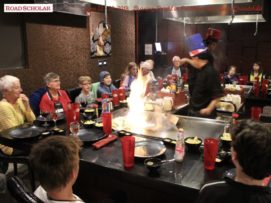
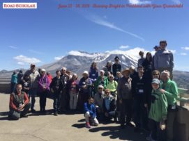
Helping people experience and learn about the rich natural history of central Oregon is always a treat. My energetic group of 14 adults hiked, rafted, and explored the amazing volcanic landscape.
Trip Report:
Group Leader: Mark Hougardy | Organization: Road Scholar | Date: August 2019 | Duration: 8 days | Participants: 14 | Type: hiking, rafting, tour
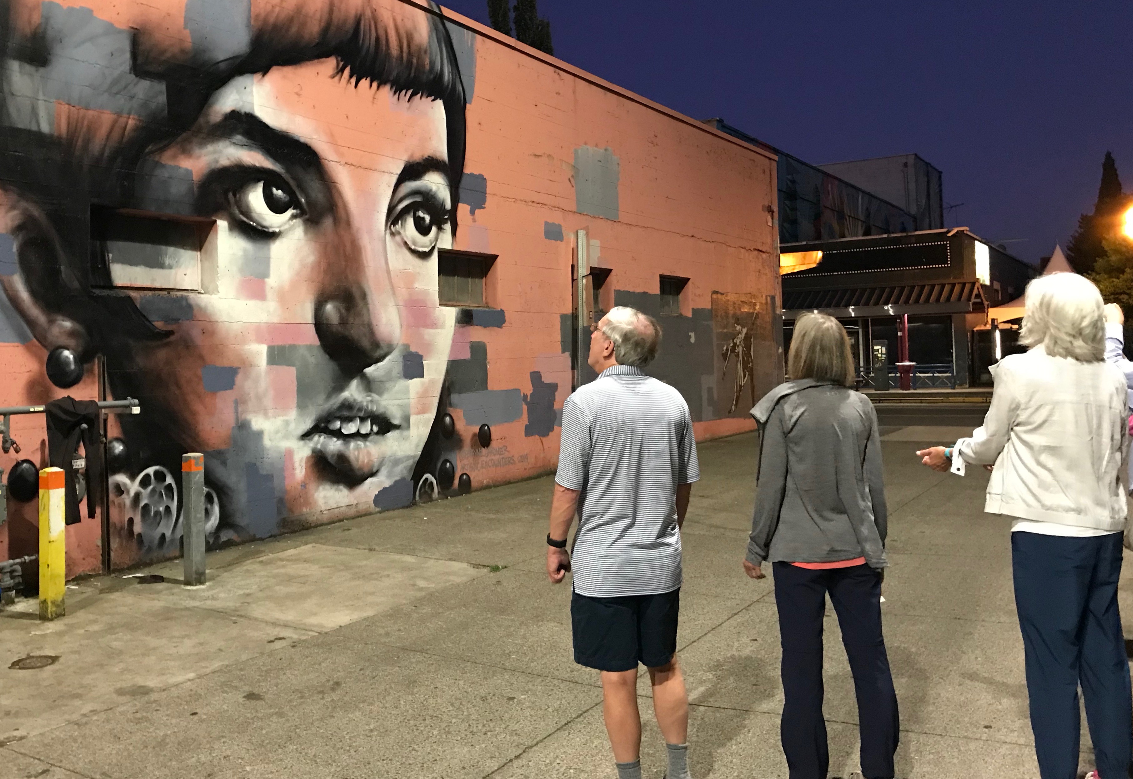
A Double Rainbow Over Crater Lake!Rafting on the Deschutes River A Day Hike in Smith Rock State Park, OregonA day hike across a magnificent lava field.Entering the Massive Lava Tube Cave Crater Lake National Park – The Watchman – Overlooking Wizard IslandHiking in the lush CascadesEnjoying the 100-feet cascade of Diamond Creek Falls, Willamette Pass, Oregon.We just finished up a rafting trip on the Santiam River.Enjoying an evening walk to explore Eugene’s colorful murals and micro-art.
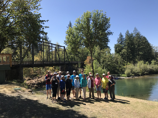
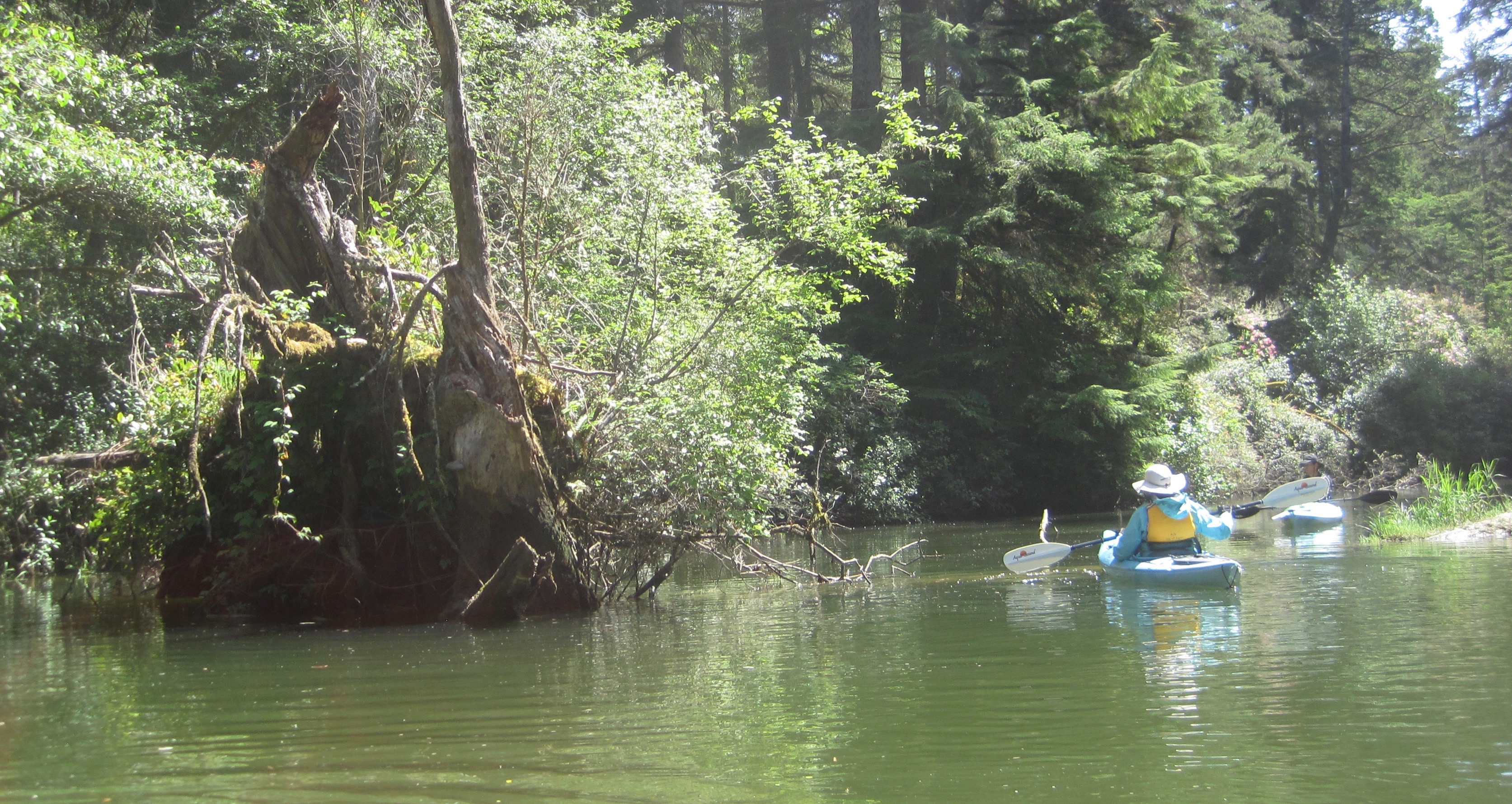
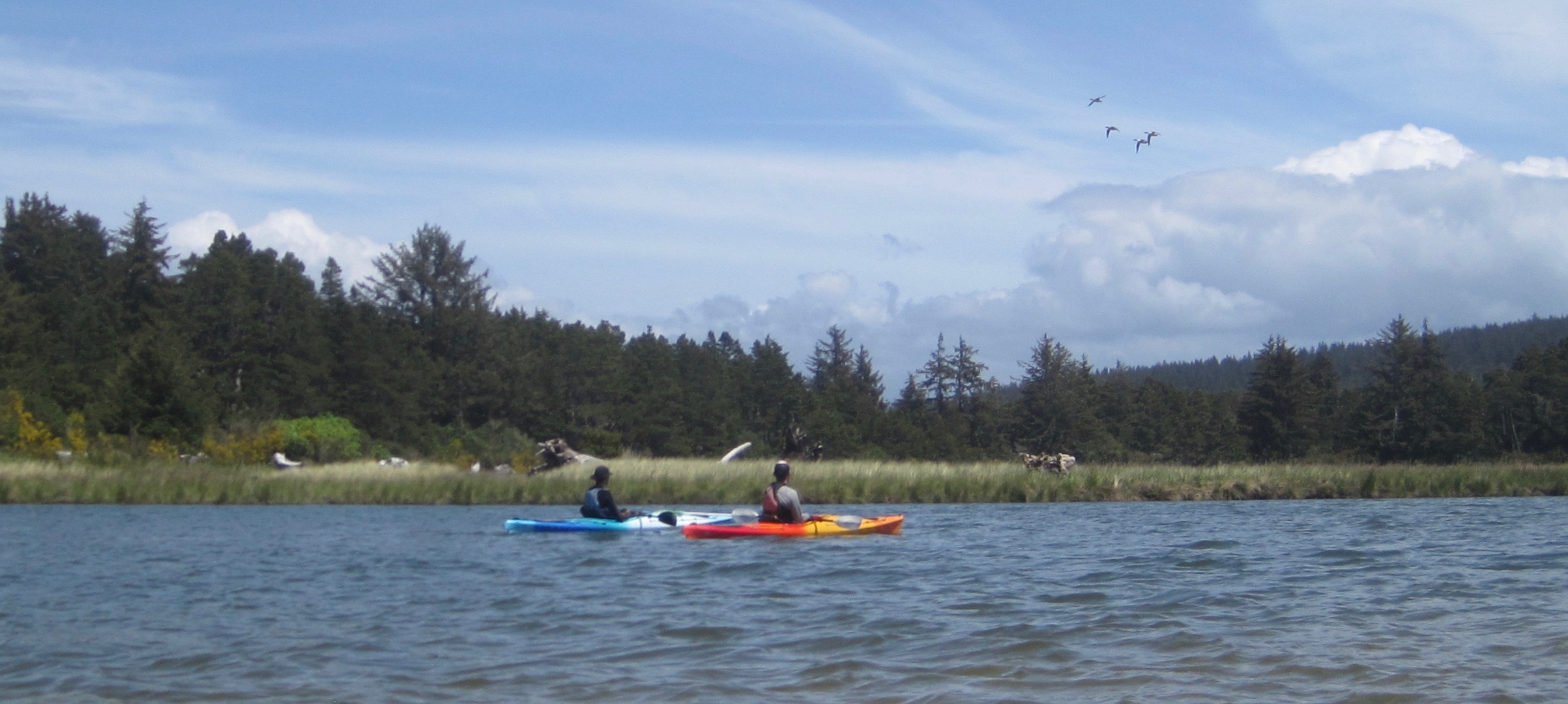
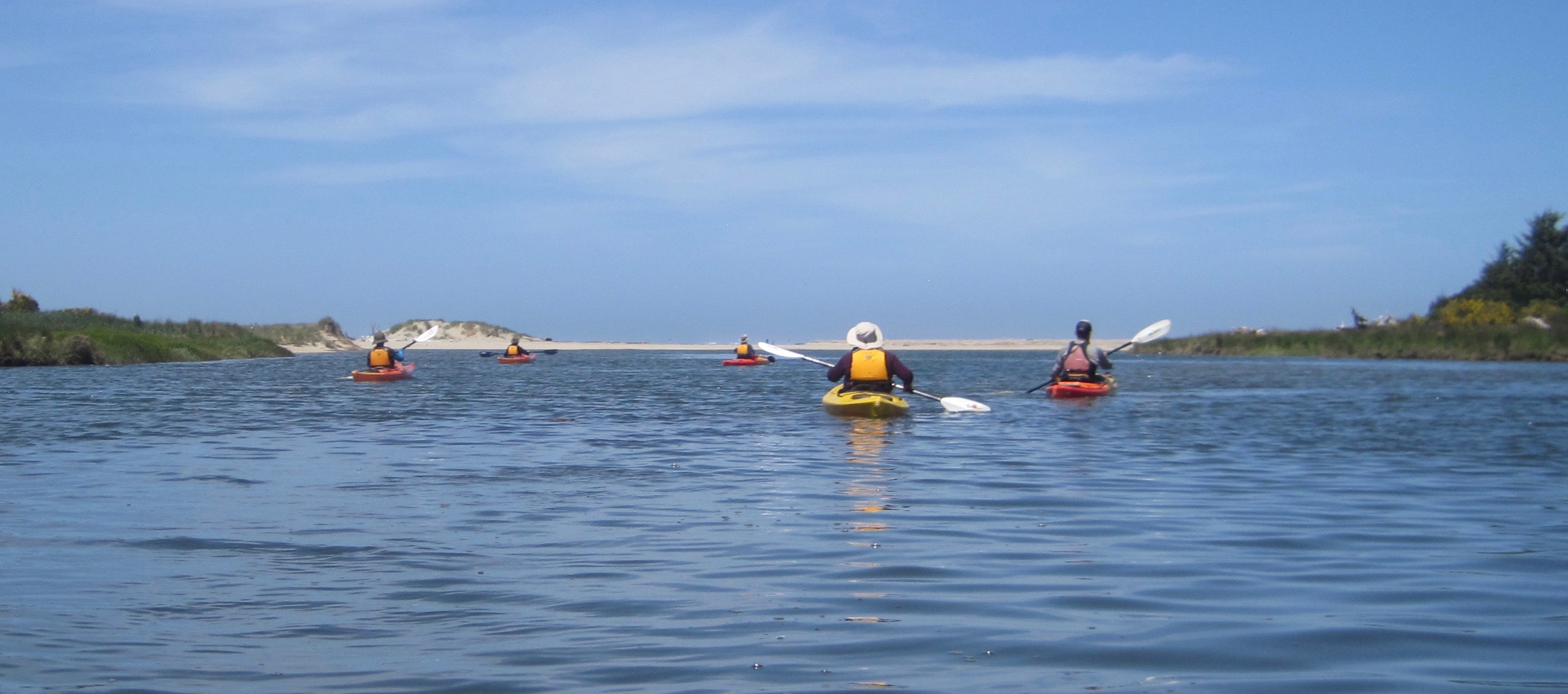
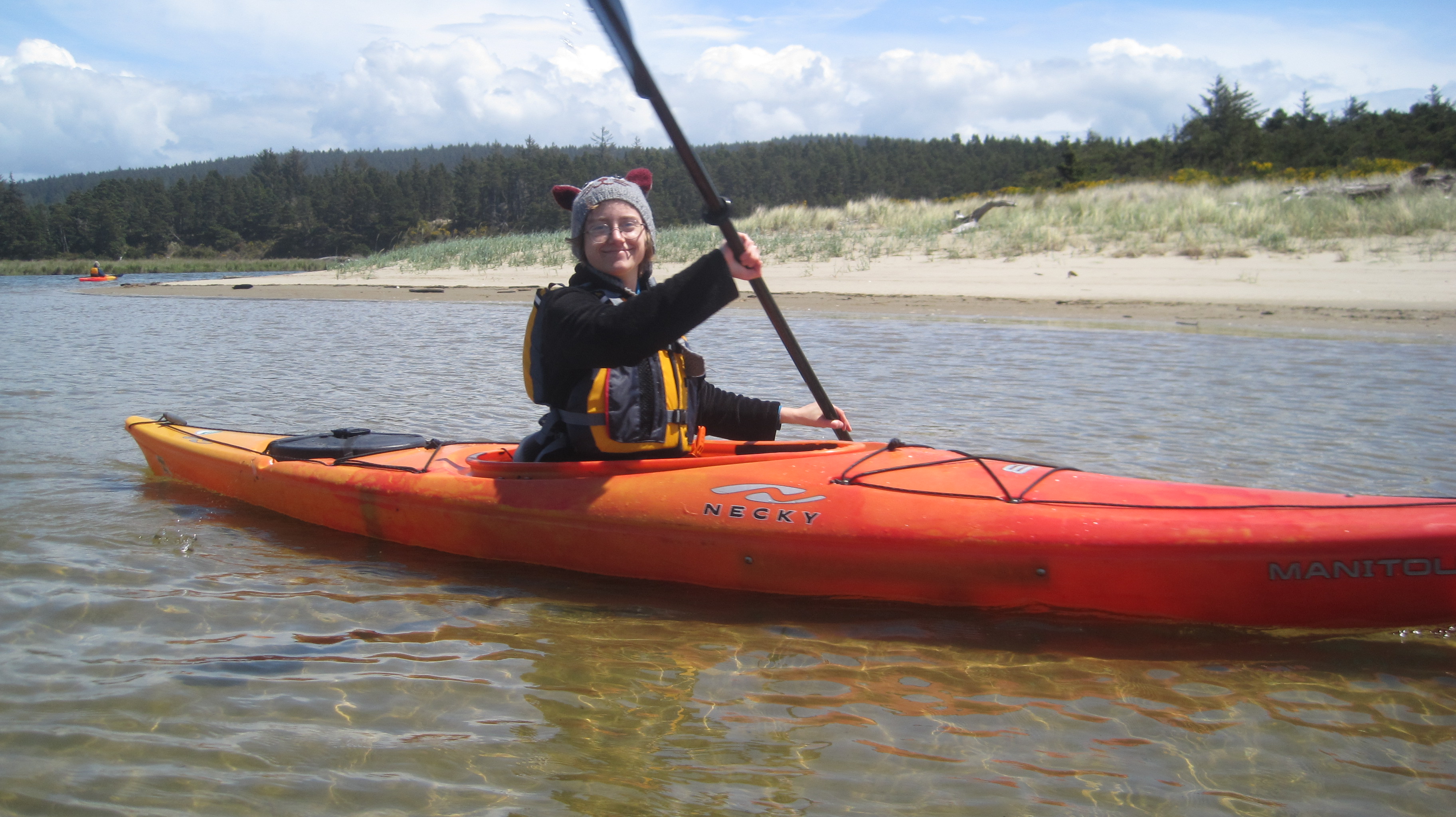
Trip Report: Volunteer Leader: Mark Hougardy | Organization: Eugene-based Hiking Club | Date: May 2019 | Duration: 1 day | Participants: 7 | Type: kayaking
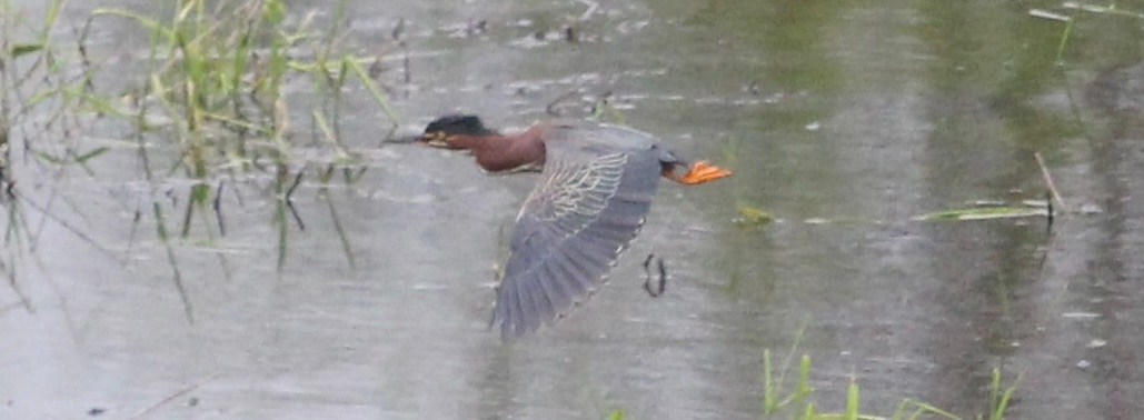
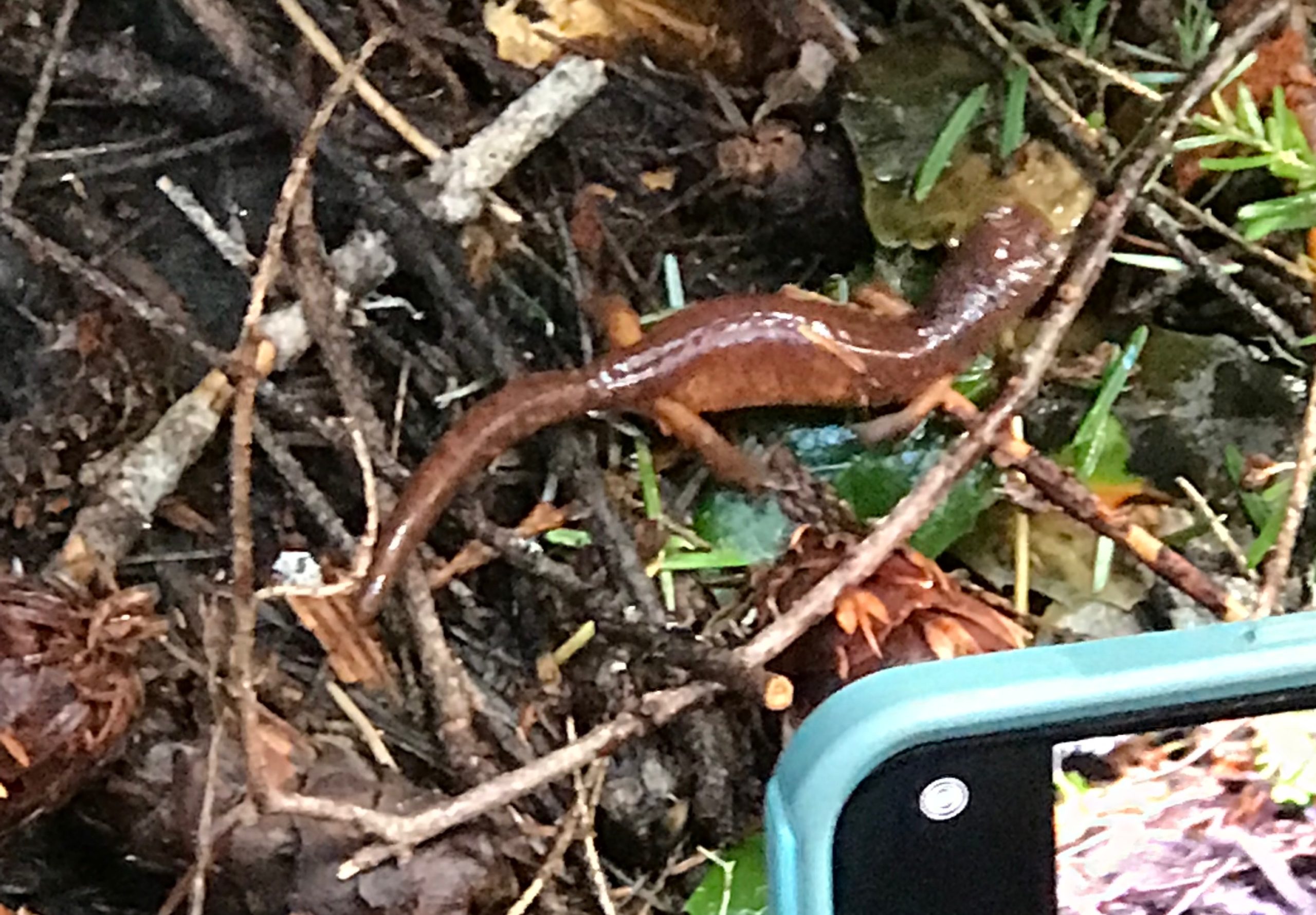
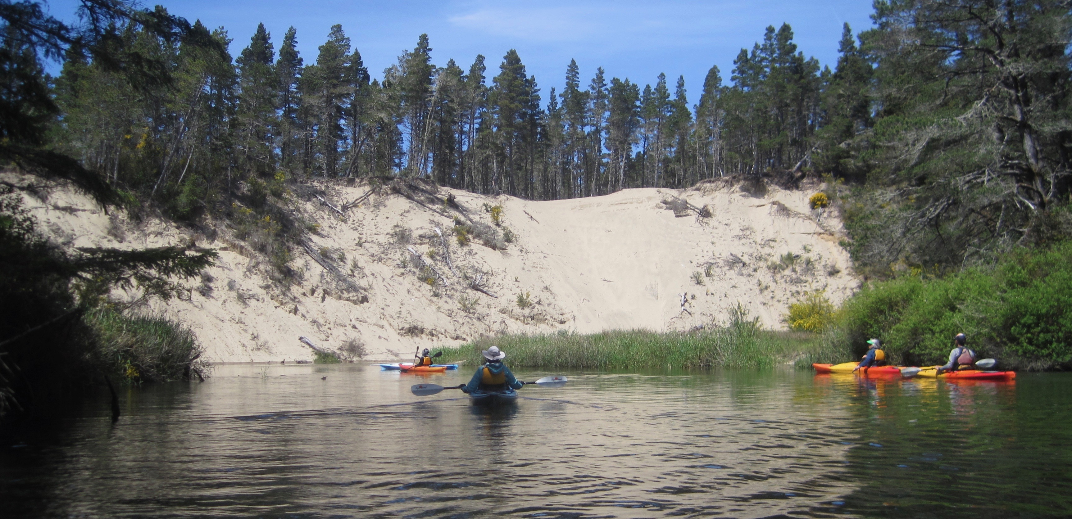
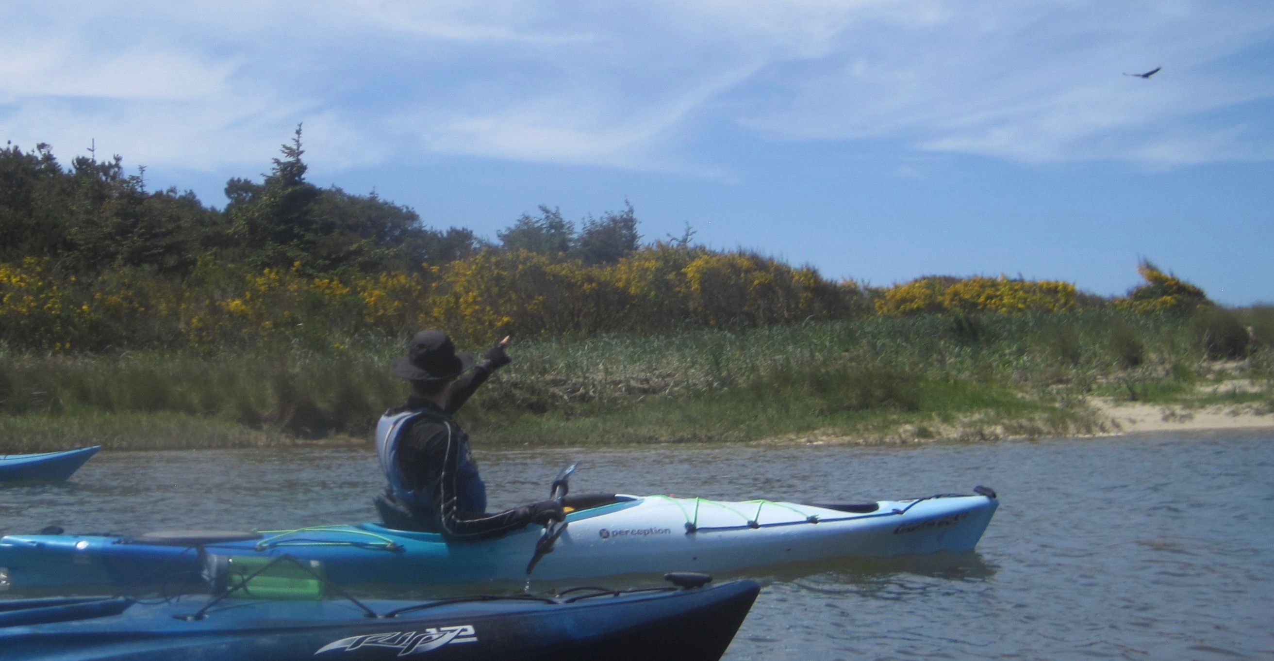
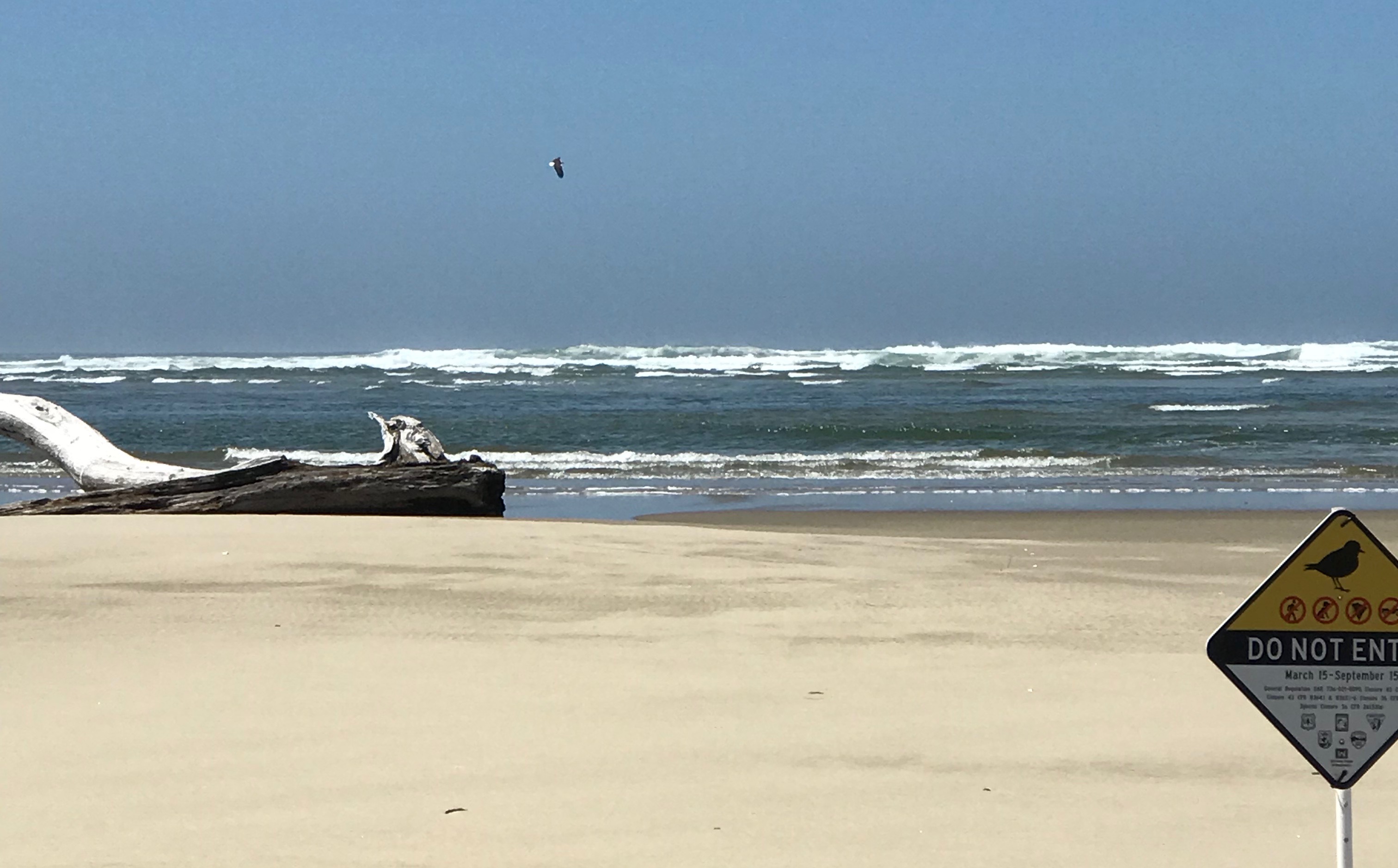
Kayaking Oregon’s Siltcoos River during the springtime is a treat, provided you can time it right. A day earlier dark clouds, lighting, and sheets of rain pelted the area. But, today, the temperature was warm and the sky was clear, allowing us to witness the Siltcoos in all its splendor. We were fortunate and very thankful. The Siltcoos is an interesting interplay of a riparian area within the Oregon Dunes National Recreation Area. The dunes are one of the largest expanses of temperate coastal sand dunes in the world. When geologic forces created the dunes, the sand-choked off several coastal rivers and created about 30 lakes. Some of the rivers have found a way back to sea, the Siltcoos River is one of these rivers. Today, it is a slow-moving three-mile long waterway that holds the distinction of being a canoe trail. We were unable to visit the lower water dam because of a large fallen tree. A special thank you to the River House Outdoor Center of Eugene for the use of their kayaks and local guides. From the water, our group saw at least 18 animal species: bald eagle, osprey, a grey fox, swallows, killdeer, newt, bumble bee, heron, fish, stellar’s jay, crow, seals, egrets, mergansers, butterflies, dragonflies, spiders, and egrets. We also saw a dog at the bow of a kayak, and (not paying attention to posted signs) a human and dog in a protected area.
An 80-foot wall of sand along a bend in the river.Upriver there were a number of fallen and downed trees we gave them a wide berth.The dunes gave way to open spaces and a green marsh. Several ducks were flying overhead.A large bird turned in our direction. As it approached we saw a white head and white tail feathers – it was a bald eagle! A magnificent sight, and seeing it was worth all the money in the world at that moment.The river widened as we approached the mouth of the Siltcoos River.At the mouth of the Siltcoos River. The Pacific Ocean had 4-6 foot swells that day. A bald eagle was observed looking for a mid-afternoon snack in the surf. Note the white tail feathers. The area before us (all the shoreline in the area) was closed to protect habitat for the Snowy Plover, a threatened species. Photo credit: Anna Hougardy.A happy trip participant
Trip Report -Volunteer Leader: Mark Hougardy; Group: Eugene-based Hiking Club; Dates: April 2019; Participants: 16; Type: Urban & Trail Walking
Imagine attending a grand celebration… Every year, 100 people gather to laugh, tell stories, eat good food, and celebrate. Near the conclusion of the festival, everyone erupts into a joyous song, this music is extra special because for it to be harmonious each person is responsible for contributing just one note at the right time. The song rises and flows with many voices as old and young share. The following year there is another celebration but now a people few are missing. The next year, there are others who don’t attend and the melody starts to fray. For decades this unraveling of the song continues as fewer people are around to sing. Afer one hundred years only two people remain. They sing with passion, but how do they celebrate the larger song with so many notes missing? …How would you?
In the early 1800s, the Kalapuya people numbered around 15,000 and were the largest Native American group in what is now known as the Willamette Valley of western Oregon. Diseases introduced to the area decimated the population and by 1850 about 1,000 people remained. In 1900, the Kalapuya numbered about 300 (2% of the original population) and by the 1950s the last generation of speakers had passed. A 1977 University of Oregon anthropological paper declared, “the Kalapuya population is now presumed extinct.”
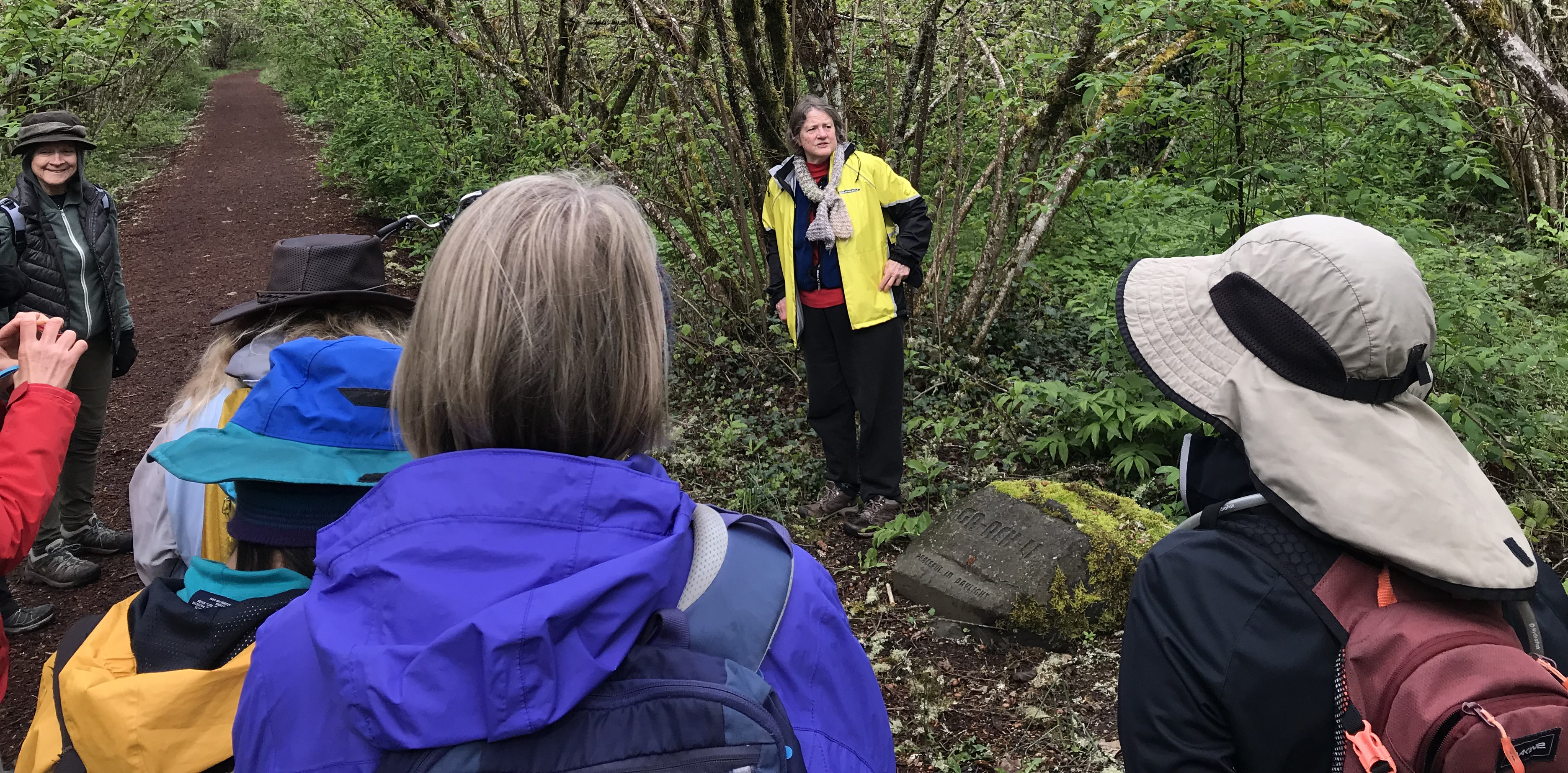
This was the setting for Esther Stutzman, a woman of Kalapuya heritage who wanted to revive the language. Over the years she made incremental steps to build awareness about the Kalapuya and awaken the language, but even into the early 1990’s, she was told by academics to not even bother as the language was dead. One reason for this difficulty was the geographic connection to Kalapuya place names no longer existed; pioneers had given all the landmarks names. Esther eventually partnered with the Citizen Planning Committee of East Alton Baker Park. Together, they convinced Willamalane Parks and Recreation and the City of Eugene to re-associate place names with Kalapuya words and phrases. The 237-acre park was re-named the Whilamut Natural Area of Alton Baker Park, and a year later, they placed cultural art installations known as the Kalapuya Talking Stones.
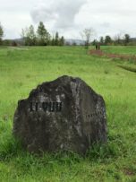
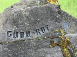
The Talking Stones are etched boulders that carry a Kalapuya word from one of the several dialects that describe the location where the stones reside. Today, fifteen stones quietly speak with those who will listen from along riverside trails in the Whilamut Natural Area in Eugene and the Eastgate Woodlands of Springfield, Oregon.
Talking Stone GUDU-KUT (frog)
The stones are etched with a simple font that approximates being written by a human finger as though an elder has just shared an idea by drawing a concept in the earth.
Placing the stones required years of work, public education, and patience from Esther and often-unsung heroes on the Citizen Planning Committee (CPC), including Charlotte Behm, Vicky Mello, David Sonnichsen, and others. The group has spent more than twenty years (as volunteers) diligently working to place and maintain the sacred Talking Stones and to educate the public about their important role in our community. The Talking Stones is a watershed project on blending native place names within metropolitan areas for the education about the people who once lived -and continue to live- in the area.
Charlotte Behm shares stories about the creation, installation, and public interactions with the Talking Stones.
To better understand the Talking Stones’ stories Charlotte Behm joined us on our 2.5-hour walk. She shared her experiences and history about the stones and some of the challenges that remain. We were happy to listen and better understand the geographic connection to Kalapuya place names. Thank you, Esther and Charlotte, and the many others for helping to share a larger story with your voices.
An additional thank you to Charlotte Behm for her help with this article.
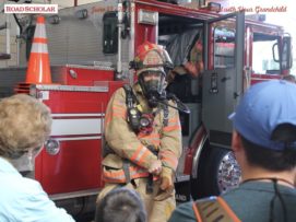
I’m happy to have been the leader on another great Road Scholar trip. This program introduced grandparents and grandkids to how fire helps forge every aspect of our life (homes/communities, food preparation, entertainment, arts, places we play, and our survival).
Trip Report:
Leader: Mark Hougardy | Organization: Road Scholar | Date: June 2018 | Duration: 6 days | Participants: 28 | Type: Field Trips & Motorcoach
“Erupting volcanoes. Blacksmithing. Outdoor cooking. Glassblowing. A fire has countless uses, and incarnations, and has been paramount to our way of life since the beginning of our time. You and your grandchild will spark your desire to safely learn more about fire through interactive experiences with professional firefighters, survivalists, welders, and fire dancers. Discover how fire can create a delicate piece of artwork, as well as destroy entire forests and cities. Learn how to survive in the remote wilderness, and discover the inner workings of a city’s fire engine. Together with your grandchild, finally have the chance to play with fire as you discover why nothing can hold a candle to this learning adventure.”
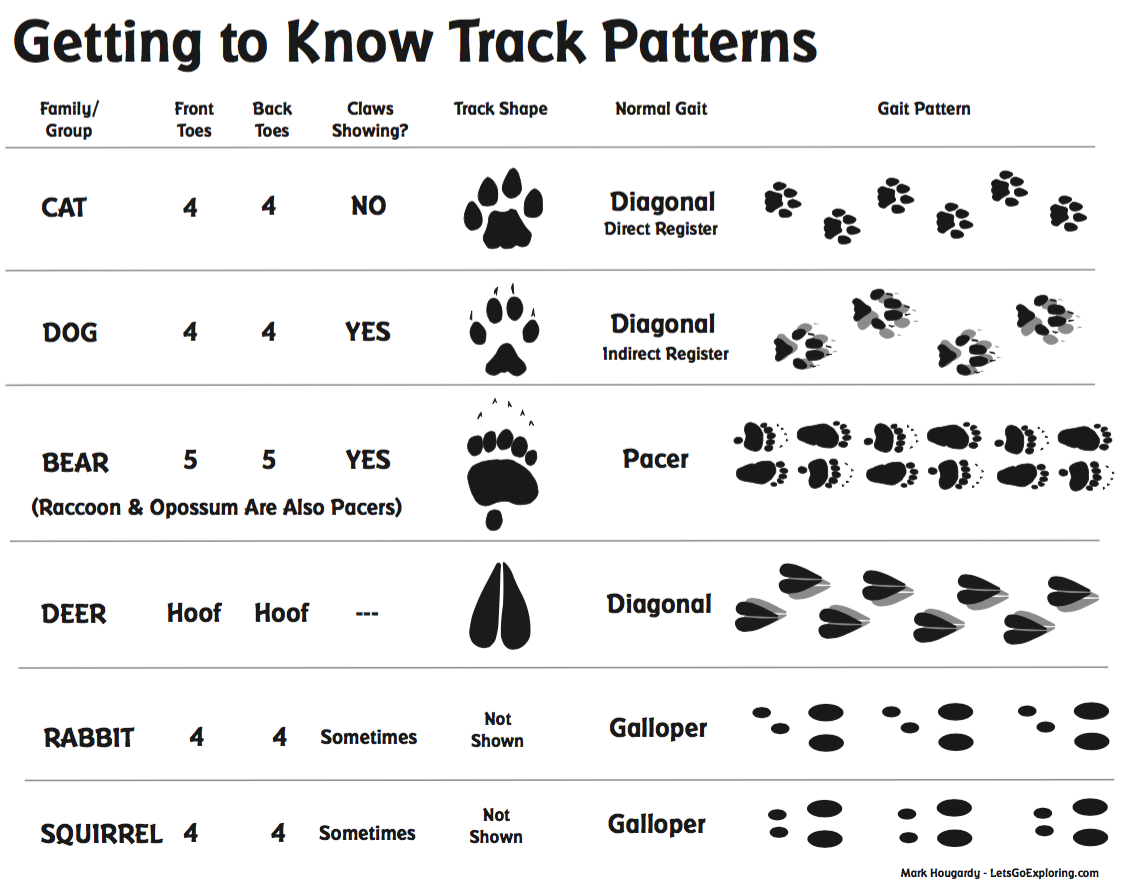
Understanding how animals move is a basic feature of tracking. When you start to see “the story†written upon the ground you see patterns, infer distances, visualize speed, and even what type of animal made the tracks. Recognizing the gait – the animal’s manner of walking– is key to knowing the story. Here is a simple PDF I developed called, “Getting to Know Track Patterns” to use in the field. I use when I’m interacting with kids (and adults too). It helps to have someone demonstrate these gaits on all fours to visualize the gait. Then try to walk that way for yourself.
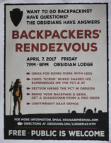
During the recent Backpackers’ Rendezvous 2017 held in Eugene, Oregon, I shared a printed spreadsheet detailing the various systems used by backpackers of all skill levels. Thinking in systems (rain system, footwear system, sleep system, etc.) is important because it can save you time, money, and reduce headaches. Enjoy the spreadsheet for yourself, may it help you better plan your own journeys. Thank you to everyone who contributed! Please note the spreadsheet is legal-sized and front and back. Download the PDF here.
Volunteer Organizer: Mark Hougardy | Location: Eugene-based Hiking Group Lodge | Date: April 2017 | Duration: 1 day | Participants: 80+ | Type: Outreach Event
The Backpackers’ Rendezvous helps hikers, backpackers, and anyone curious about the trail to network, learn, and do more with less. I’m happy to have organized the event and contributed to Eugene’s backpacking community.
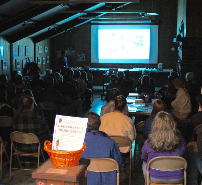
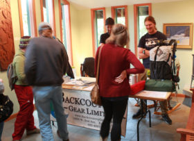
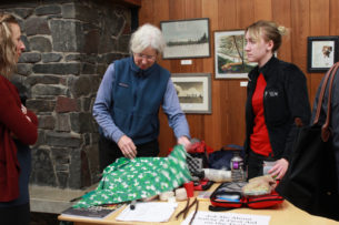
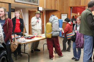
An evening of rain, wind gusts, and downed trees could not deter seventy hearty folks of all ages and skill levels from attending the second Backpackers’ Rendezvous held at a local lodge in Eugene, Oregon.
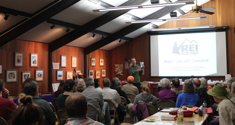
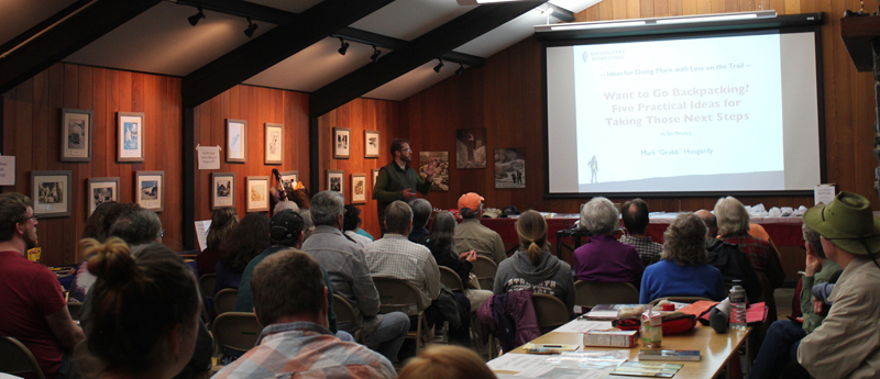
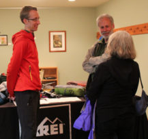
The first hour includes presentations from PCT and AT thru-hiker Chris “Scrub” Burke with tips on approaching a large hike, REI’s Mark “Jar-Jar” Lemaire on researching lightweight gear options, and Mark “Grub” Hougardy on five tips for starting a section hike on Oregon’s PCT.
Presenters from Left to Right: Mark “Grub” Hougardy rendezvous organizer, Mark “Jar-Jar” Lemaire of REI, and Chris “Scrub” Burke a PCT/AT thru-hiker.
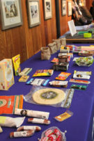
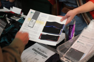
The second hour included knowledge tables, pack shakedowns, and interactions with local outdoor retailers and thought leaders, including lightweight ideas for the big three with REI-Eugene, staying warm and dry with Backcountry Gear; resources for making your gear with the Rain Shed, staying safe outdoors with a hiking club’s safety committee, hiking Oregon’s coast with the National Coast Trail Association, and dry food options with Capella Market.
One of the best quotes during the event came from a woman in her thirties, “I want to go backpacking and don’t know where to start. I came here to find out more.” Thank you to everyone who helped enrich and strengthen the backpacking community in Eugene.
Chris “Scrub” Burke, PCT & AT thru-hiker shares his lightweight tips.
Mark “Jar-Jar” Lemaire of REI on “Lightweight Ideas for the Big Three, Starter Trips, & Navigation.”
Mark “Grub” Hougardy on “Want to Go Backpacking? Five Practical Ideas for Taking Those Next Steps”
Volunteer Organizer: Mark Hougardy | Location: Eugene-based Hiking Group Lodge | Date: April 30, 2016 | Duration: 1 day | Participants: 25 | Type: Outreach Event
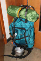
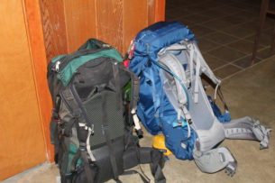
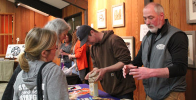
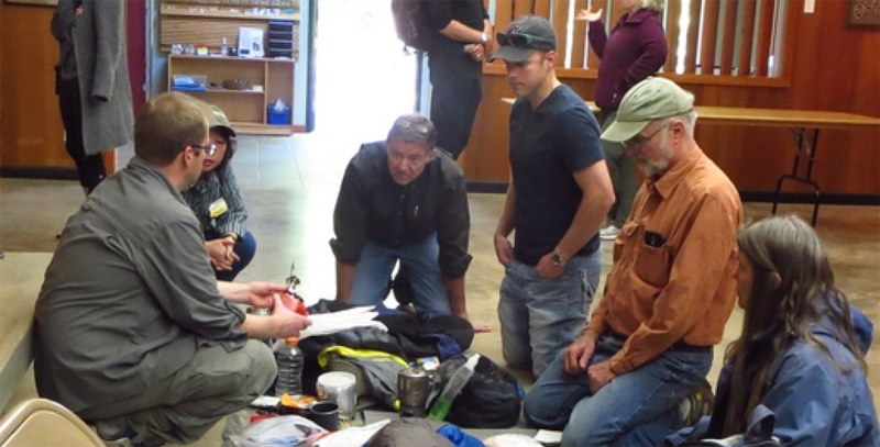
Backpackers of all experience levels spread out their gear to share ideas and swap stories about backpacking. Of particular interest was the lightweight and ultra-light items and how they could help people do more with less. Twenty-five people attended to learn from other backpackers about what stove, sleeping bag or tent might best help them on the trail.
In the spring and summer of 2014, I enjoyed volunteering with the Nature Conservancy of Oregon (Southwest office). My role was to help grow participation in the local volunteering community. My services included upgrading their email management tool (to Constant Contact) and designing several newsletters.


 Volunteer Organizer: Mark Hougardy | Location: Eugene-based Hiking Group Lodge | Date: April 2017 | Duration: 1 day | Participants: 80+ | Type: Outreach Event
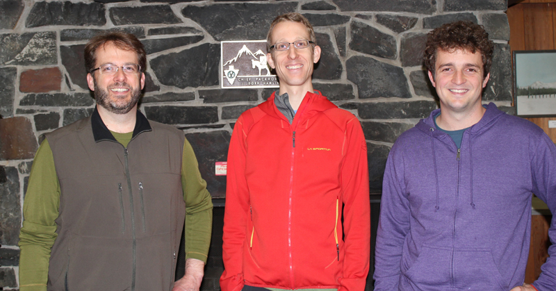


 In the spring and summer of 2014, I enjoyed volunteering with the Nature Conservancy of Oregon (Southwest office). My role was to help grow participation in the local volunteering community. My services included upgrading their email management tool (to Constant Contact) and designing several newsletters.