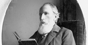
Judge John B. Waldo is often associated with John Muir and Henry David Thoreau. While his impact was substantial he is not as well known as other conservationists of the day. In the late 1800’s he proposed a green space straddling the crest of Oregon. For decades he traveled extensively documenting the area’s unique topography and natural beauty. He worked hard to pass legislation preventing special interests from monopolizing the area’s resources. Today, numerous national forests, a national park, and wilderness areas between the border with California clear to the Columbia Gorge exist because of his vision. Our visit to the UO Archives was an introduction to his original writings and photographs. We even saw some founding documents for Crater Lake National Park.
Trip Report – Volunteer Leader: Mark Hougardy | Group: Eugene-based Hiking Club; |Â Dates: February 16, 2019 | Participants: 6 | Type: University of Oregon Archives
Dan Witz is a master of trompe l’oeil (‘trick of the eye’), the visual style of painting that looks three dimensional.
In the summer of 2017, he visited Eugene, Oregon, and placed 11 (according to the city) of his works around town. While Eugene celebrates many building-sized murals, Dan’s artwork is on a smaller scale. Locating them requires some leg-work as they are not published on a map. Also, you might have to revisit places that you at first would overlook. Most of his works are downtown between 7th & 11th Avenues and Olive & Willamette Streets – I listed some hints below – their charm is in discovering them. Several pieces are outside the downtown grid and for these, I’ve provided more specific information on where to find them. Several were removed (stolen), these are mentioned as well.
While researching Dan’s work I learned that he called such works “WTF” images. The idea is that a casual bystander on the street or someone passing in their car might briefly spy one his works, and ask the question, “What the f$@k was that?”
His artwork is creative, surprising, and sometimes disturbing. You will be asking questions about his work long after you spy them.
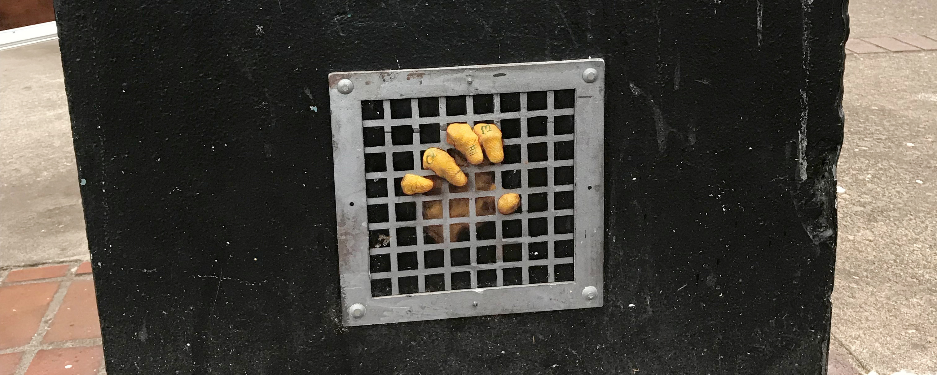
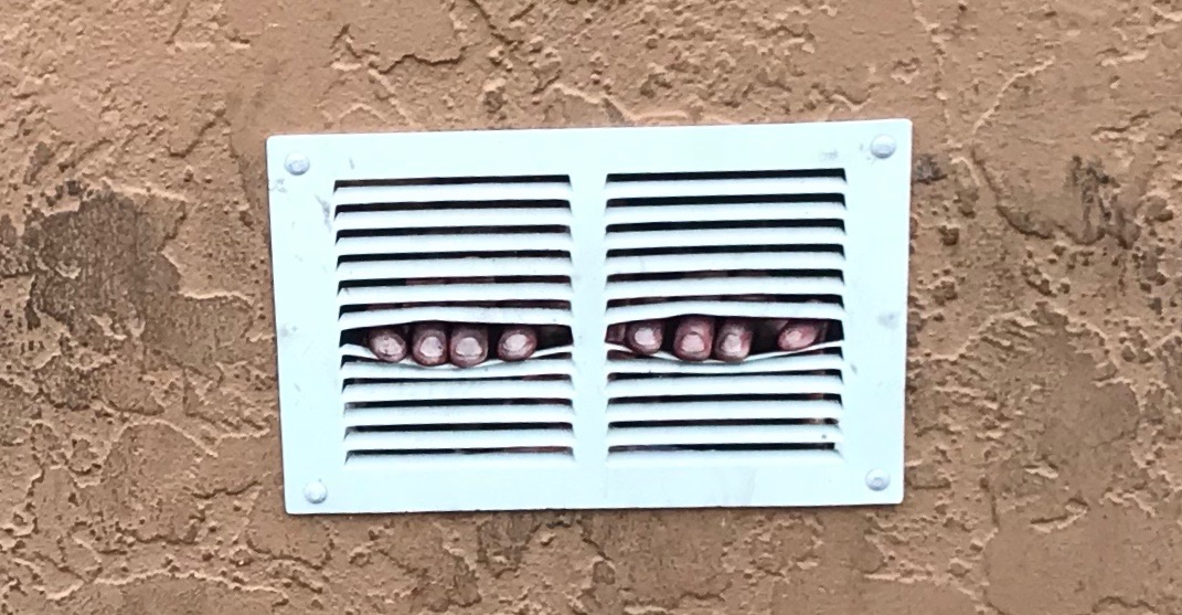
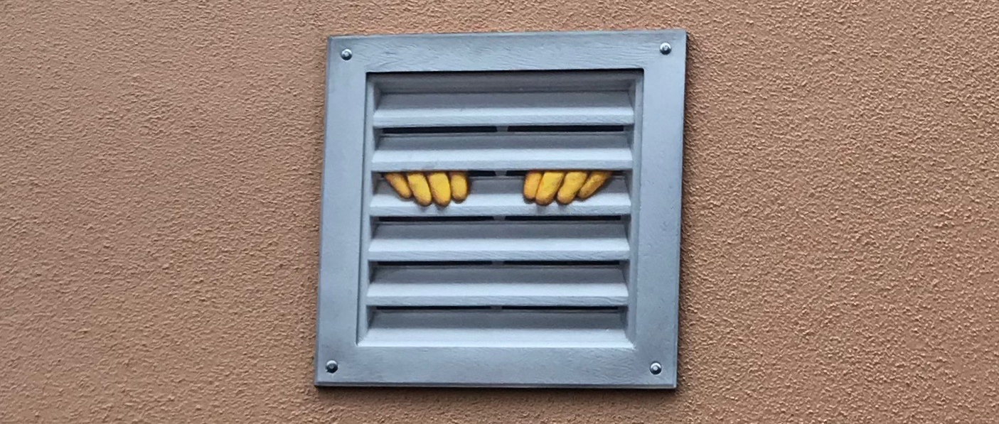
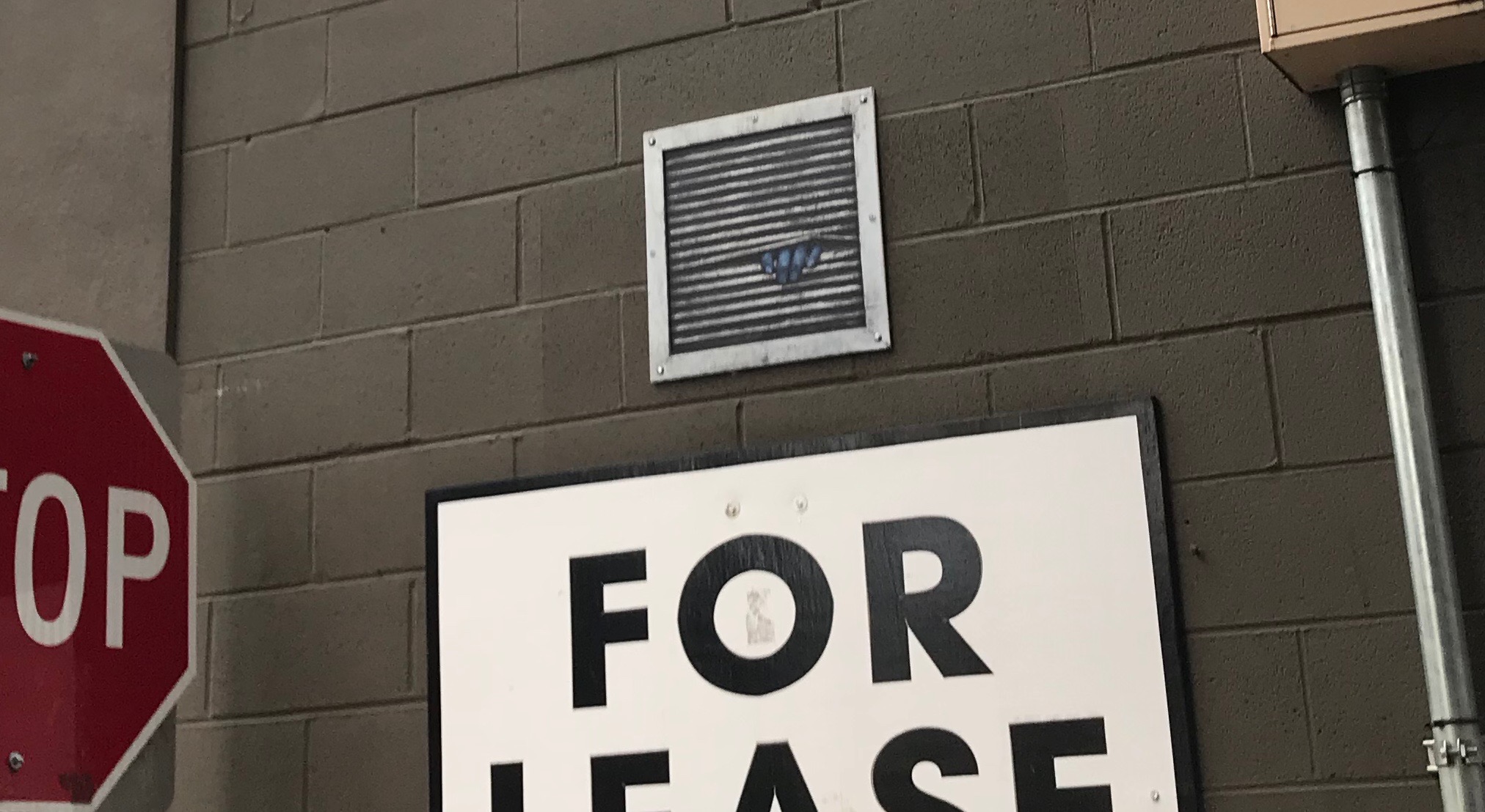
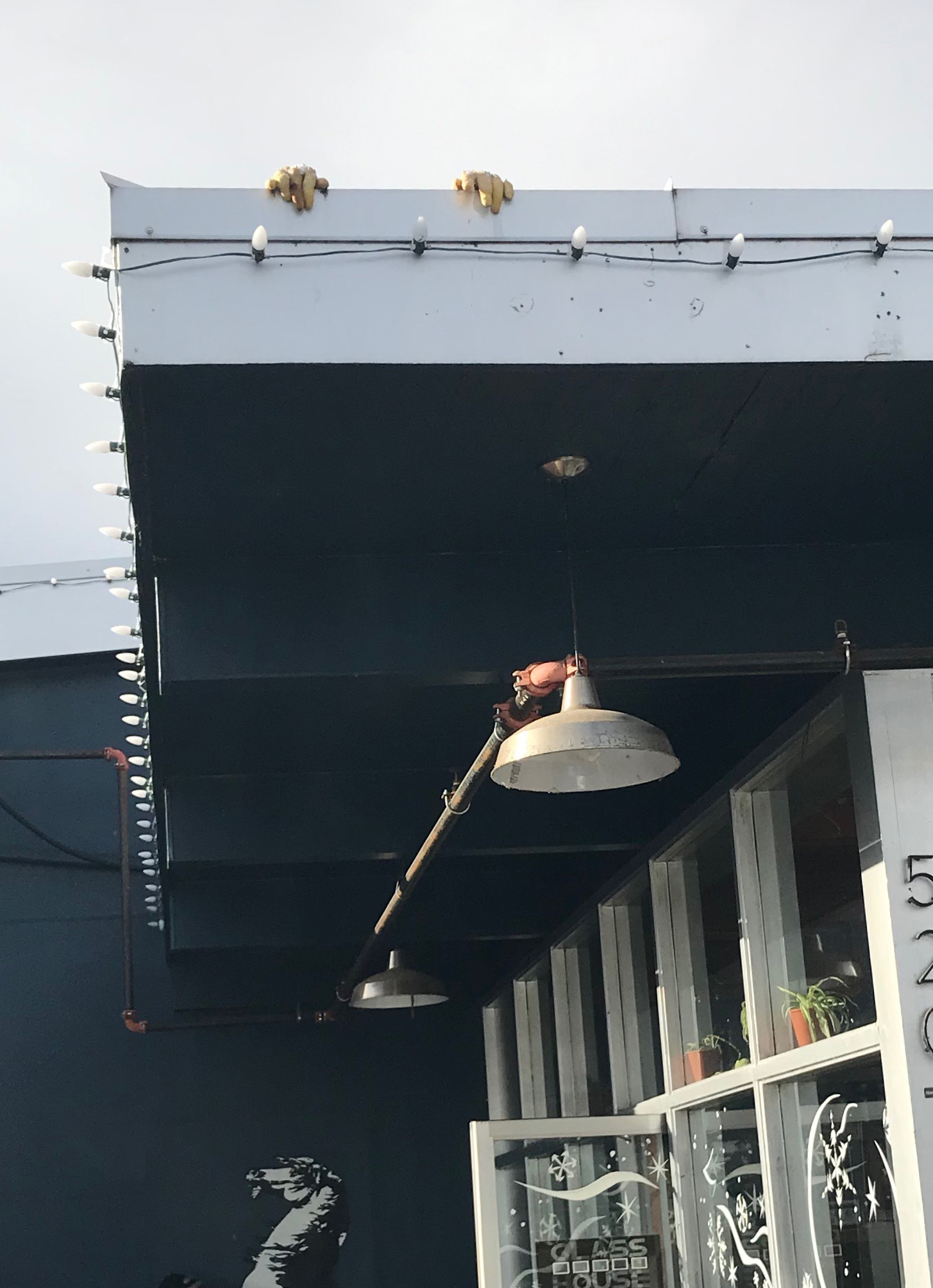
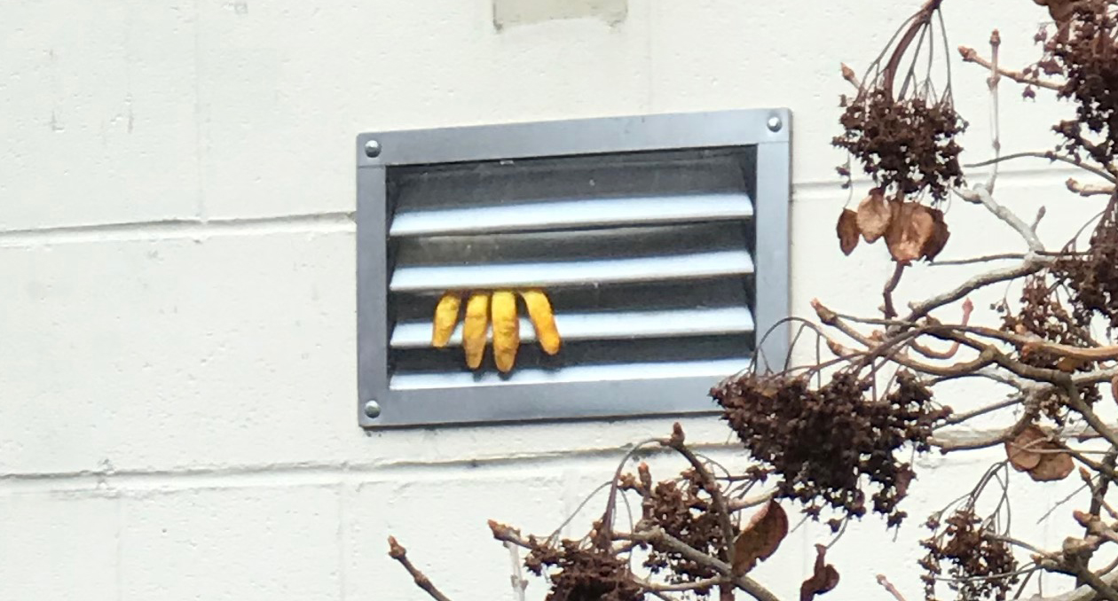
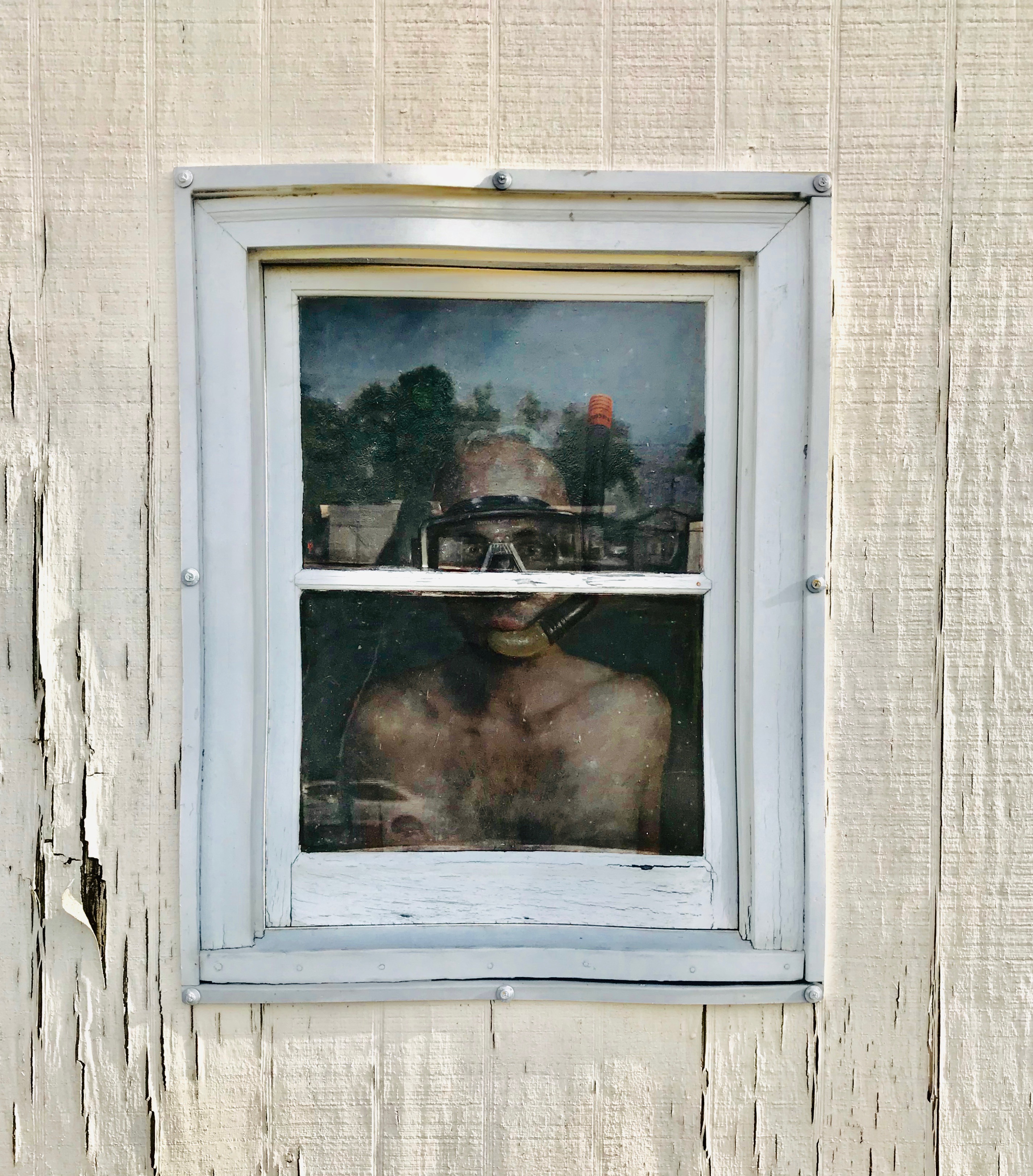
#1. One of the most photographed images of Dan Witz’s work in Eugene. It is located downtown on Broadway near a restaurant. Look close to the ground.#2. Dan’s images are sometimes in places that you might not visit. Here, in a downtown alley, next to the trash dumpster and the recycling bin is a WTF image. …most people would overlook such an area, I did…at first. I wonder how much of the grime on the wall and the neglected-looking doors is real vs painted by the artist.#2 (continued) A close-up of the image.#3. These hands appear to be wearing yellow rubber gloves like a person might wear who uses caustic chemicals in cleaning. Such gloves hide hints of race, age, gender or other traits that might bias the viewer. It also suggests anonymity. You’ll find this in an alley close to Broadway.#4 (two panels). Many of Dan’s images are in close proximity to Blek le Rat’s stenciled works here in Eugene. Like all good things, it takes some work to divine the location of his images. Both pieces in the photo shared wall space which appears unfinished, even a bit garish, yet it is in this unkempt space where you find the artists’ creativity. Dan’s work on this wall is possibly one of this most disturbing for me; one because of its unnerving presentation of a reclining human figure that appears to be inside a wall, and secondly that I walked past this wall for many months before I really saw it.#4 (continued) A close-up of the reclining man; is he resting, or deceased? The two panels together are about 5 feet. Sometimes it’s easier to see this image from the side. To find this piece, look at the back wall where a cabaret for actors might work.#5. Definitely a WTF image – seeing a blue hand pushing the grate apart. Why is the hand blue? Does the hand belong to a tagger whose hand is covered in blue paint? Or is it something more sinister? The location for this is easily overlooked by people visiting the local farmer’s market on weekends. Instead of walking up the stairs to your car take a look around the garage’s ground level.#6. OK, this is not one of his paintings, but his work does trick the eye. While in the proximity of Tacovore in the Whiteaker (Eugene) look at rooflines for his yellow gloves. Note the Blek le Rat work in the background.#7. This image is downtown. It’s hiding in plain sight above the back door of a music venue that opened in 1925.#8. This is a window-sized design. I have both driven past and seen its location from across the street many times, yet never observed it. It is worth finding. Start at the Whole Foods in Eugene and make your way across the street to the All Prophets Tattoo shop, keep your eyes open. REMOVED: Sadly, this work was removed in early February 2019 when the building repainted. It is unknown if the artwork survived.
#9 REMOVED: This was located near 6th & Pearl along the stairwell of the Lane County Parking structure.
#10 REMOVED: This very small piece was located on the corner of Oak & Broadway. Look for the crossing light box in front of D.A. Davidson & Company. You will see an outline of where the piece had been affixed to the box. It is just below his tag: a gray smudge (a tell-tale sign, but it is incongruous with the clean surroundings and one’s eye will at first overlook it).
#11 REMOVED. This photo is from the 20x21EUG Mural Project. This 2017 image shows Dan Witz working on his street art located on 11th Ave by the Chase Bank. It was removed/stolen.
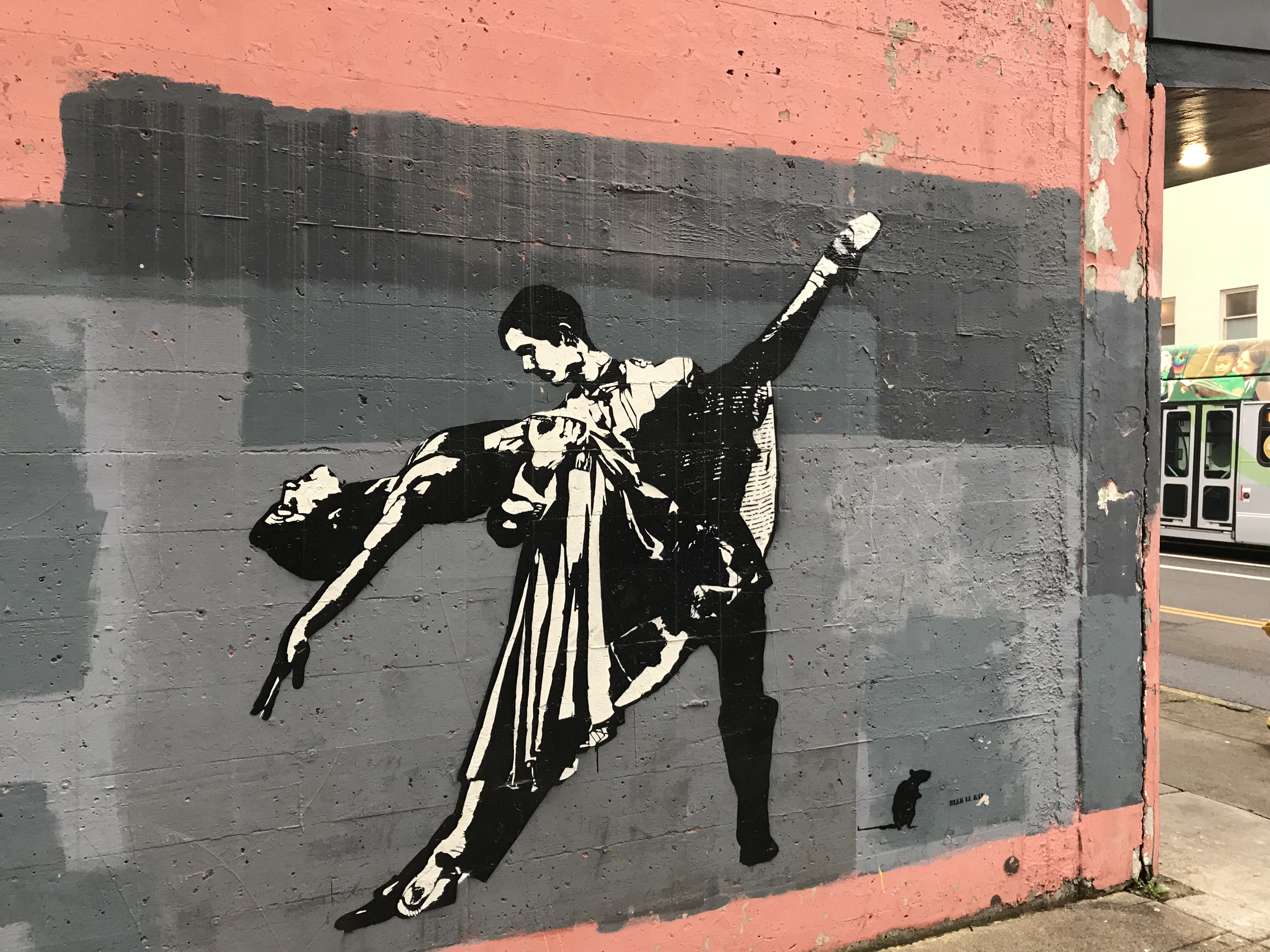
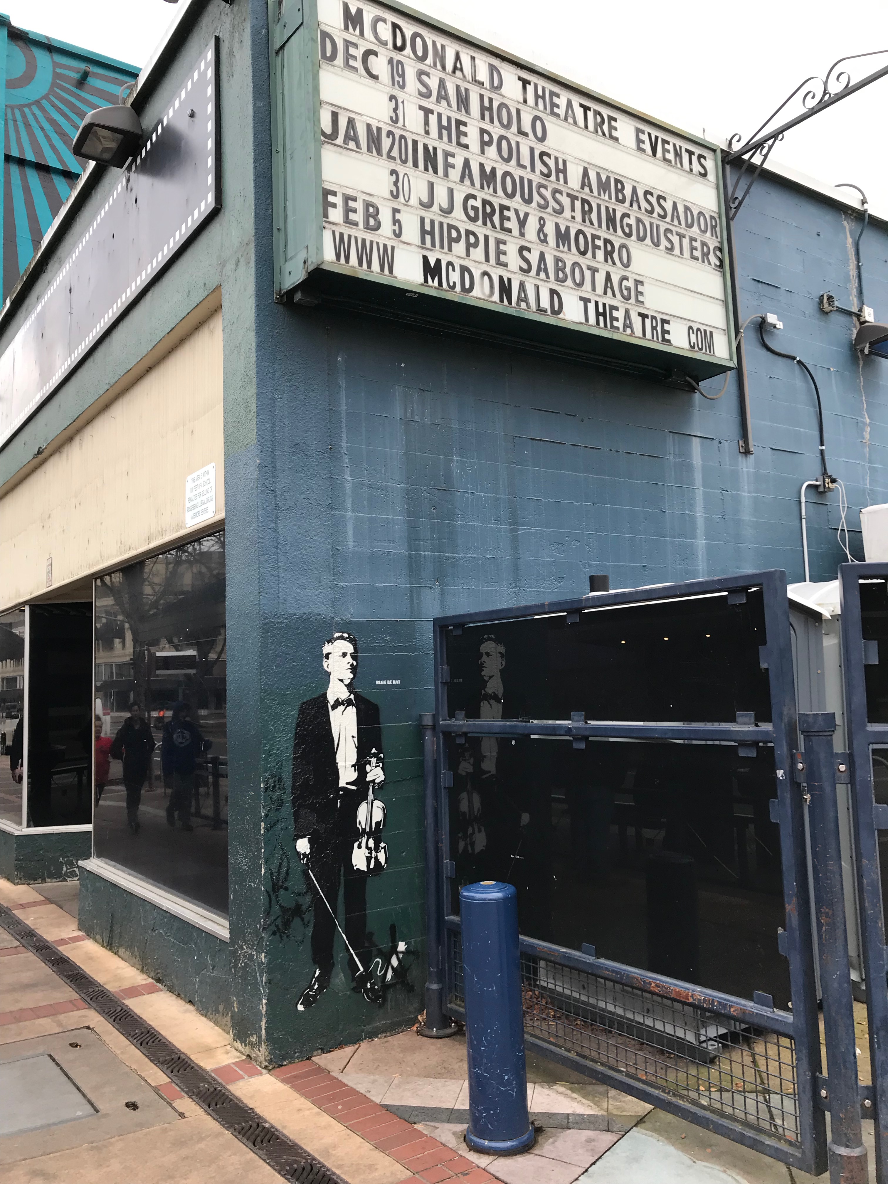
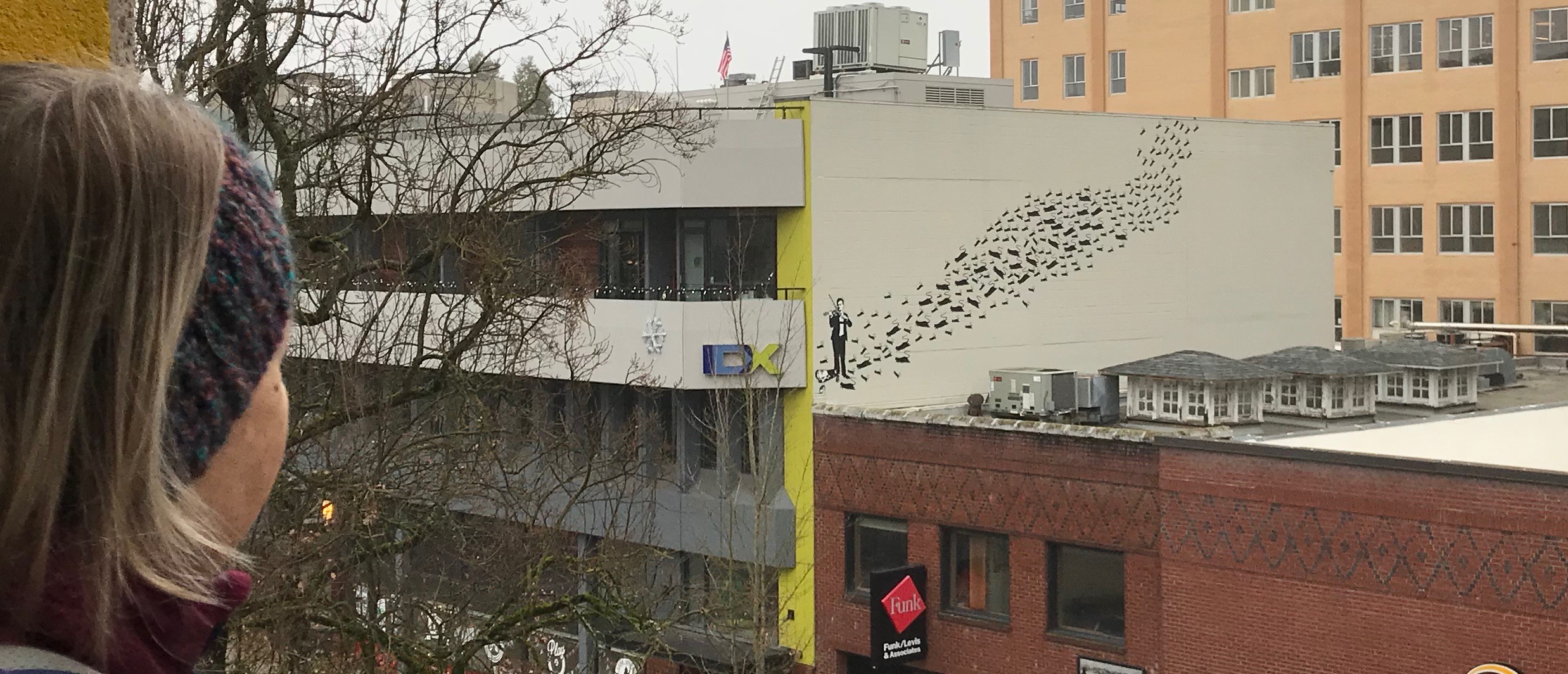
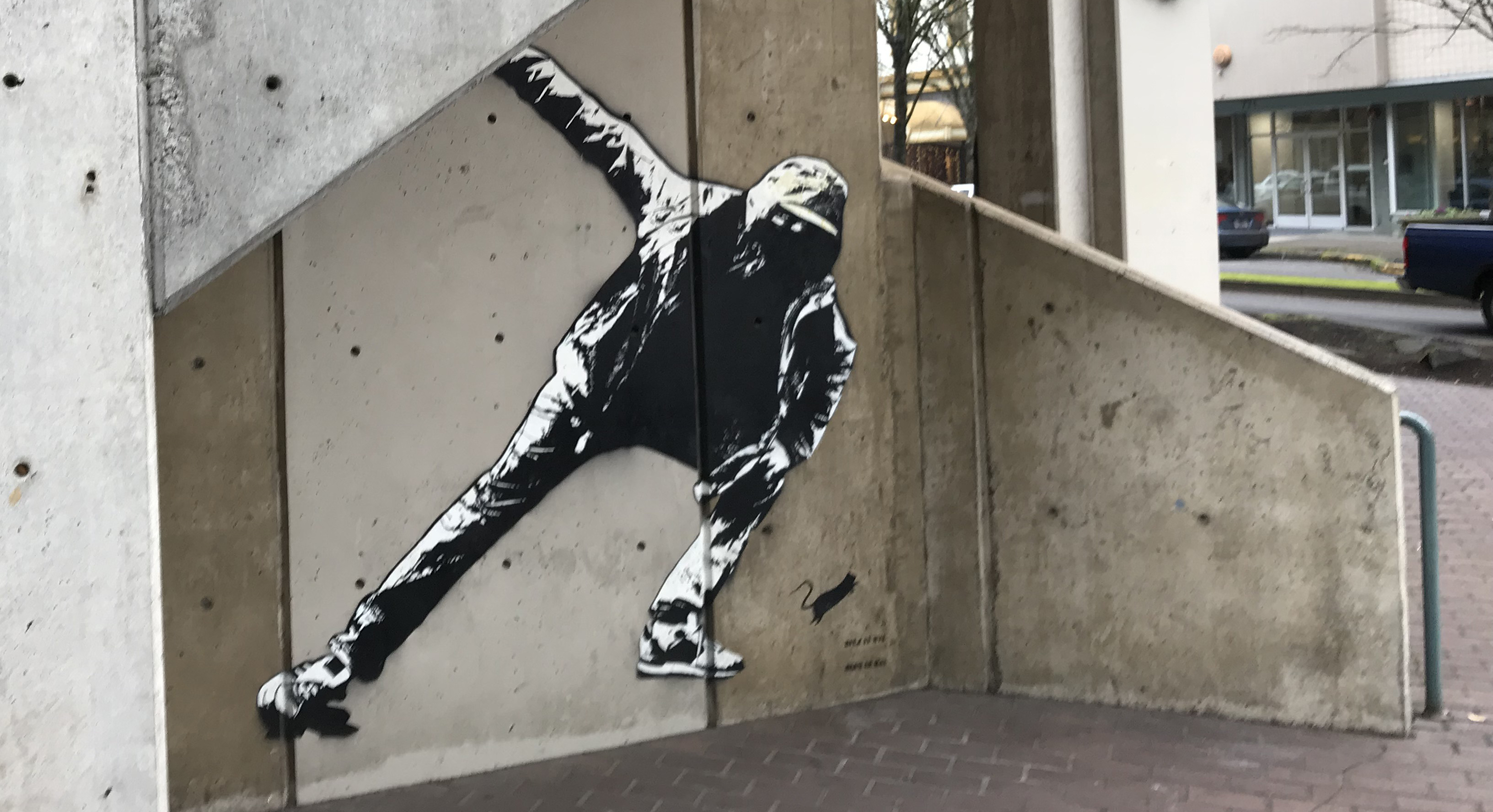
Blek le Rat is a street artist whose work appears in many cities, including Eugene, Oregon. Finding his work can be part of a great day outing.
In 2017 Blek le Rat visited Eugene, Oregon, as part of the 20×21 Mural project. He placed 10 works around town. Most are located in a grid in the downtown area between 7th & 11th Avenues and Oak and Olive Streets. Several images are outside this grid area and those locations are mentioned in the captions. One piece was painted over in the summer of 2018, an image of it is included below.
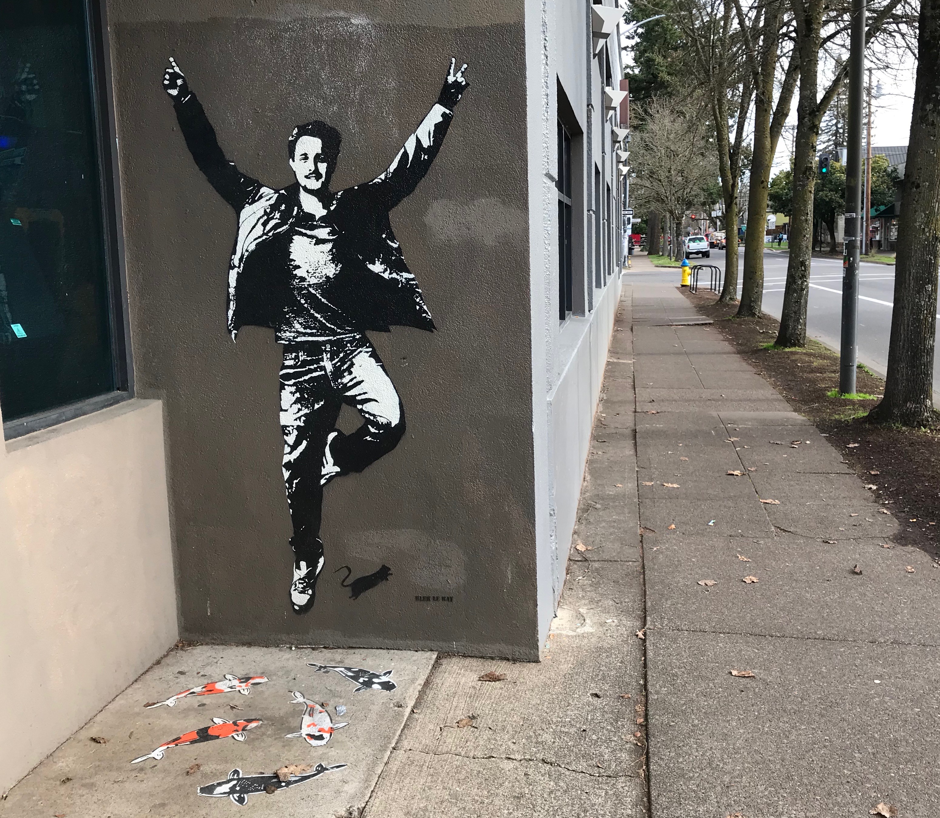
Blek le Rat got his start as a graffiti artist in the 1970s in Paris. Eventually, he used stencils to differentiate his street writing from others. Today, he is considered the godfather of stencil street art and is credited with influencing many others, including Banksy. Accompanying his work is often the image of a black rat. Blek once mentioned (paraphrasing) that rats are the only wild creatures in an urban setting, their numbers are vast compared to the human population, and they also carry subversive plague like how graffiti affects a city.
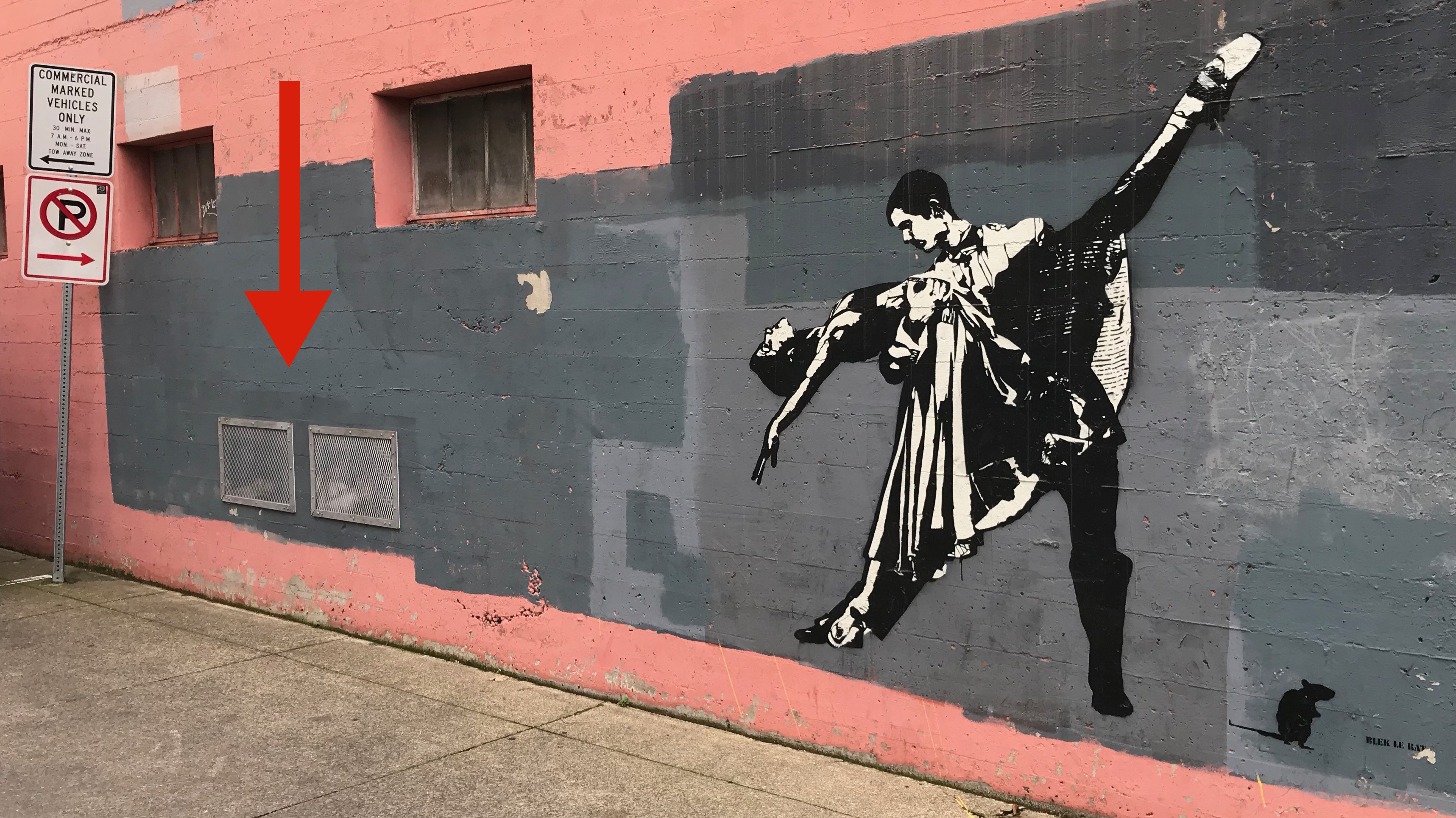
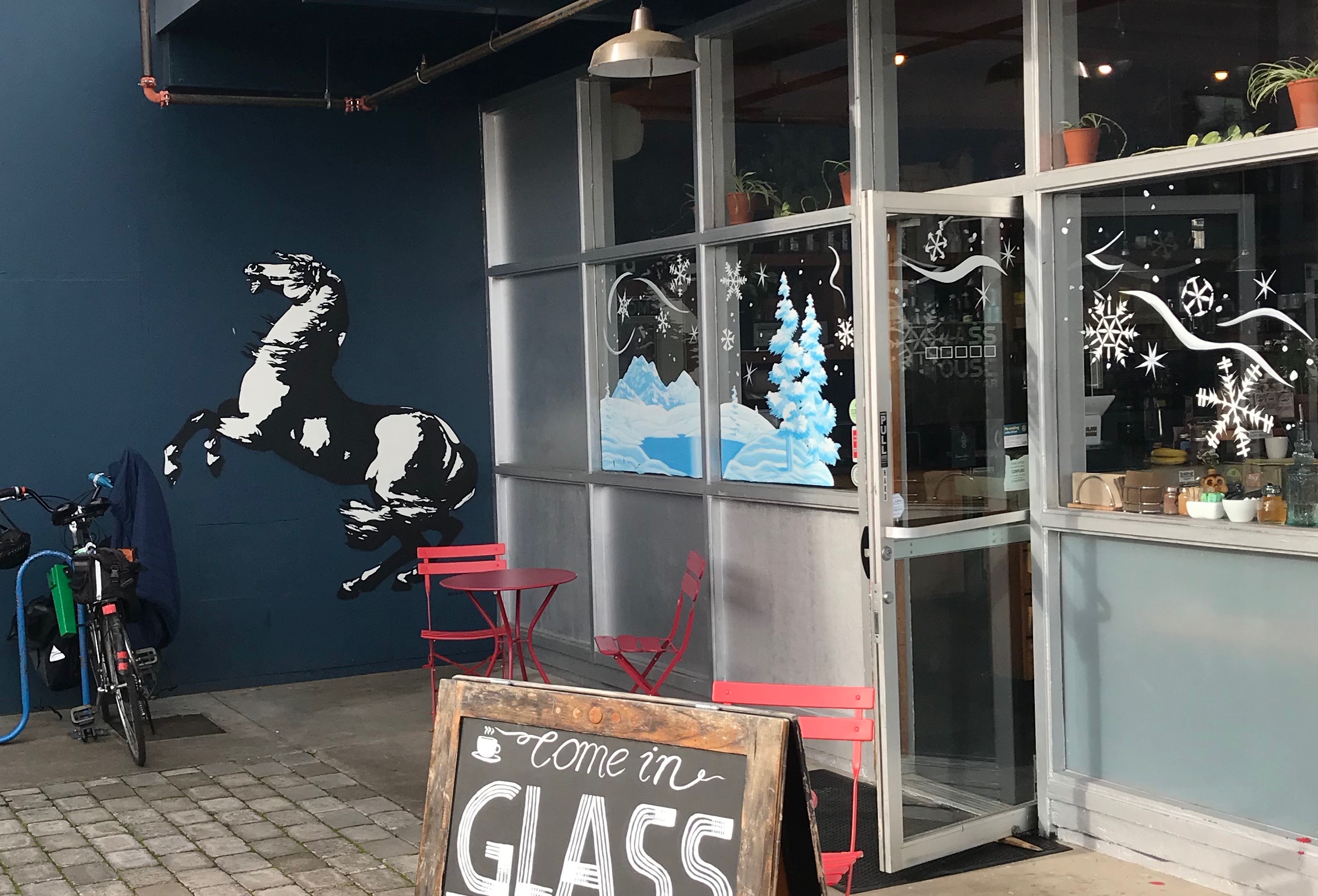
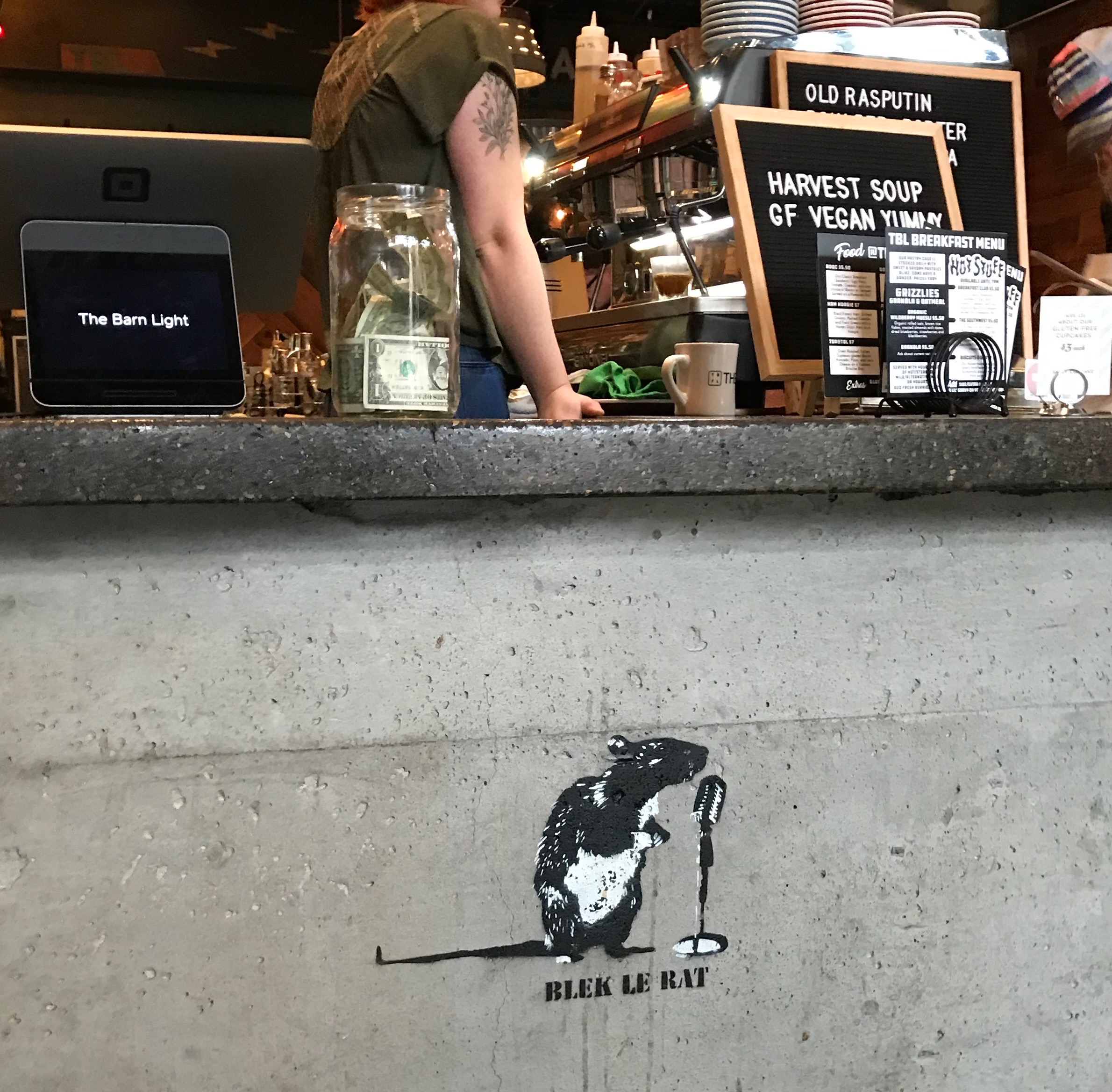
Tug of War. This image is located next to the stage door of the Hult Center (in an alley).Another one of Blek’s stenciled works outside the downtown grid. This eye-catching design is located next to Tacovore in Eugene. Enjoy a cup of coffee at the local shop as well.This is another work that is outside the general grid. It is located near 13th and Oak, and in the proximity of some other wonderful murals (from other artists). The man is the image is apparently of Blek’s son and his likeness appears on many of the Blek’s works around Eugene. The Koi Fish are from a previous artist’s work and can be seen at several location swimming around town.A downtown image on the backdoor of a restaurant. Note the tagger is dropping the can of spray paint. Is he dropping it because it is empty or because the cops have shown up?Ballet – dancing couple. When you find this piece (if you take public transit downtown look around) keep your eyes open for works of other artists like Dan Witz.Another one of his works in downtown Eugene. The musician is not playing. I really like the reflection in the plexiglass, this is almost two images. Curiously, in juxtaposition, a nearby work of his features two dancers.The Pied Piper. This wall-sized work is at the edge of the IDX building in town. It is not hard to see the piper from the road below, but I’m surprised how many people overlook the work entirely. To see it properly you need to climb up several flights of stairs in the parking garage. At the piper’s feet is a rat with a microphone.A graffiti tagger looks around a corner. If you park your car to attend the local Farmer’s Market you’ll see the tagger – or, the tagger will see you.An image of the tagger and bird in Eugene, Oregon. This sadly was painted over in the summer of 2018, it was located just off Broadway between Willamette and Olive Streets. Photo from Blek’s website.The mouse with a microphone. Possibly my favorite of his Eugene works. This is different from his other pieces in Eugene in that it is located inside a building. It is easy to overlook, though it can be viewed from the sidewalk through the door. The name of the establishment is in the photo. …Nice ink on the person’s arm.
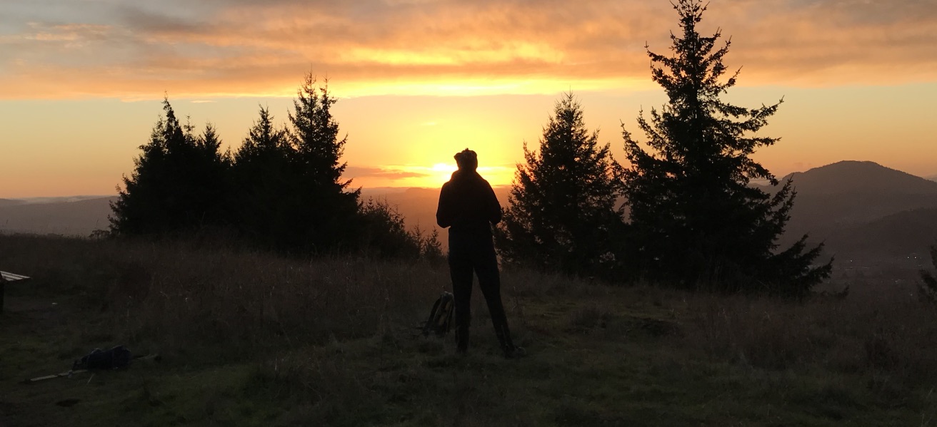
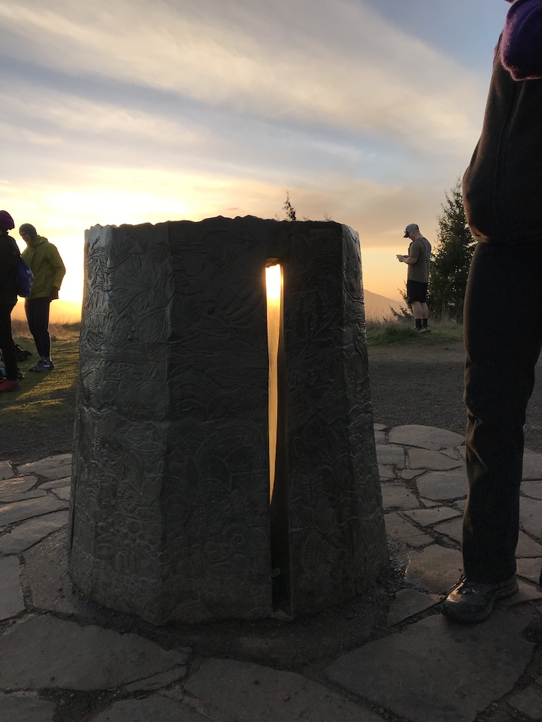
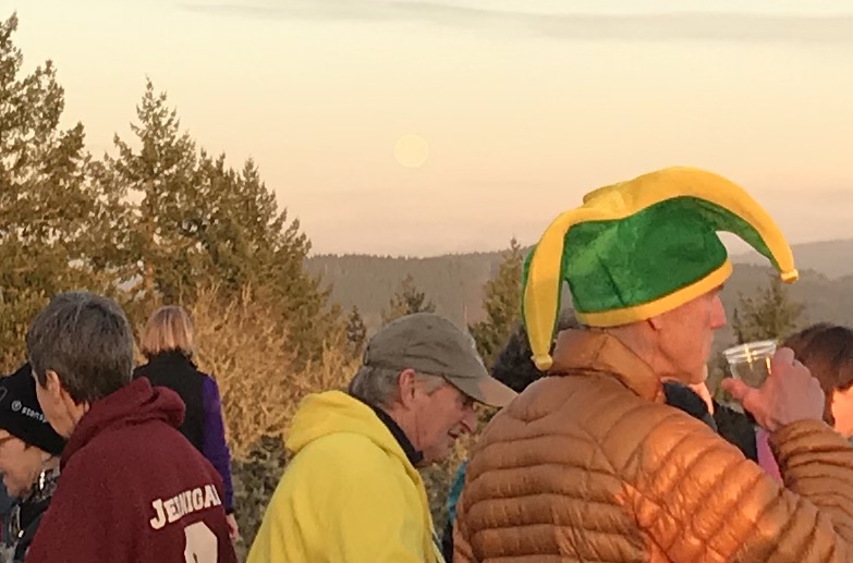
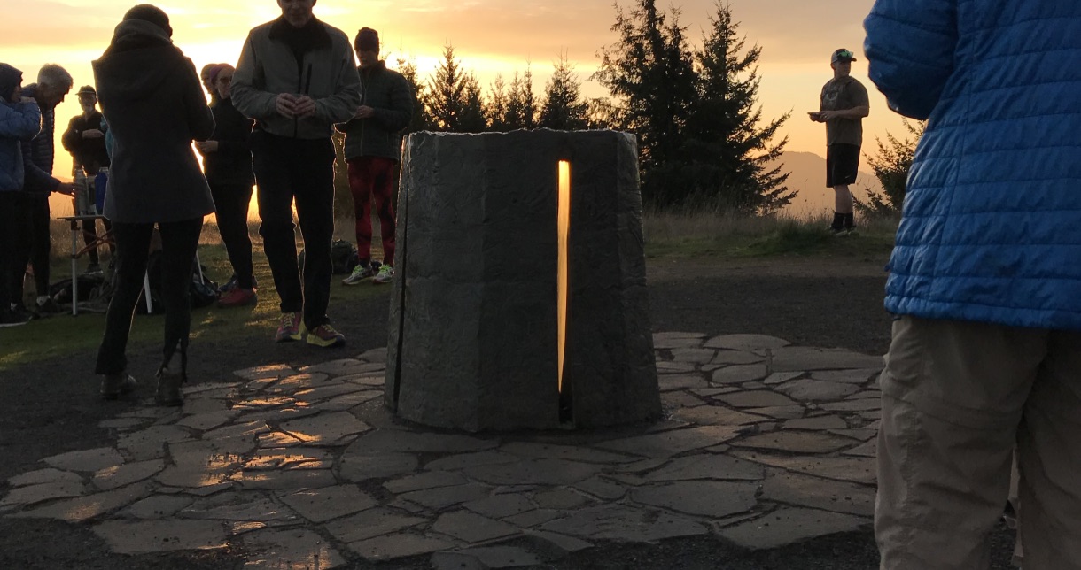
Happy Winter Solstice! This evening, a group of runners, hikers, and outdoor enthusiasts celebrated the return of the light at the Mt. Pisgah Sighting Pedestal, Eugene, Oregon. During sunset, we also witnessed a simultaneous moonrise – the December Cold Moon. What was really cool was that by looking back through the pedestal to the east the moon could be seen cresting the horizon. The setting sun and moonrise were approximately 180 degrees opposite!
The sighting pedestal is aligned with the setting sun Summer and Winter Solstice, the light appears through the notch at these select times.The moon’s orb rises over the revelry. Locals climbed 1,000 feet to the top of Mount Pisgah to celebrate.
San Francisco is a city born within a moment – the discovery of gold in 1848. The city’s parents were not elites or idealist, but gritty prospectors, sailors, railroad workers, gamblers, ladies of the night, grifters, poets, and carney hustlers. Like then, today’s San Francisco is often idealized as being a place where a person can discover one’s fortune, where an individual can craft their future, and where it’s OK to be weird. But, beneath the sidewalks, unimpressive alleys and among lonely buildings of the original city —the old Barbary Coast— is a hidden San Francisco, a city that was forged in fear, sex, and gold.
Trip Report:
Volunteer Leader: Mark Hougardy | Organization: Eugene-based Hiking Club | Date: November 2018 | Duration: 4 days | Participants: 8 | Type: walking and urban exploration
Our interpretive walking trip explored how fear, sex, and gold changed the city in three important ways. We saw how fear directed at those considered “unfit” by society (poor, minorities, and women) reveals they are the true backbone of the city, then how censorship of sex led to modern freedoms, and finally how gold fever changed forms never really disappeared.
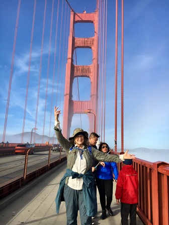
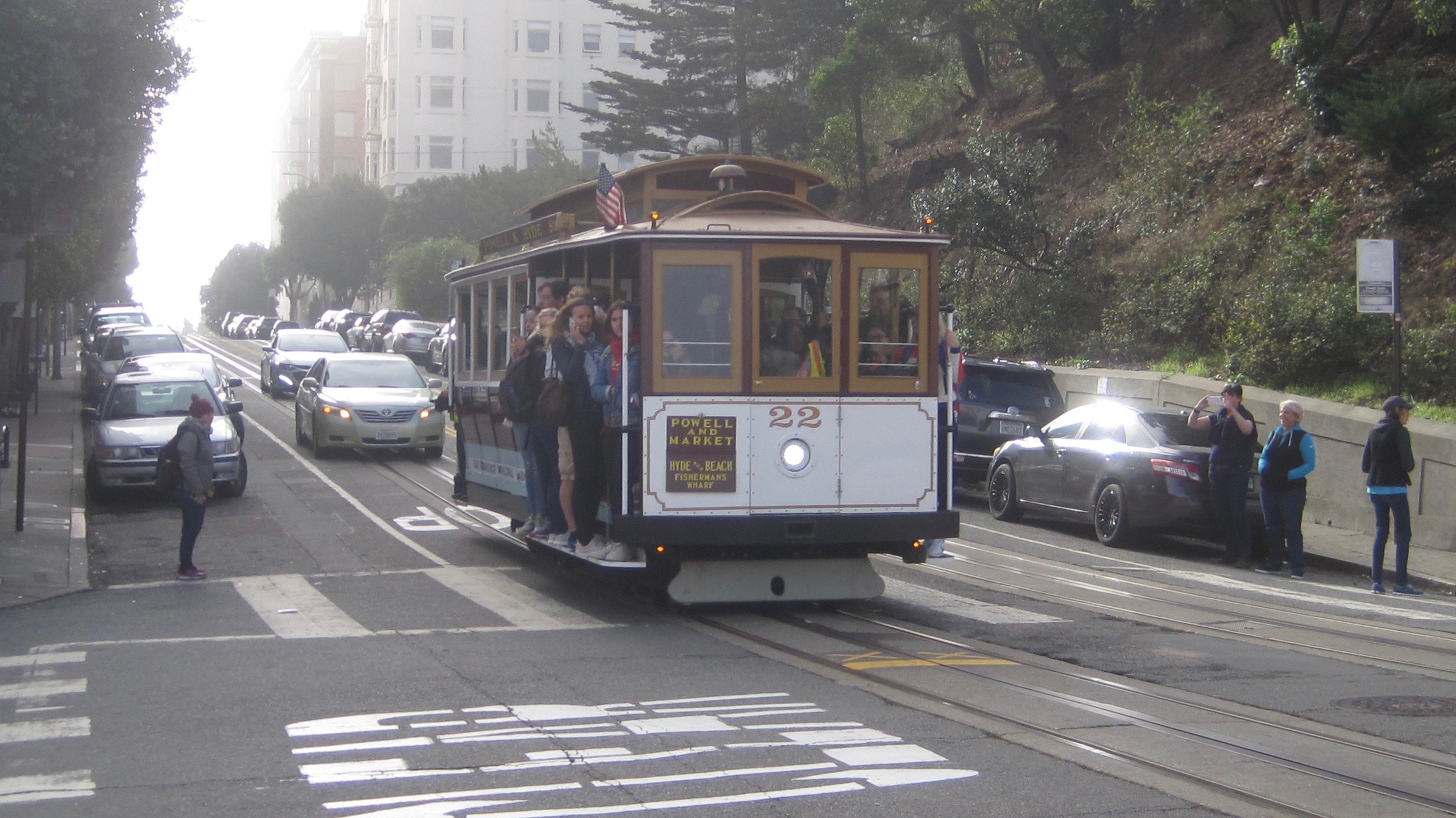
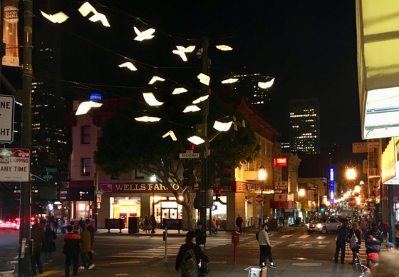
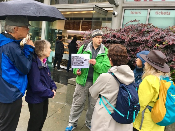
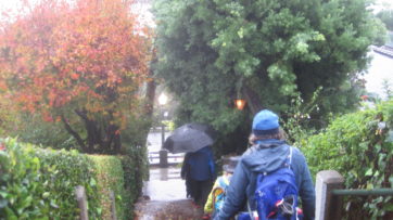
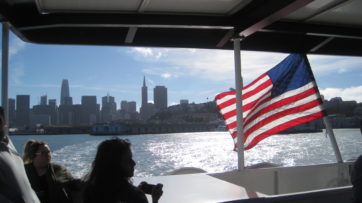
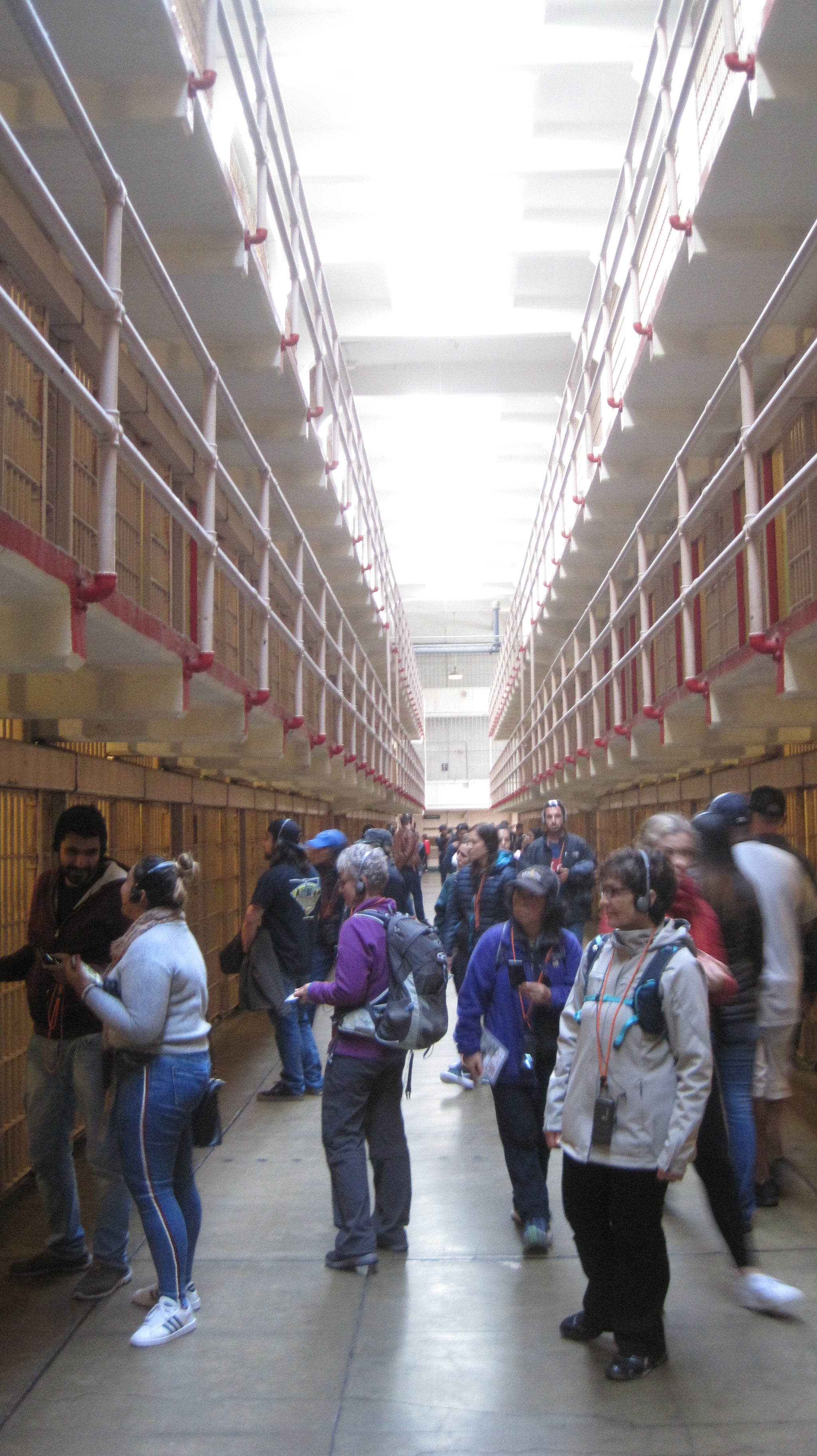
Our group traveled by air from Oregon on Thanksgiving Day to San Francisco. Many of us overnighted at the Fort Mason Hostel and dined at a waterfront restaurant. The next day we traveled by trolley to Union Square and enjoyed the Christmas decorations before starting our 5-mile walk. We explored the sordid history of Maiden Lane, the colorful streets of Chinatown, and the historically depraved area known as the Barbary Coast. Our route followed much of the original shoreline, which is now half a mile inland. We visited City Lights Books and places where the counter-culture Beats hung out. We climbed the steep steps of Telegraph Hill to see the murals of the historic Coit Tower. Our walk took us along garden-lined staircases and alleys. The next day we traveled to the lonely island of Alcatraz to learn more about its prison then enjoyed an afternoon exploring the city. That evening the group enjoyed a salty performance of Beach Blanket Babylon. On the final full day, several members walked ten-miles from the Marina District over the Golden Gate Bridge to Sausalito and returned by ferry. The group walked ~20 miles in total. The group returned by plane to Oregon. Photos by Mark Hougardy & Meg Stewart Smith.
Some of the faces and places who showed participants a good time… er, helped them learn more about San Francisco’s story on this wicked trip.
Group Leader Mark Hougardy sharing a story about a gutsy woman who challenged societal norms in the 1860s. Today, everyone can ride a trolley in San Francisco because of her struggle.
We caught a Holiday performance of Beach Blanket Babylon. King Louie sings his heart out. Photo: Beach Blanket Babylon
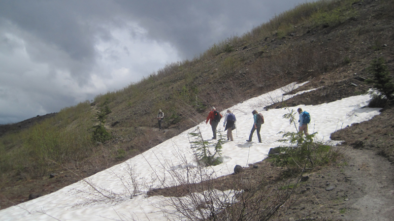
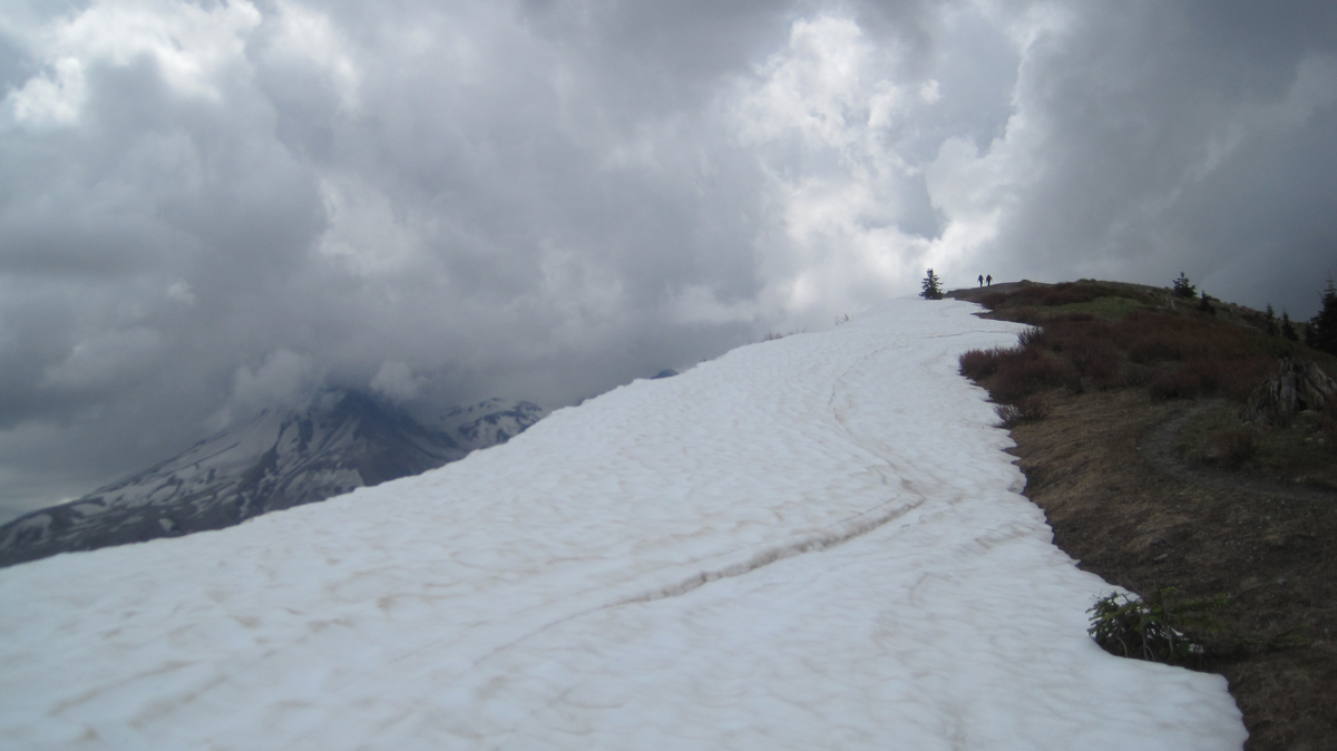
Explorations can sometimes be found at 38,000 feet while sitting in the cramped quarters of an airplane. The route between San Francisco, California and the Pacific Northwest is a favorite to visually explore because of the varied topography. Here are some photos, the images were taken over several trips.
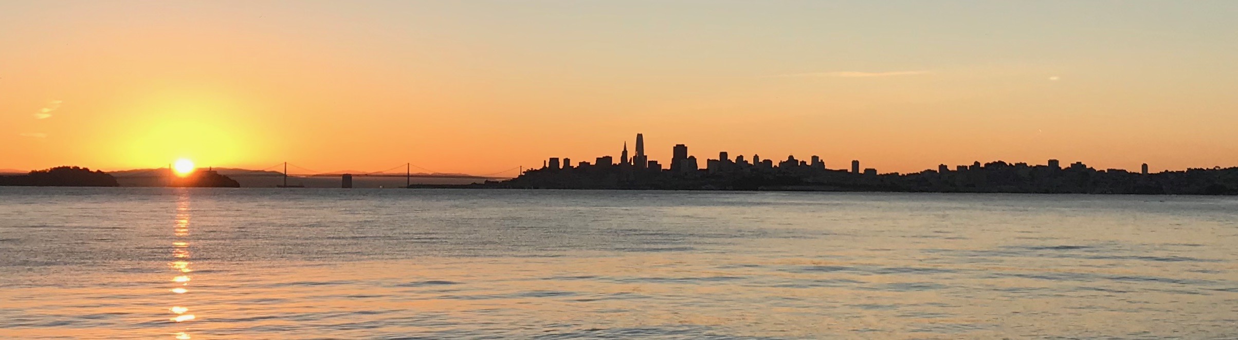
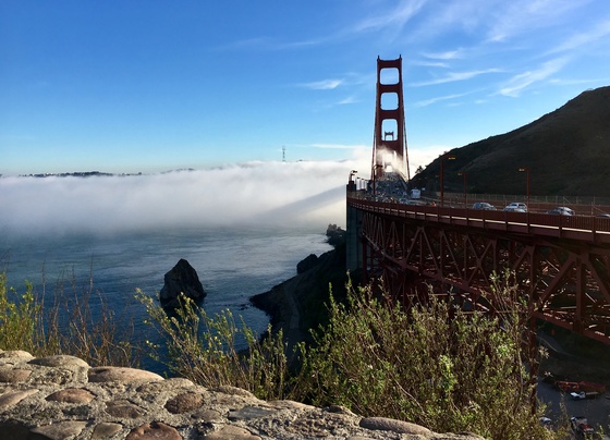
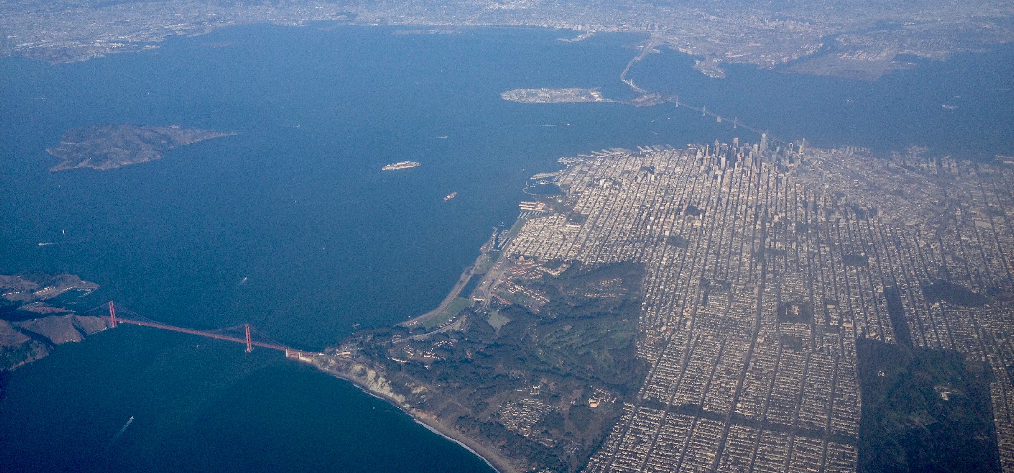
A magnificent view of San Francisco and the Golden Gate. San Francisco covers an area roughly 49 square miles! The Golden Gate Bridge shown on the left is 1.7 miles in length and 746′ tall.
Mount Shasta (14,179′). Shasta sits uniquely at the southern end of the Cascade Range and the northern end of the Sacramento Valley. The mountain is so massive that it can be seen from 280 miles away from atop Diablo Mountain (3,848′), the tallest mountain in the eastern San Francisco Bay Area.
Crater Lake is in the distance. Once known as Mount Mazama, this peak rivaled Mount Shasta for prominence upon the skyline. Mazama erupted about 7,000 years ago, and in the process list its peak and collapsed upon itself. Over time the remaining crater filled with water. The lake is 2,000′ deep and about 5 miles across.
From north to south – left to right: Black Butte (6,436′) Mount Washington, Belknap Crater (6,876′), and the Three Sisters (north, middle and the south sisters); they were once known as Faith, Hope, and Charity.
From north to south – left to right: Ollalie Butte (7,219′), the snow-capped Mount Jefferson (10,497′), Three Fingered Jack (7,844′), Black Butte, Mount Washington, and Belknap Crater.
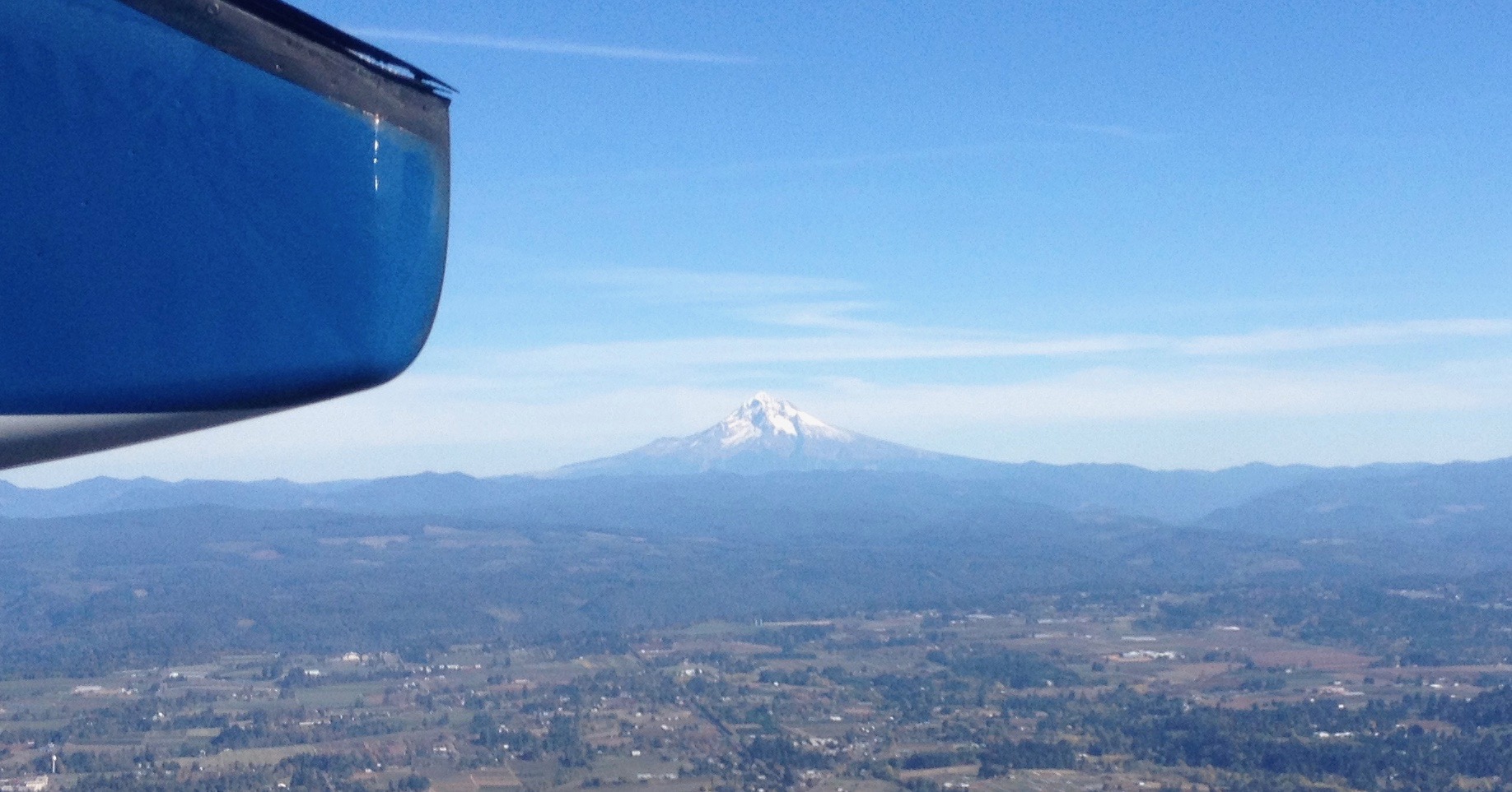
Mount Hood (11,250′) dominates the skyline east of Portland, Oregon.
Looking north into Washington State to Mount St. Helens (8,366′), Mount Rainier (14,411′), and Mount Adams (12,280′). The mighty Columbia River is in the foreground.
This was an exploration of two dramatic volcanic landscapes timed with the Autumnal Equinox.
Trip Report:
Volunteer Leader: Mark Hougardy | Organization: Eugene-based Hiking Club | Date: September 2018 | Duration: 4 days | Participants: 5 | Type: car camping, hiking, and caving
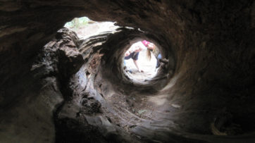
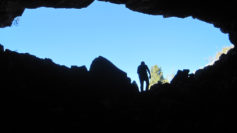
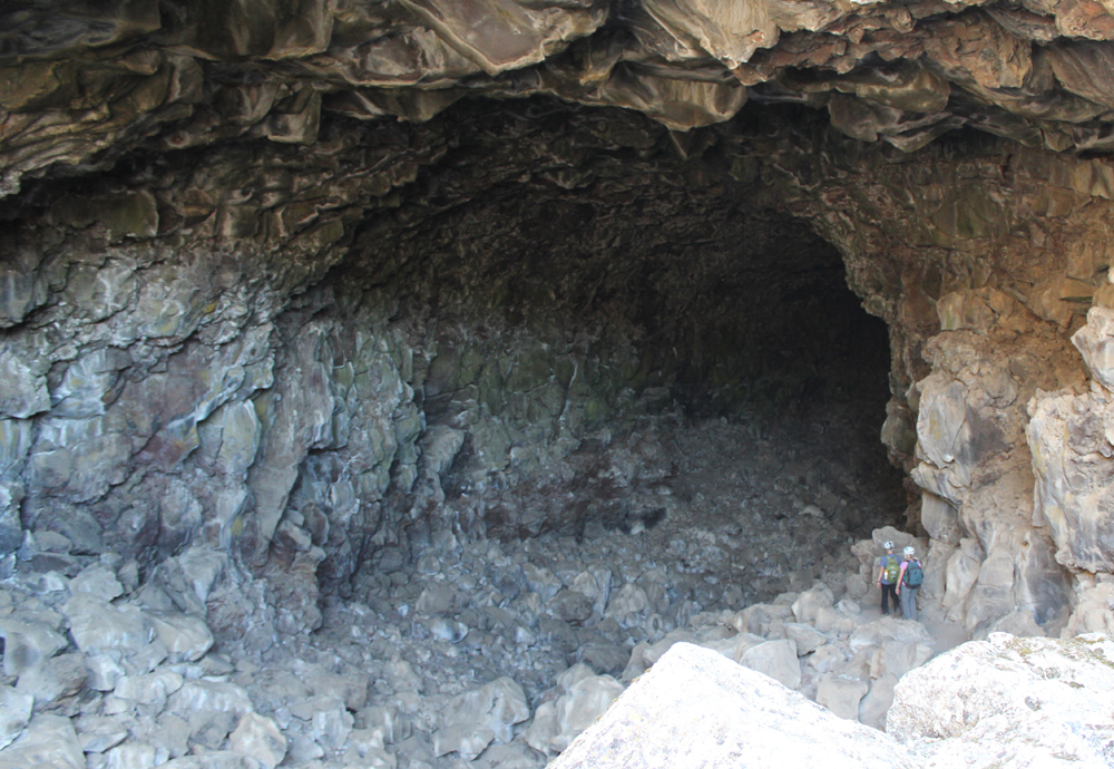
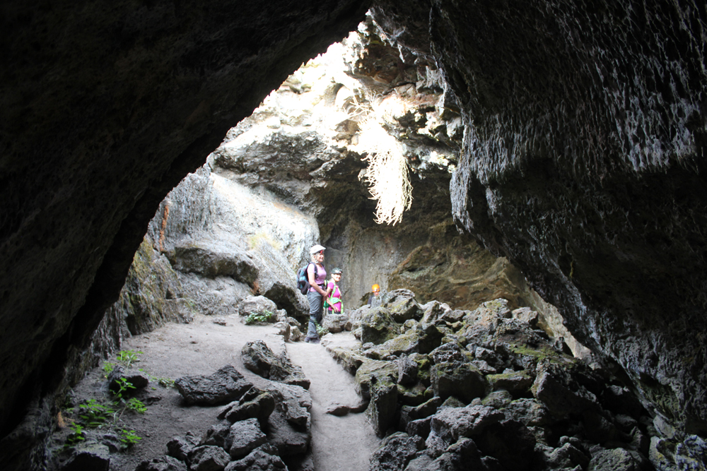
Upon arriving at the forbidding Lava Lands National Monument we made camp and then explored several accessible lava tube caves around the visitor center. We also climbed the conical shaped 5,302-foot tall Schonchin Butte where we enjoyed views 100 miles east to the Warner Mountains, near Nevada, and 50 miles west to Mount Shasta. In the evening, we walked along a dusty trail into the Schonchin Wilderness Area and encountered an entrance to a lava tube that was at least 4 stories tall.
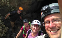
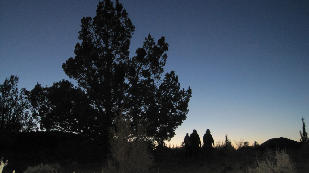
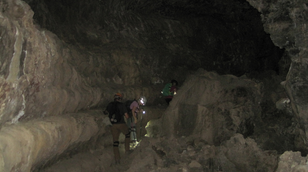
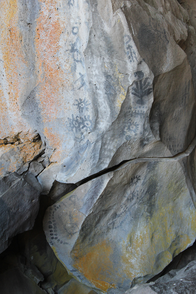
The next morning we hiked from the campground to Skull Cave where a small ice pond can be viewed year round. We also hiked to several pictograph caves and enjoyed our lunch on the trail. As the afternoon warmed we spent our time underground where we explored three caves and partially a fourth. Back at camp, we were surprised to discover that several hundred bugs had descended upon the hood of one of the cars, possibly attracted by the metallic-blue color. They had apparently been engaged in a frenzied mating and exhausting themselves to death. Bugs that fell onto the ground were snapped up by an eager lizard. As the sun set, we hiked into the nearby wilderness and enjoyed a pastel sky.
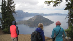
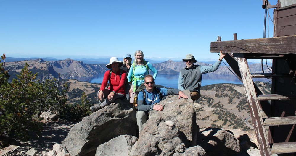
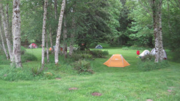
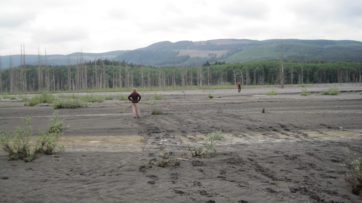
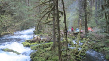
On the third day, we packed up and drove through the northern section of the monument. Our last stop was to Petroglyph Point where a monolithic wall includes petroglyphs, raptor nests, and evidence of former wave action. Tule Lake was a gigantic, yet shallow inland lake that existed for millennia. The lake was drained in the early 1900s and the exposed land turned into farmland. The existing lake is far to the west and is one-sixth its original size. Future explorations to Lava Beds will include additional sites of the Modoc War and seeing the remnants of an imprisonment camp where Americans of Japanese ancestry were forced to live during WWII. In the afternoon we drove to Crater Lake and made camp. The Mazama Campground was closing for the season and this was its last weekend. Upon our arrival, the sky darkened and it rained for several minutes. After making camp we hiked to the Great Spring and down the picturesque Annie Creek trail loop. In the late afternoon, we made good use of the camp showers then drove the rim to enjoy the views from Discovery Point. At dinnertime, we made our way to the historic Crater Lake Lodge where we raised a glass to celebrate the Autumnal Equinox then enjoyed a meal. Back at the campground, a nearly full moon encouraged multiple parties at neighboring campsites and sleeping was difficult.
On day four we woke to a frosty 28 degrees Fahrenheit. We warmed up though at the local Annie Creek Restaurant with some hot coffee and breakfast. As we drove along the east rim to the Mount Scott trailhead the sky was blue and clear. We hiked for about an hour to this highest point in the park, which stands just less than 9,000 feet. The view of the once massive volcano Mount Mazama, now known as Crater Lake, was superb! We could see about 100 miles in each direction; to the north the Three Sisters, and to the south Mount Shasta. As noon approached we hiked back down the mountain and ended our trip with a late lunch. There was a definite chill in the air, fall had arrived.
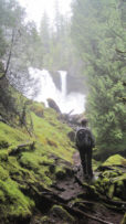
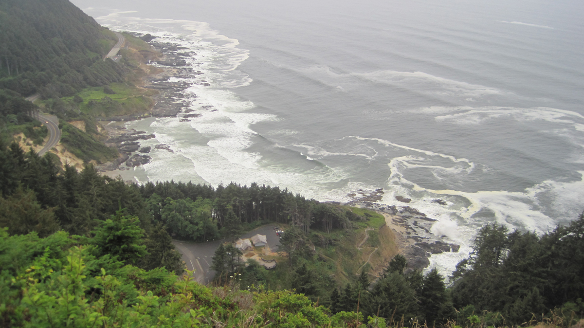
The Cape Perpetua Scenic Area on Oregon’s coast is stunning.
Trip Report:
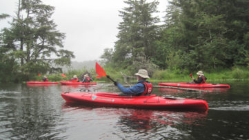
Volunteer Leader: Mark Hougardy | Organization: Eugene-based Hiking Club | Date: August 2018 | Duration: 2 days | Participants: 8 | Type: car camping, hiking, and kayaking
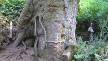
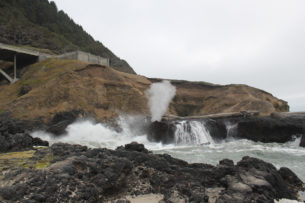
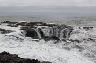
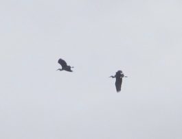
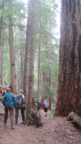
Our group was fortunate as the weather was surprisingly mild and there was little wind. We spent much of the morning exploring tide pools and beachcombing during low tide. The Cape’s forest offered us the chance to stand at the base of the 200-foot tall and 500-year old Sitka Spruce. These amazing trees grow in a four-mile-wide zone along the coast from northern California to Kodiak Island in Alaska. Around lunchtime, we pitched our tents at a nearby campground and had a quick bite to eat. Our two tiny campsites proved challenging with our collection of tents. In the late afternoon, during high tide, we appreciated the coast’s craggy beauty. A favorite is Spouting Horn, where wave action forces water into a small sea cave and through a hole at the top creating a sizeable plume. Thor’s Well, a large sinkhole on the shoreline, water cascades into what appears to be an unearthly entrance to the underworld. In the evening, some of us climbed the 700-foot cape and enjoyed awe-inspiring views of the rocky shoreline below. Standing inside the historic Civilian Conservation Corps shelter, we witnessed a brief sunset. That day we saw a whale, gulls, cormorants, sea lions, a myriad of tide pool creatures, turkey vultures, and ravens.
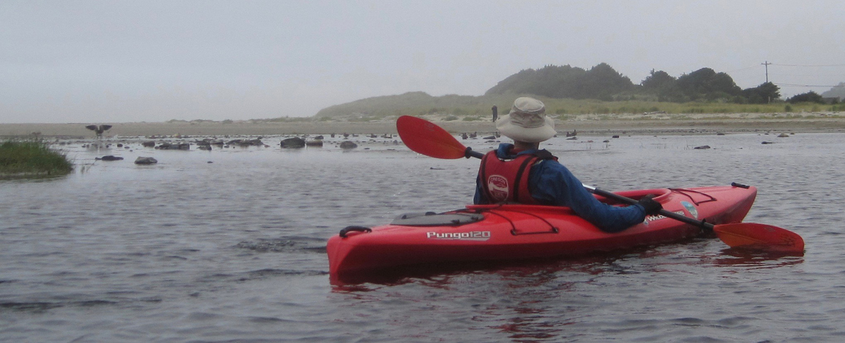
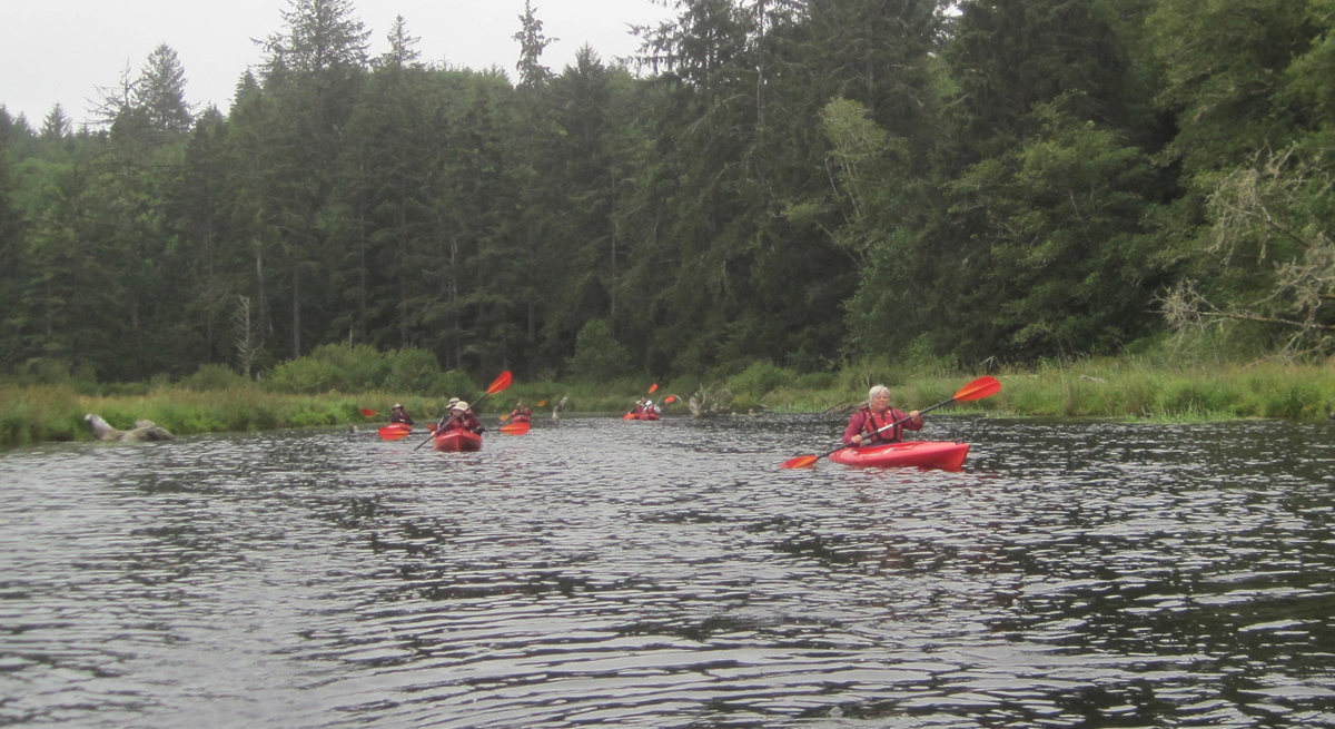
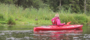
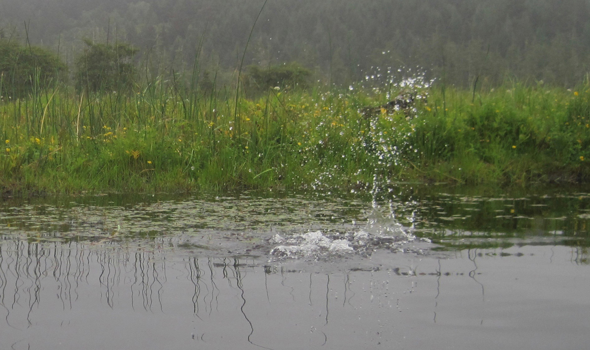
We woke with the sun and drove to Brian Booth State Park where we participated in a kayaking trip along Beaver Creek. This interpretive tour is offered as a service by Oregon State Parks. Beaver Creek is a freshwater estuary and is prime habitat for Coho salmon, cutthroat trout, winter steelhead, and waterfowl. We finished our three-mile paddle about noon and had a great time. We had seen ducks, nutria (invasive), a family of river otters, kingfishers, a young bald eagle, swallow, cranes, blue herons, a green heron, Canada geese, merganser, and a red-tailed hawk. As we pulled our kayaks from the water there was a nearby splash, a river otter had been playfully observing at us. Across the creek, a bald eagle surveyed our group. That afternoon we drove south to Yachats and enjoyed a tasty lunch before heading home.
I snapped this picture half a second too late! A chain of bubbles was rapidly passing my kayak on Beaver Creek. They were followed by a furry head popping out of the water. The river otter, upon seeing me, immediately dove. Here is the splash it made as it disappeared.
Recently, I was asked to share ideas with a tour director who was new to leading natural history walks. Here are some simple tips:
When introducing folks to a natural area I like to include in my welcome, “Are there things on this walk that you’d like to know more about?” People almost always want to know about poison ivy/oak and if they will be encountering any. Answering this takes some of the uncertainty people might have about an area off the table and helps them better enjoy the walk.
You’re not there to be an encyclopedia.
Do know the “big idea” of your walk. A big idea is what you want them to take when they leave.
If you know of any good stories about the area, place names, or local colorful characters, share them.
Think of things where people can engage their senses: look, listen, and feel.
When you visit a neat spot (beaver pond, an interesting grove of trees, etc), ask, “What do you think you know about this?” Get them to respond and share information. Everything has a story; people of First Nations or settlers could have used even an unassuming plant as an important resource.
If there is an area where people can be comfortable have them sit in silence for several minutes (3 is ok). Afterward, ask them what they see, hear, smell, and feel.
Point out any temperature shifts, like when you enter a shaded or lighted area.
Compare the feel of different tree barks. Why might they be different?
People tend to look at big things, have them find a small area, and just observe for a few minutes. Ask them what they saw. A lot is happening on a small scale and it is just as important as the big things.
You need to know where North is for this. Well into your walk ask them to point to the north. The results are often surprising and entertaining even when the sun is out. Bring a compass and have a young person confirm the direction.
At the end of the walk ask people to share what they saw, heard, and smelled, etc.
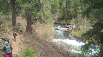
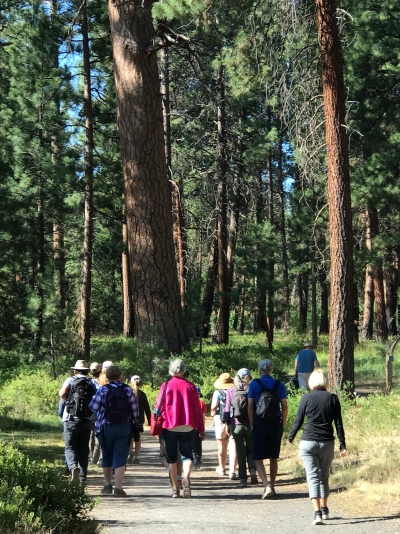
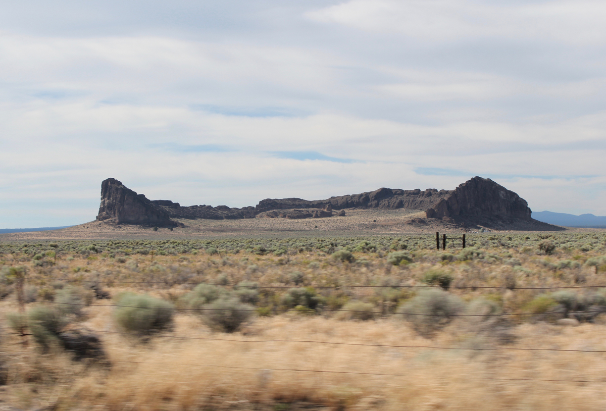
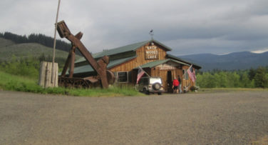
Our 4-day trip to learn more about central Oregon’s historic past started with a call from the interpretive ranger at Fort Rock. The 100-degree heatwave hitting the region was the cause for canceling our visit to the Fort Rock Cave for safety concerns and the threat of extreme fire danger. The cave is a significant archaeological site where shoes dating back 10,000 years were discovered and public entry is limited to just a handful of people each year. Sadly, but understandably, we were not able to visit the cave and I had to amend our trip to Oregon’s high desert on the fly. Fortunately, everything worked out. [Here is a link to a later visit to Fort Rock Cave.]
Trip Report:
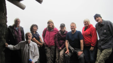
Volunteer Leader: Mark Hougardy | Organization: Eugene-based Hiking Club | Date: July 2018 | Duration: 4 days | Participants: 7 | Type: A 4-day exploration of central Oregon’s rich cultural heritage, dynamic geology, and the majestic night sky. Car camping, hiking, and lots of open space.
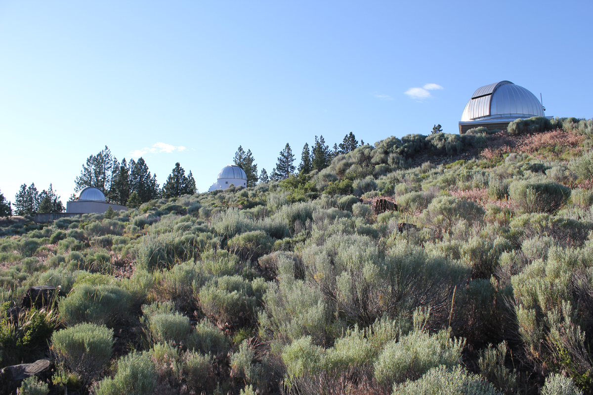
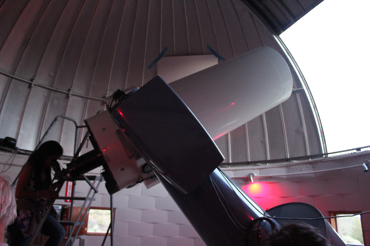
Group photo at the Pine Mountain Observatory. The red lights are easier on the eyes when working around astronomical equipment.
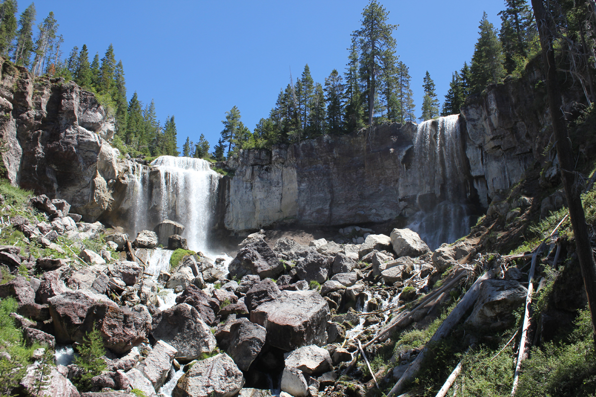
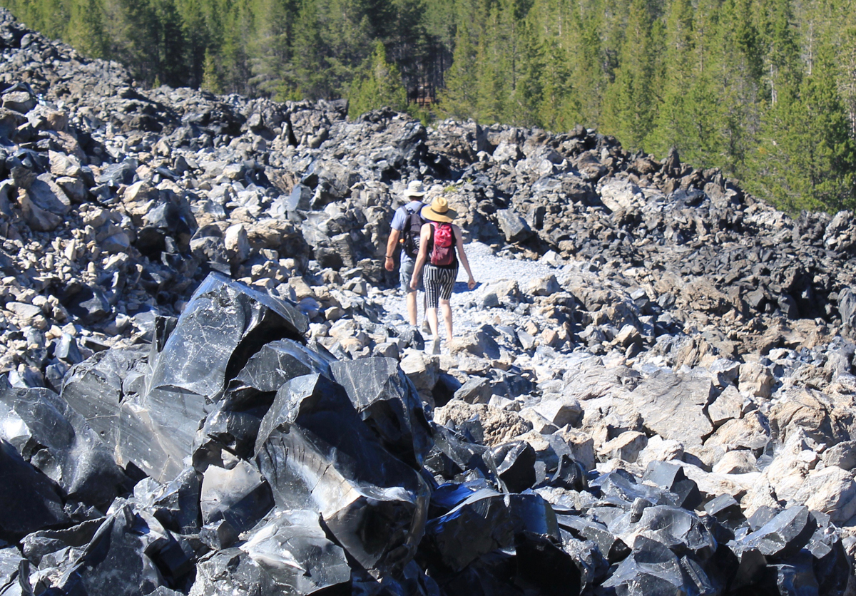
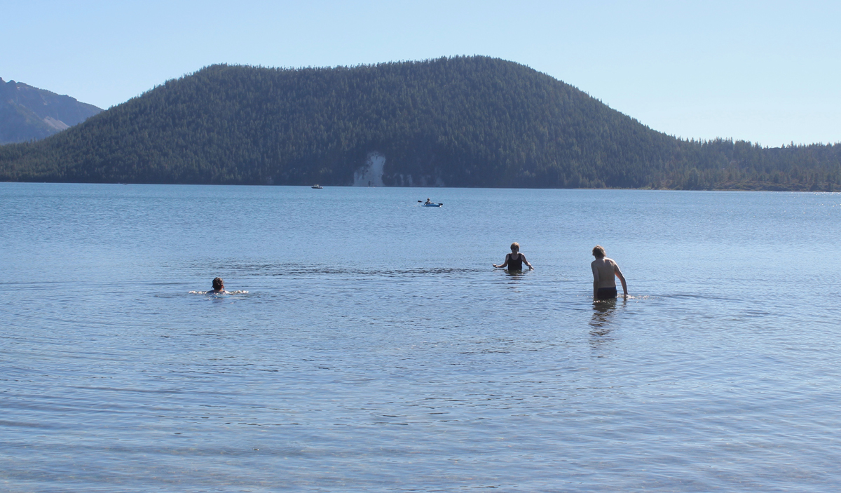
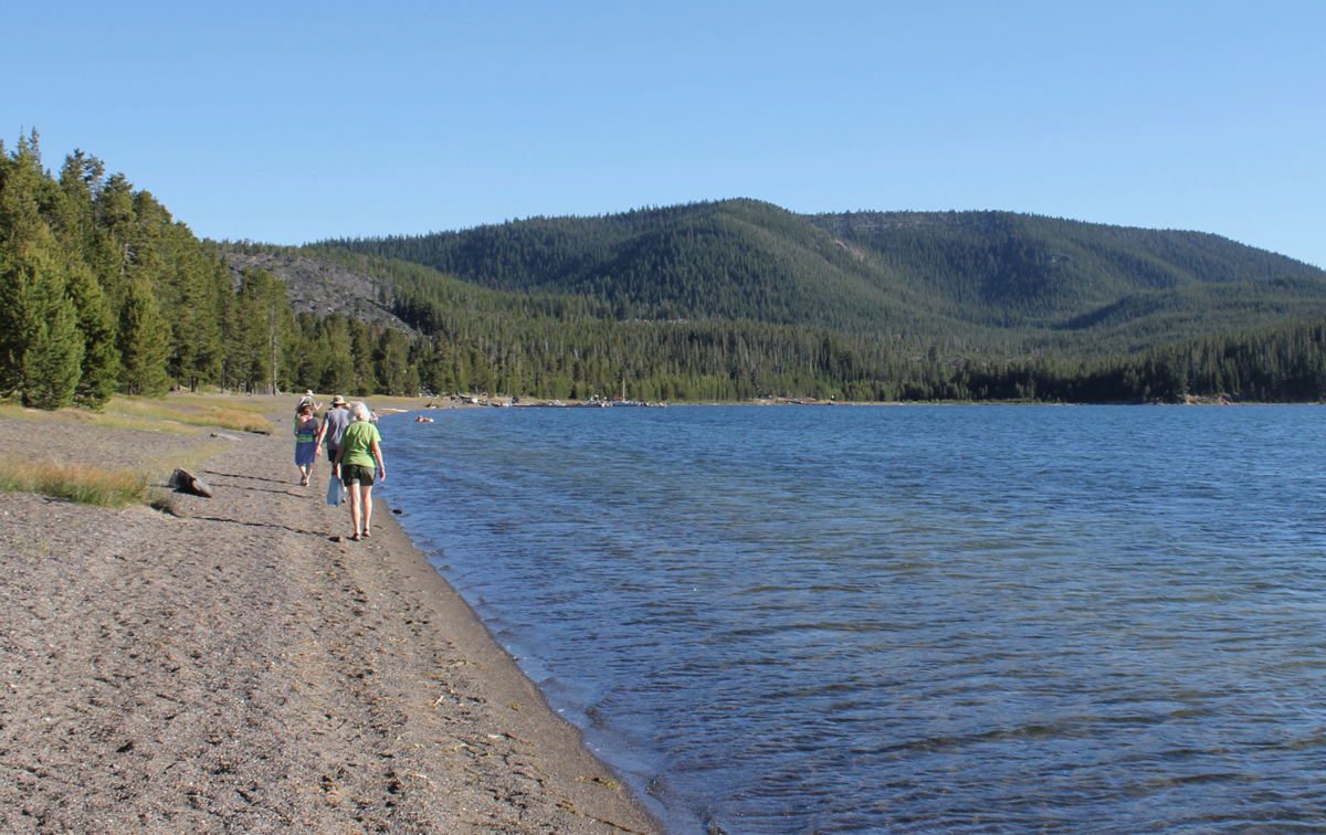
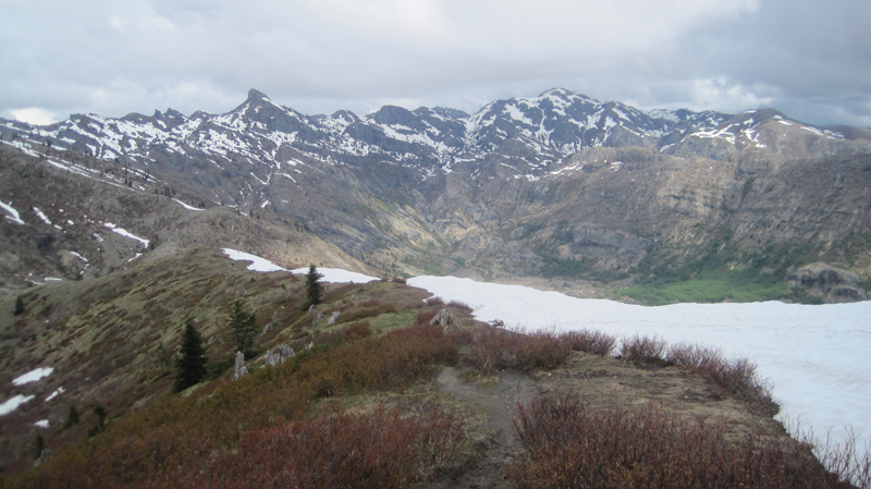
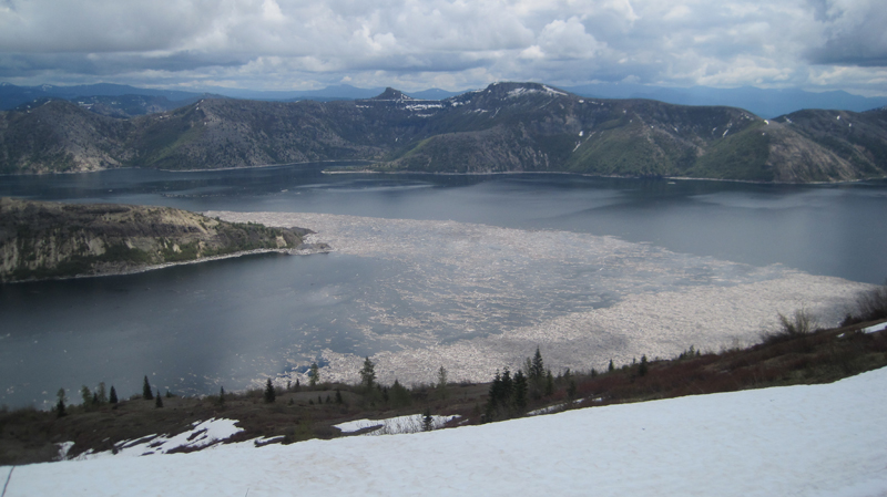
On our first day, we arrived at the massive caldera located in the heart of the Newberry National Volcanic Monument. We visited the double 80-foot Paulina Falls and ate lunch overlooking the stream. We located two adjoining campsites on the picturesque East Lake, and just in time as the park was busy. In the afternoon we hiked the impressive Obsidian Flow trail, a massive flow of volcanic glass and pumice 17 stories tall. Returning to camp we enjoyed a swim in the cool and clear waters of East Lake. Afterward, we hiked on the beach to the local resort and were reminded of the subtle, yet abrasive qualities of volcanic glass on the feet. At the lodge, we enjoyed a delicious meal and had some good laughs with the staff. The radio in the background was playing a tribute to Tom Petty. We walked about a mile back to camp. That night we listened to acapella hymnals from a Mennonite group camping nearby.
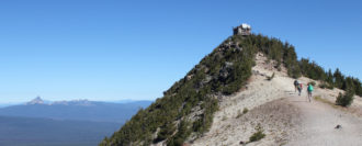
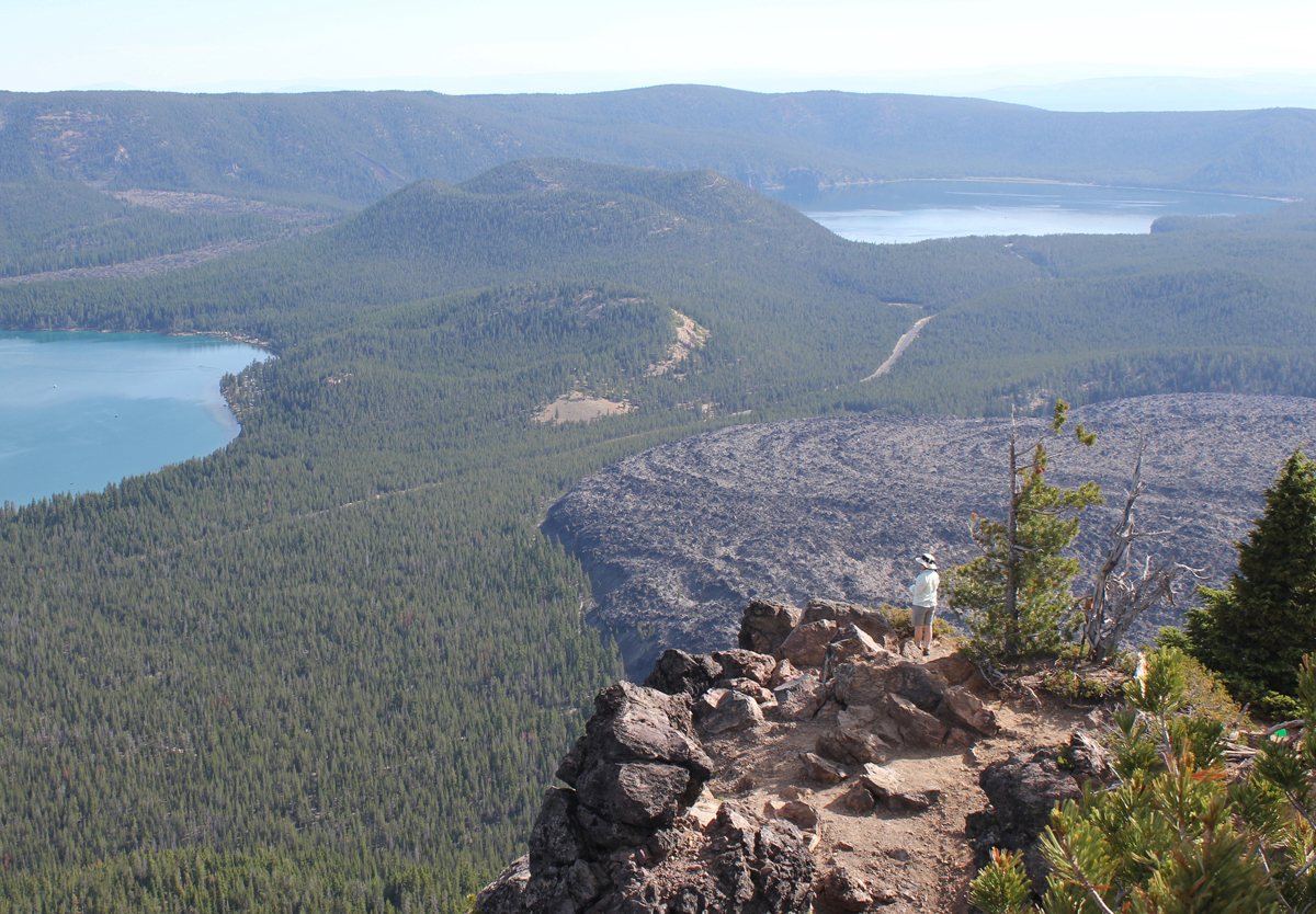
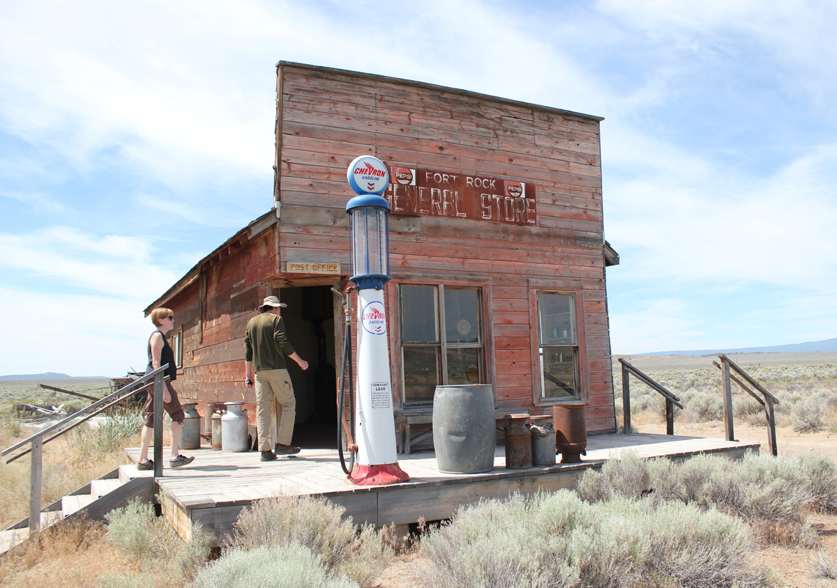
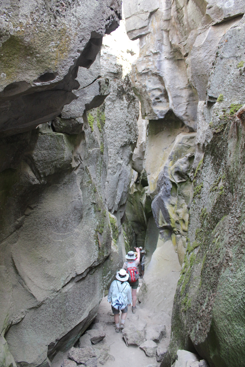
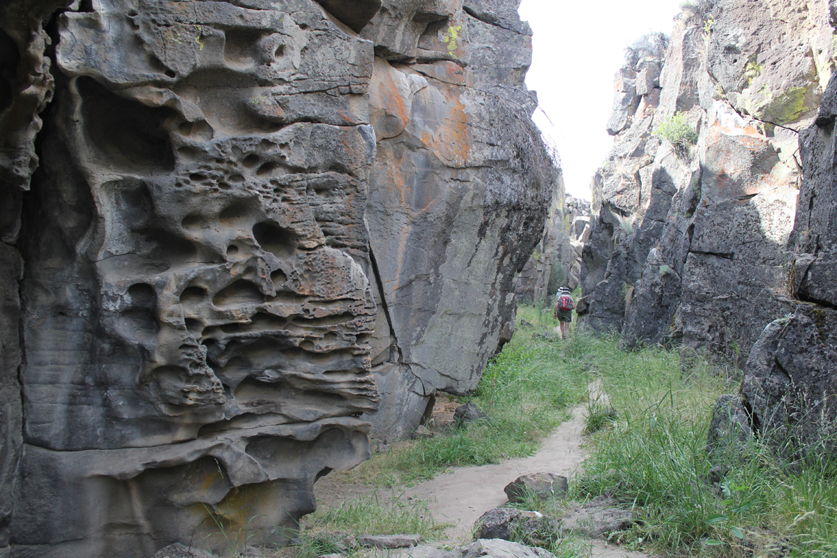
On day two we drove to the top of Paulina Peak. The peak is 7,984 feet and sits in the middle of Oregon. The views are impressive; to the north, we could see the massive stratovolcano, Mount Hood, then down the spine of the Cascades to the steep-sided Mount McLoughlin close to the California border – a distance of about 300 miles! To our south was our next stop, the iconic shaped Fort Rock, a volcanic landmark named for the tall fort-like walls. We left Paulina Peak and drove for about an hour. Our first stop was the Fort Rock Homestead Museum, an open-air collection of historic structures. This is where I learned about a shortcut of a backroad to Derrick Cave, a remote lava tube that we had hoped to visit. Apparently, the private landowner had closed the shortcut because visitors were not closing a gate and his cows were escaping. The alternate route would have involved about a 50-mile detour on forest and back roads. This was tabled until another visit. Our next stop was the massive Fort Rock a horseshoe-shaped tuff ring that rises 300 feet over the surrounding flat landscape. We hiked for about an hour in the heat then drove to the town of Christmas Valley for ice. We continue on a short distance to Crack in the Ground, a 2-mile-long tension fracture where we could hike and scramble over boulders about 30 feet underground. The temperature at the surface was 95 degrees, in the fissure it was a comfortable 70 degrees with some pockets of air in the lowest sections that were very chilling. Late that afternoon we stayed at the Rockhorse Ranch where we pitched our tents and gleefully enjoyed their shower! A celebrity at the ranch’s store was a black cat named, “Scratchy.”
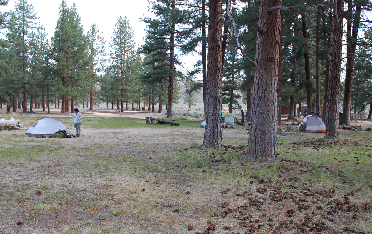
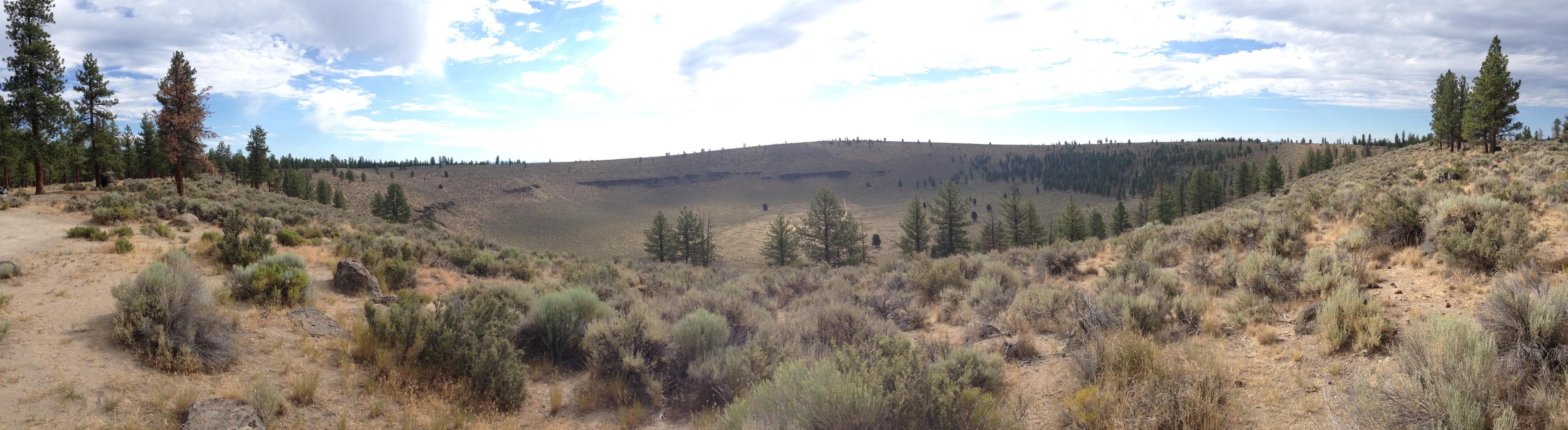
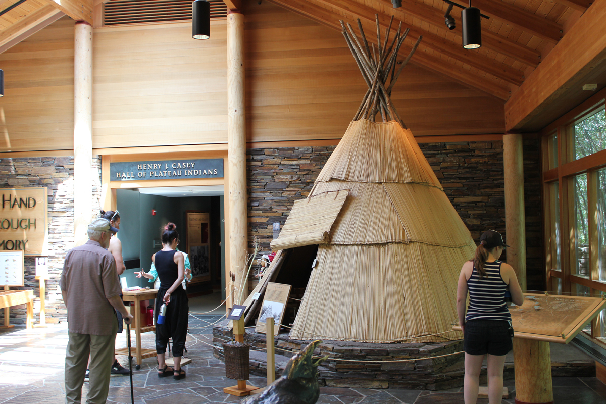
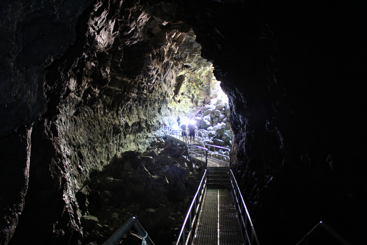
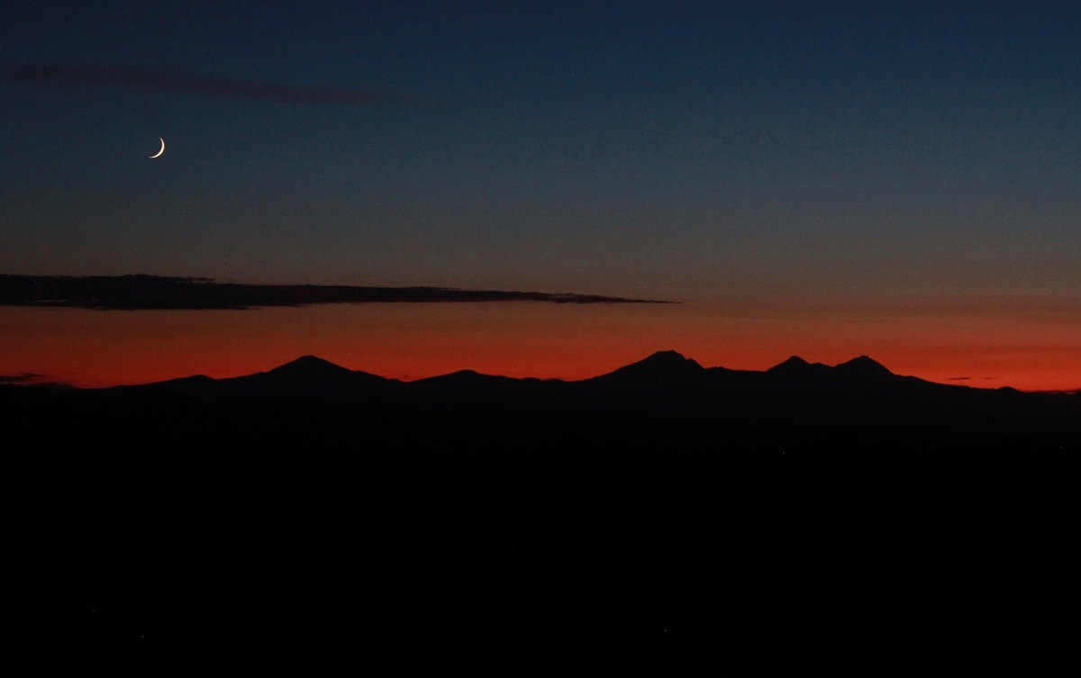
On day three we drove a short distance to Hole in the Ground, a crater that is a mile wide and 500 feet deep. Once thought to be a meteor impact the formation was actually caused by magma contacting groundwater. The resulting flash (there were many over the millennia) formed the massive hole we see today. The steep hike down the side was dusty and the walk up the forest service road was blazing hot. Near the end of our hike, three cars zipped up the road in a cloud of thick dust. The vehicles looked as though they were from the set of a Mad Max movie. The last car to pass was missing the driver-side door; the driver was wearing thick goggles. The rag-tag group waved as they passed. These were participants in the Gambler 500, a navigational adventure for cars whose value is no more than $500. Later that day we visited the High Desert Museum for a closer look at the cultural and natural history of the region, and we explored by flashlight the 1-mile-long Lava River Cave, the longest continuous lava tube in Oregon. The cave was a welcome 42 degrees! As the sun lowered in the sky we made our way about 30 miles east of Bend to the Pine Mountain Observatory, an astronomical observatory operated by the University of Oregon. The center sits near the top of Pine Mountain at an elevation of 6,509 feet. We made camp, ate dinner, watched the sunset, and enjoyed the various telescopes of the facility. There were close-up views of Jupiter, Saturn, Venus, Mars, nebulae, globular clusters, and various astronomy talks from UO instructors. Most impressive was a view of Jupiter and several moons through the 24-inch scope.
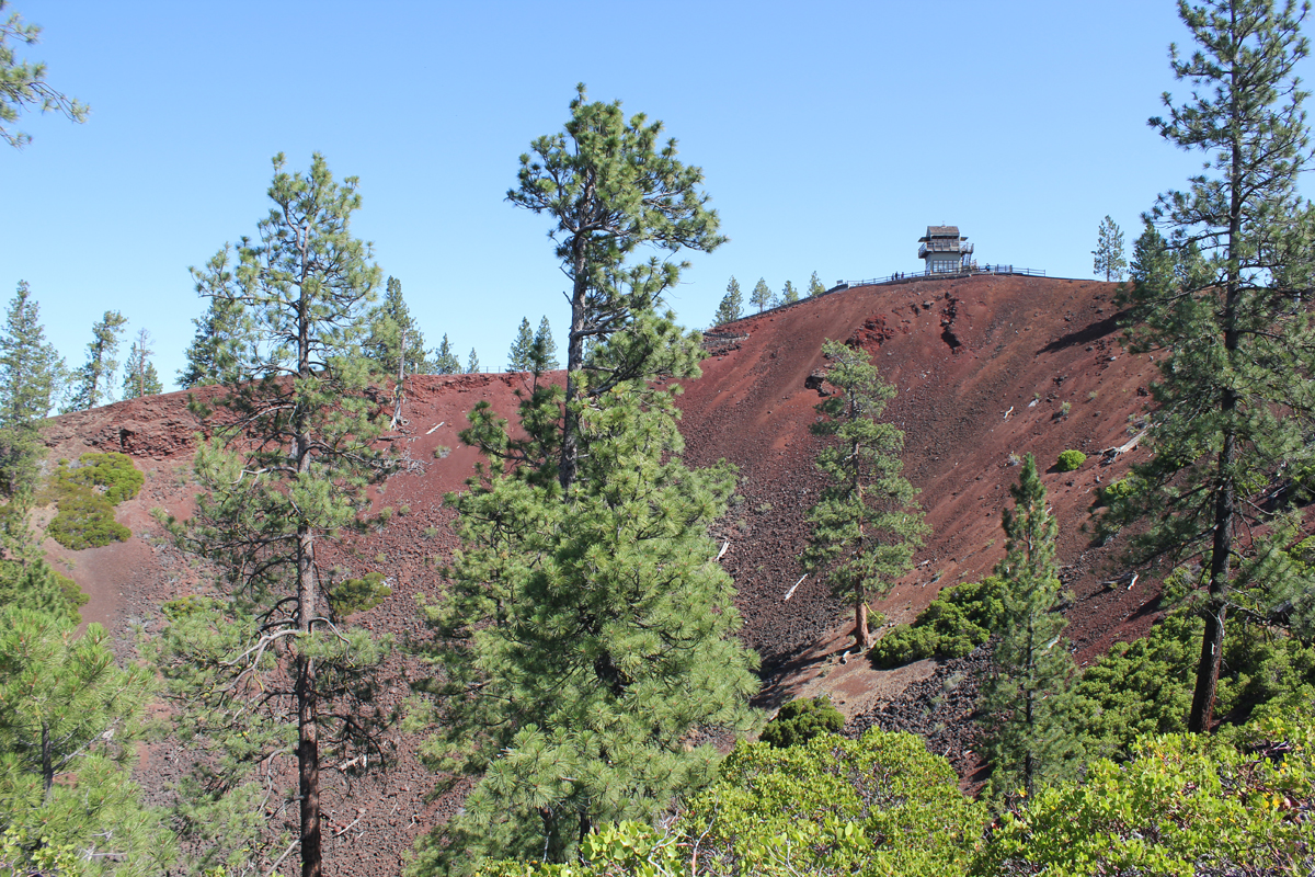
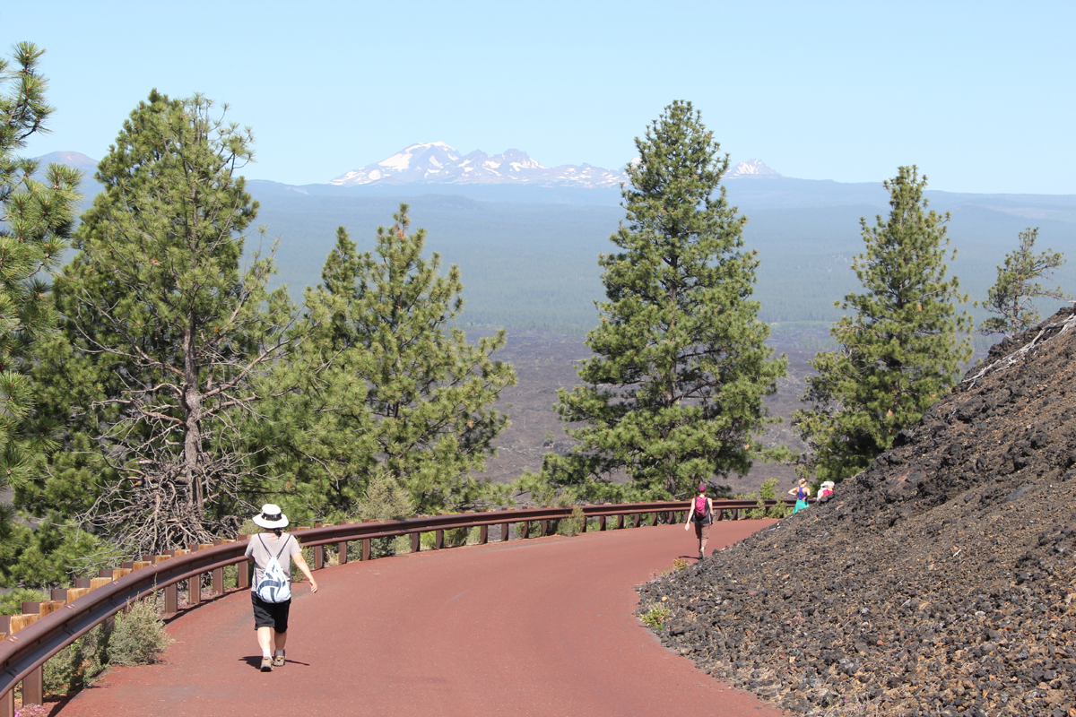
The final morning we woke up hearing a chorus of cows in the distance. We made our way off the mountain appreciating the drastic change in terrain from pines to the open high desert. We took a shortcut around Bend and stopped at the Lava Lands Visitor Center where we explored the 500-foot tall Lava Butte that has commanding views of central Oregon’s volcanic story before returning home.
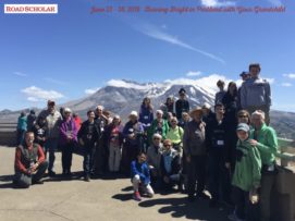
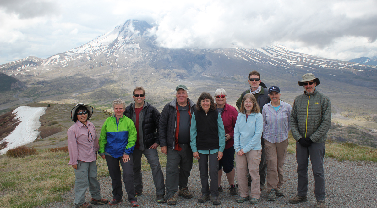
I’m happy to have been the leader on another great Road Scholar trip. This program introduced grandparents and grandkids to how fire helps forge every aspect of our life (homes/communities, food preparation, entertainment, arts, places we play, and our survival).
Trip Report:
Leader: Mark Hougardy | Organization: Road Scholar | Date: June 2018 | Duration: 6 days | Participants: 28 | Type: Field Trips & Motorcoach
“Erupting volcanoes. Blacksmithing. Outdoor cooking. Glassblowing. A fire has countless uses, and incarnations, and has been paramount to our way of life since the beginning of our time. You and your grandchild will spark your desire to safely learn more about fire through interactive experiences with professional firefighters, survivalists, welders, and fire dancers. Discover how fire can create a delicate piece of artwork, as well as destroy entire forests and cities. Learn how to survive in the remote wilderness, and discover the inner workings of a city’s fire engine. Together with your grandchild, finally have the chance to play with fire as you discover why nothing can hold a candle to this learning adventure.”
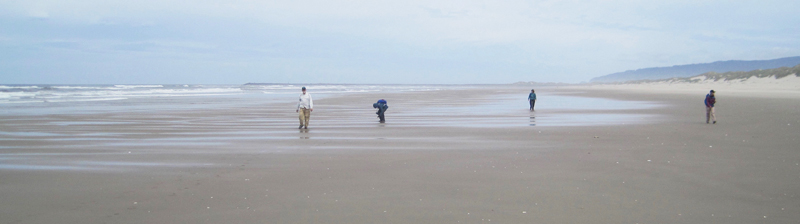
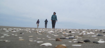
This hiking trip was to the site of the “exploding whale,” one of Oregon’s most prominent stories of local lore.
Trip Report:
Volunteer Leader: Mark Hougardy | Organization: Eugene-based Hiking Club | Date: June 2018 | Duration: 1 day | Participants: 6 | Type: Day Hike
In 1970, near Florence, a 16,000-pound whale carcass the length of a bus washed ashore. After 3-days in the sun, it became so foul smelling that locals wanted it gone. An idea was hatched to dynamite the odorous mass into tiny bits. A local TV report of the incident is classic web viewing. In the clip, a massive boom launches putrid blubber into the sky. As the blast ends, behind the camera, a series of cheers and laughs ring out. One woman’s voice is heard, “All right, Fred, you can take your hand’s our of out of your ears now … here come pieces of … my G-” No one was injured, but viewers were covered in goo and a car was nearly totaled. Our group located the approximate location of the detonation. The day included a pleasant 5-mile beach walk where we viewed a number of shells. We also observed a memorial to 41 sperm whales who mysteriously stranded themselves in the area in 1979. One whale spout was observed just offshore.
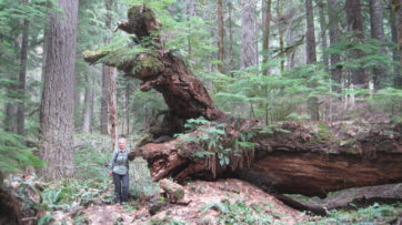
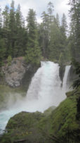
The season’s first warm weather brought significant snowmelt into the McKenzie River watershed and over the majestic Sahalie Falls and Koosah Falls.
Trip Report:
Volunteer Leader: Mark Hougardy | Organization: Eugene-based Hiking Club | Dates: May 2018 | Participants: 5 | Type: Hiking and Car Camping
Our plan to hike to Tamolitch Falls (Blue Pool) was cut short when a sign stated a mile of trail was closed because water had flooded the path in places to a depth of 3 feet. Even with the closure, there was plenty to appreciate further upstream at Clear Lake with its crystalline waters and turquoise colored Great Spring. Animals that were seen along the trail also appeared to appreciate the warmer weather as fish jumped in the lake, several species of birds flew overhead, and a garter snake warmed itself on the rocks. In shaded areas winter still managed to hold its grip as large patches of snow remained. Springs spontaneously appeared on the trail sometimes forming small ponds, and at one point, all of us were mesmerized by a plate-sized vortex that had formed in such a pool. After a solid day of hiking, we visited Belknap Hot Springs for a relaxing soak. Because we timed our visit before the Memorial Day crowds the U.S. Forest Service campground was basically empty. Our campsite was green with moss and located next to a white rushing stream that looked like it was born from a Tolkien novel. The next day we enjoyed the comfort of a morning campfire, broke camp, and explored several more miles of trail before heading home.


 A magnificent view of San Francisco and the Golden Gate. San Francisco covers an area roughly 49 square miles! The Golden Gate Bridge shown on the left is 1.7 miles in length and 746′ tall.
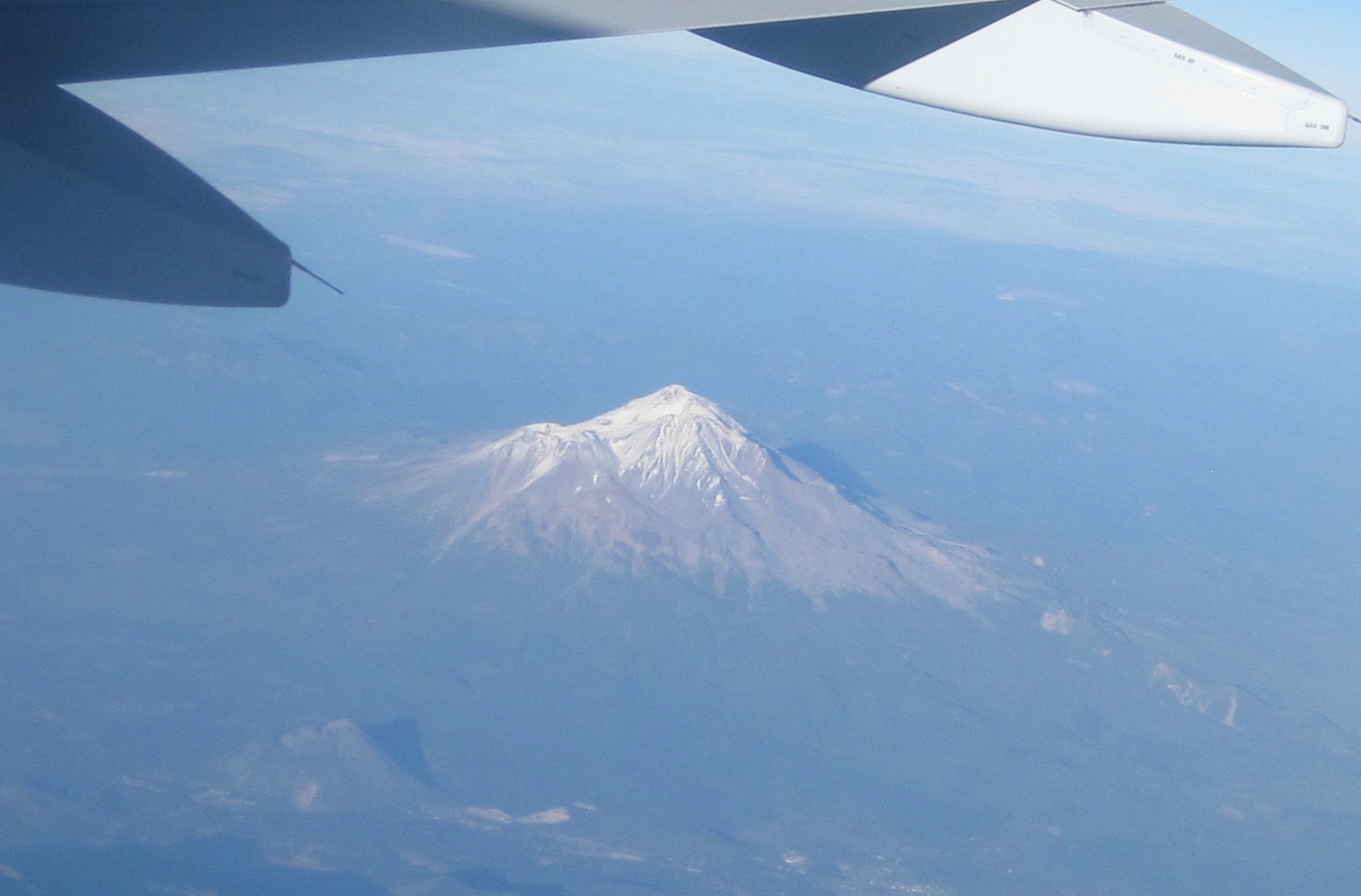 Mount Shasta (14,179′). Shasta sits uniquely at the southern end of the Cascade Range and the northern end of the Sacramento Valley. The mountain is so massive that it can be seen from 280 miles away from atop Diablo Mountain (3,848′), the tallest mountain in the eastern San Francisco Bay Area.
 Crater Lake is in the distance. Once known as Mount Mazama, this peak rivaled Mount Shasta for prominence upon the skyline. Mazama erupted about 7,000 years ago, and in the process list its peak and collapsed upon itself. Over time the remaining crater filled with water. The lake is 2,000′ deep and about 5 miles across.
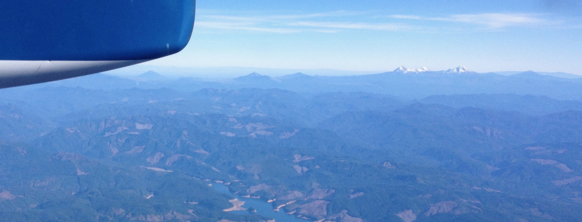 From north to south – left to right: Black Butte (6,436′) Mount Washington, Belknap Crater (6,876′), and the Three Sisters (north, middle and the south sisters); they were once known as Faith, Hope, and Charity.
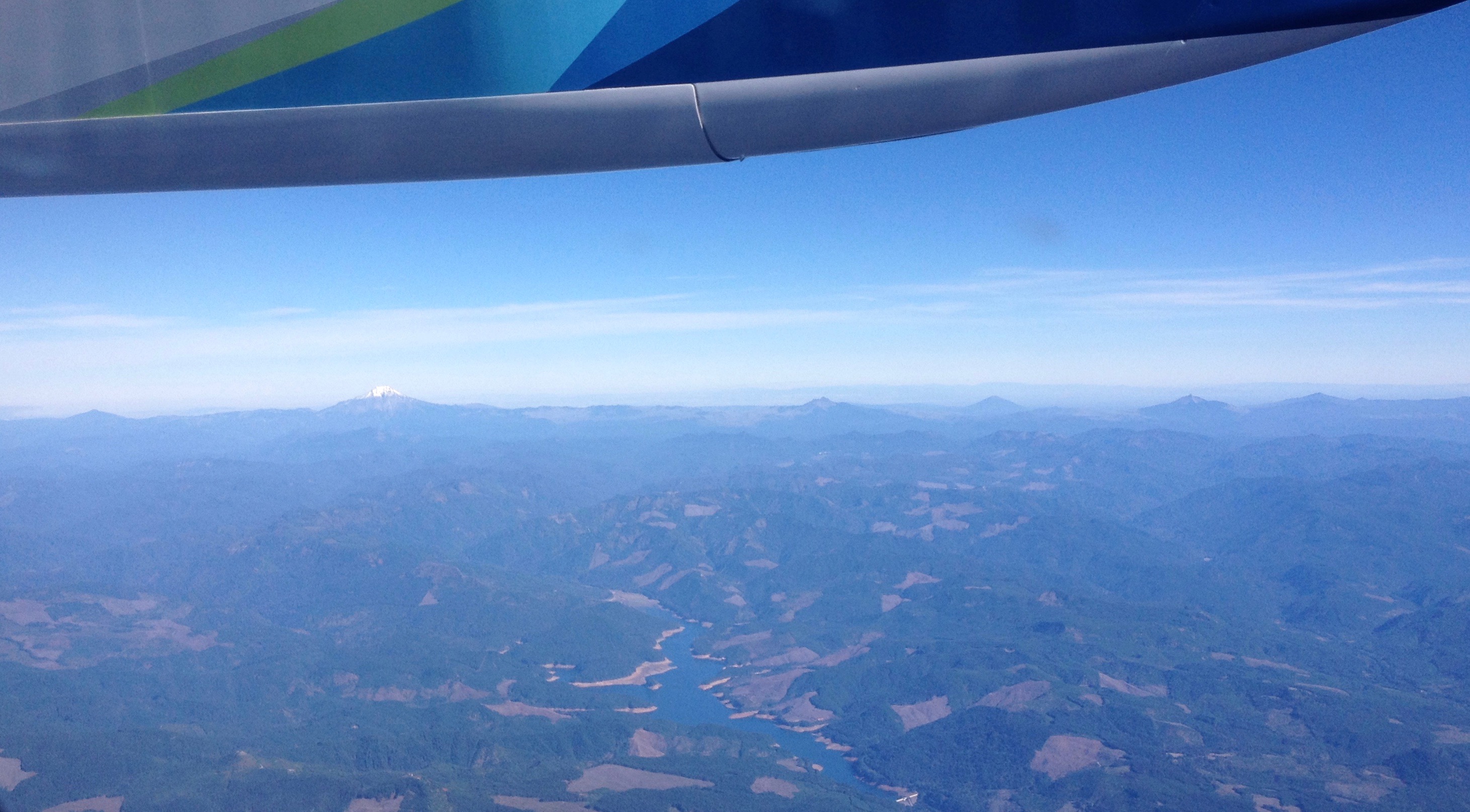
 Mount Hood (11,250′) dominates the skyline east of Portland, Oregon.
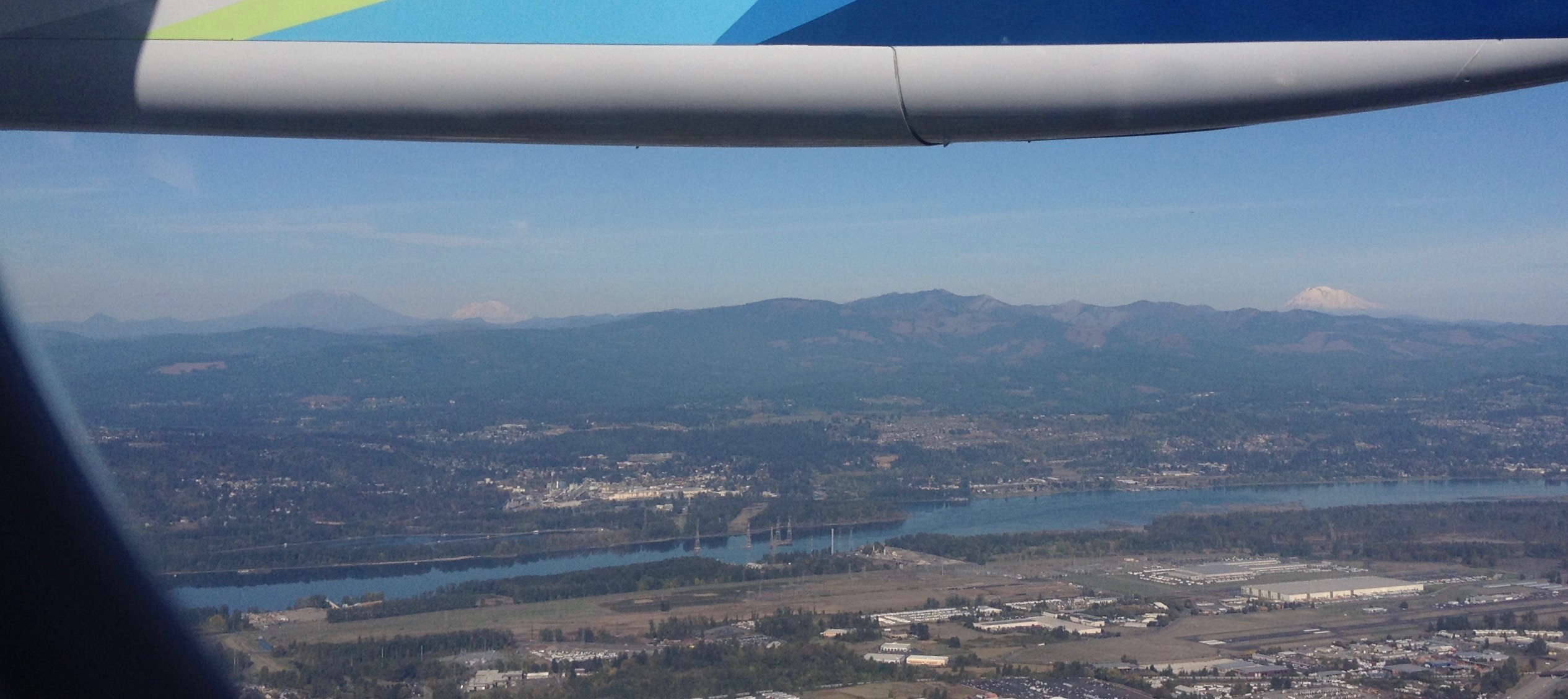 Looking north into Washington State to Mount St. Helens (8,366′), Mount Rainier (14,411′), and Mount Adams (12,280′). The mighty Columbia River is in the foreground.
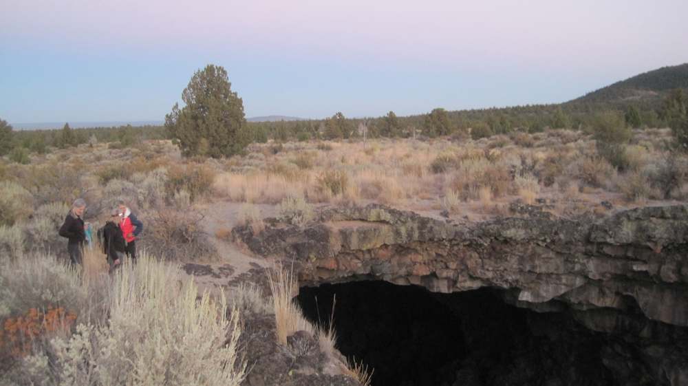


 Recently, I was asked to share ideas with a tour director who was new to leading natural history walks. Here are some simple tips:
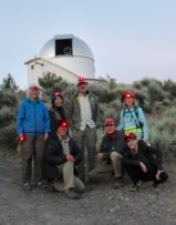


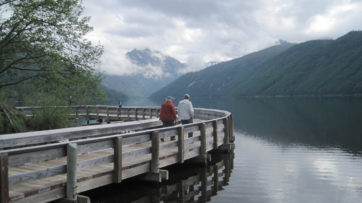
 Our plan to hike to Tamolitch Falls (Blue Pool) was cut short when a sign stated a mile of trail was closed because water had flooded the path in places to a depth of 3 feet. Even with the closure, there was plenty to appreciate further upstream at Clear Lake with its crystalline waters and turquoise colored Great Spring. Animals that were seen along the trail also appeared to appreciate the warmer weather as fish jumped in the lake, several species of birds flew overhead, and a garter snake warmed itself on the rocks. In shaded areas winter still managed to hold its grip as large patches of snow remained. Springs spontaneously appeared on the trail sometimes forming small ponds, and at one point, all of us were mesmerized by a plate-sized vortex that had formed in such a pool. After a solid day of hiking, we visited Belknap Hot Springs for a relaxing soak. Because we timed our visit before the Memorial Day crowds the U.S. Forest Service campground was basically empty. Our campsite was green with moss and located next to a white rushing stream that looked like it was born from a Tolkien novel. The next day we enjoyed the comfort of a morning campfire, broke camp, and explored several more miles of trail before heading home.
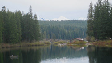
 Â Â